Browsed by
Month: August 2016

Days 22 & 23: Ain’t No Desert Hot Enough

Days 22 & 23: Ain’t No Desert Hot Enough

What a day! My alarm went off at 6:30 AM in Flagstaff Monday morning and the phone noted 45 degrees outside. By the time I actually crawled out of bed about an hour and a half later, it was 65 degrees, and upon my leaving, 68. Little did I know we’d be climbing another couple score degrees throughout the day. Yes score, as in 20, and yes couple, as in more than one.

Descending from Flagstaff and out of the pine forest on I40 was a nice transition from a little chilly to perfectly warm. Right around the town of Seligman I stopped for gas and noticed signs for Route 66 and couldn’t resist. Though it wasn’t a very long time before I had to head south, 66 was great. Not crowded, still got to drive relatively fast and it brought me through some tiny towns with all sorts of cool old route 66 themed everythings everywhere. Very cool little ride and it makes me want to do the entirety of 66 sometime.

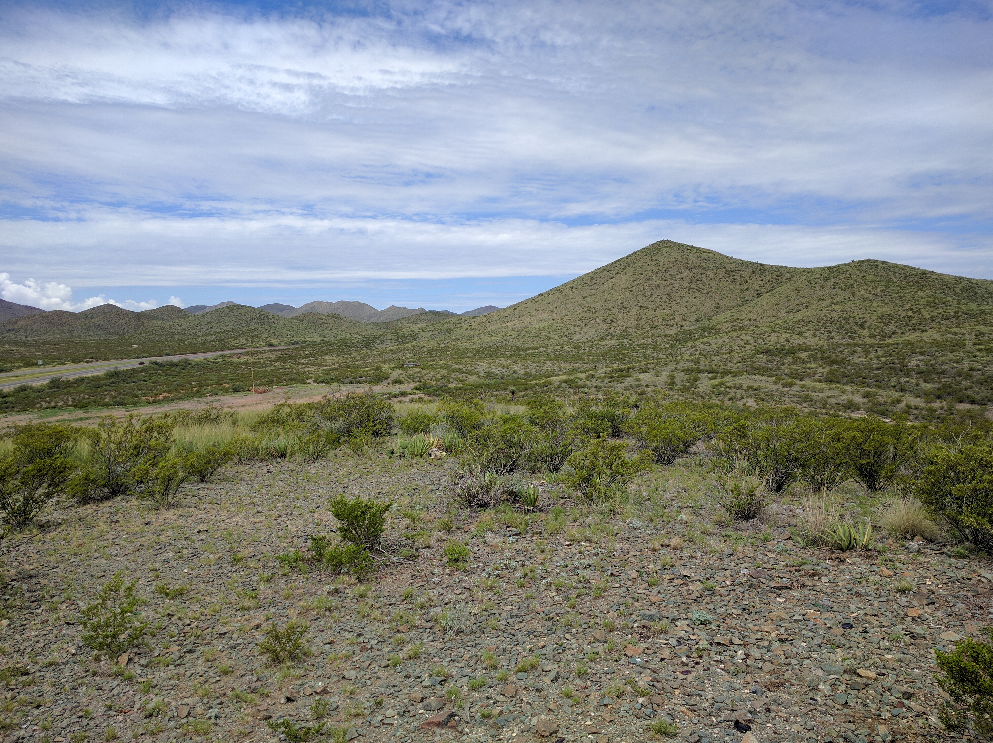
Once I turned south from I40 to Arizona 95, things started to really heat up. In fact I’m pretty sure Lake Havasu City is the hottest friggin city on the planet. Where leaving Tucson was a blow dryer this was industrial strength face melting furnace. Every so often there was a pocket of super hotness that lasted only a few hundred feet, who knows how hot it actually was in those spots.

Lake Havasu City is in the upper right. It says 105 but it was fluctuating between that and 113 throughout my joyous experience there

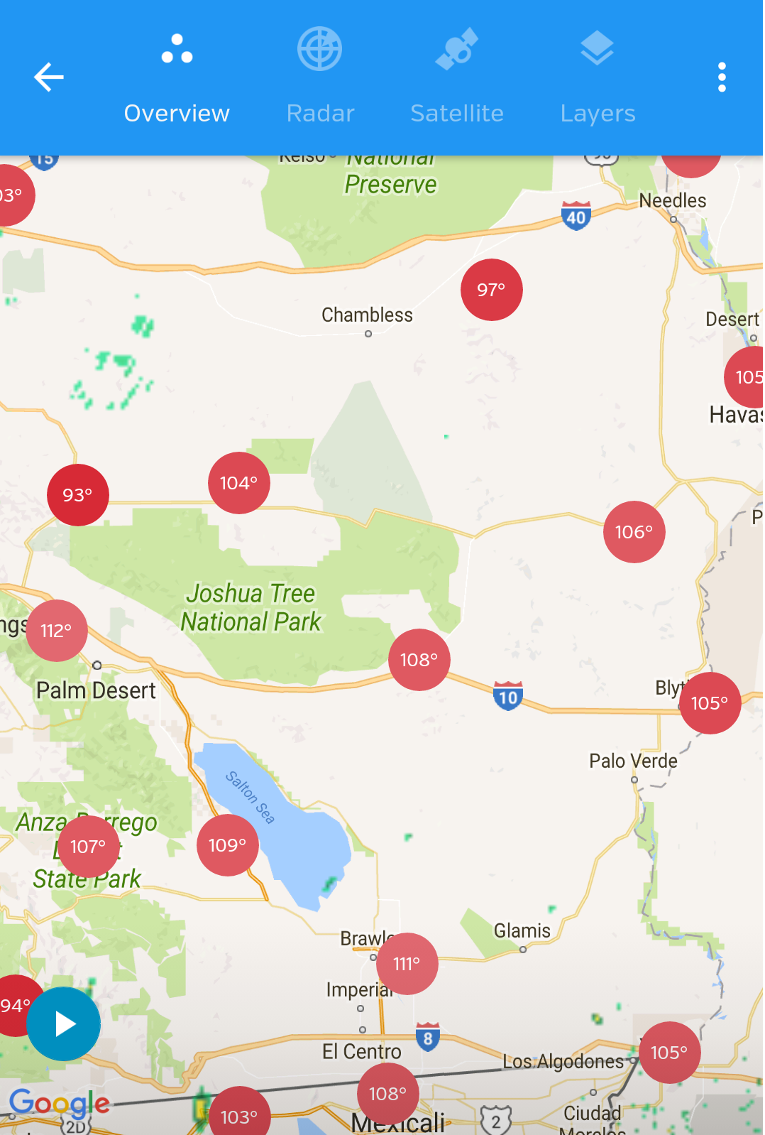
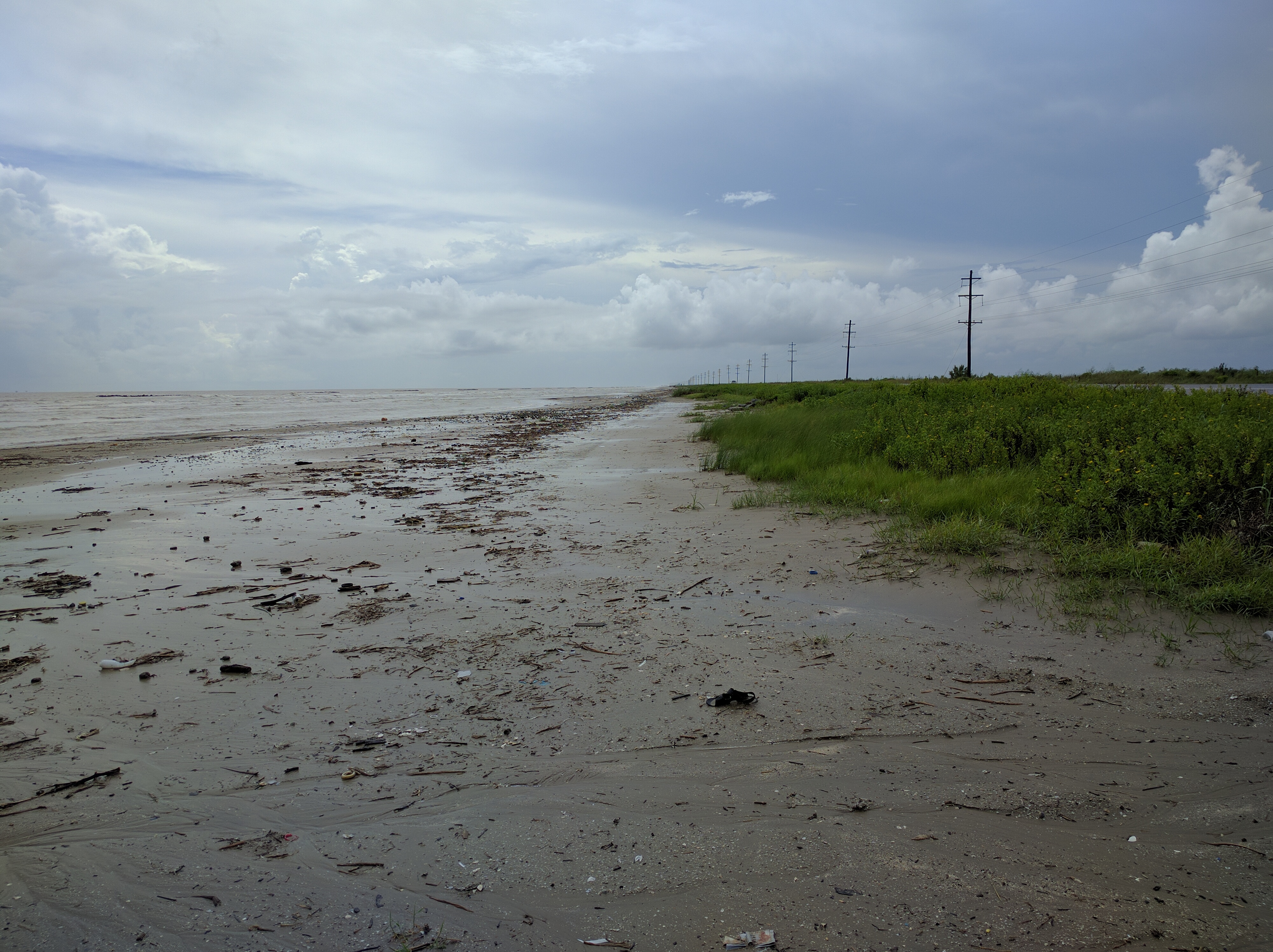
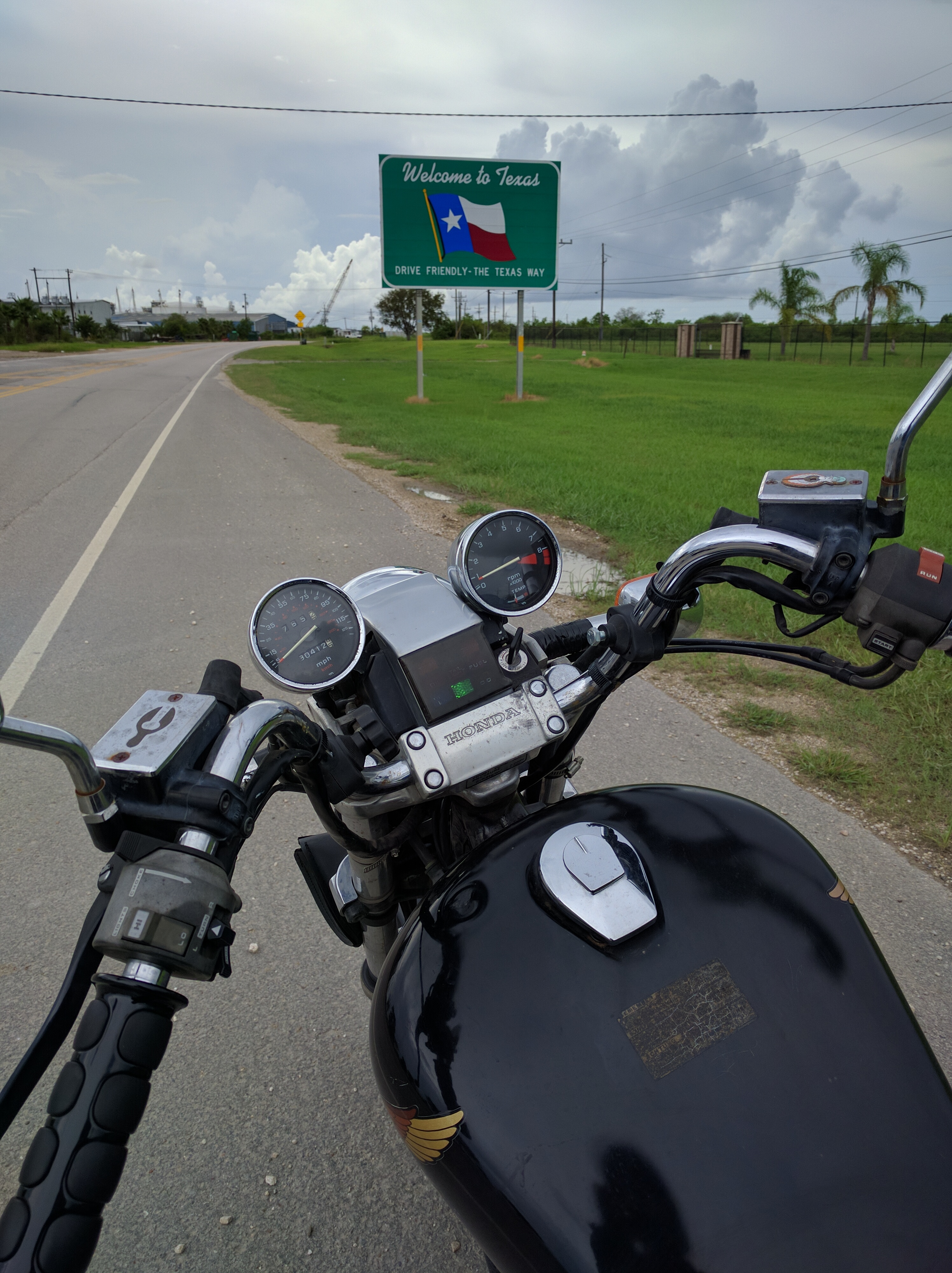
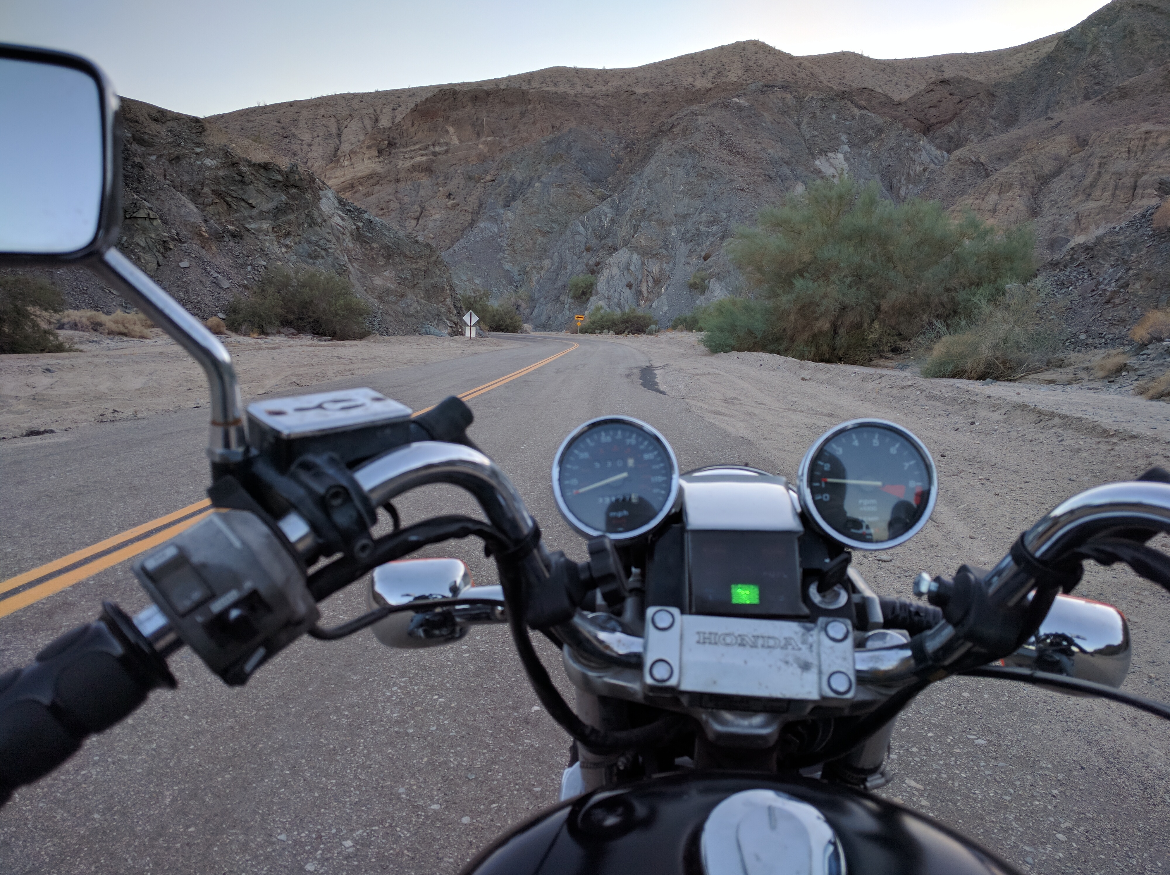
After stopping once more in Parker for a cool drink and some snacks I was ready to get to California. I eventually did enter Cali but the road I decided to take (62 so I can ride through Joshua Tree) was as barren a desert as you can possibly imagine. Literally nothing for miles except for dirty brown shrubs all wishing they weren’t there. And it was still hot. So hot.

Of all the shitty feelings I could have been feeling riding in this inferno, the worst was when my fuel light came on and I was still about 30 miles outside of 29 Palms. The last place I gassed up was Lake Havasu and I hadn’t thought to check on what was ahead of me, probably for the same reason I didn’t stop to take pictures, I just wanted to ride out of the misery.

I had to have rode into the gas station in 29 palms with only a mile or two left. I was honestly waiting for it to die before I stopped and shut it off at the pump. 148 miles it rode on a single tank, something I didn’t even think was possible. Damn you desert, that was a close one.

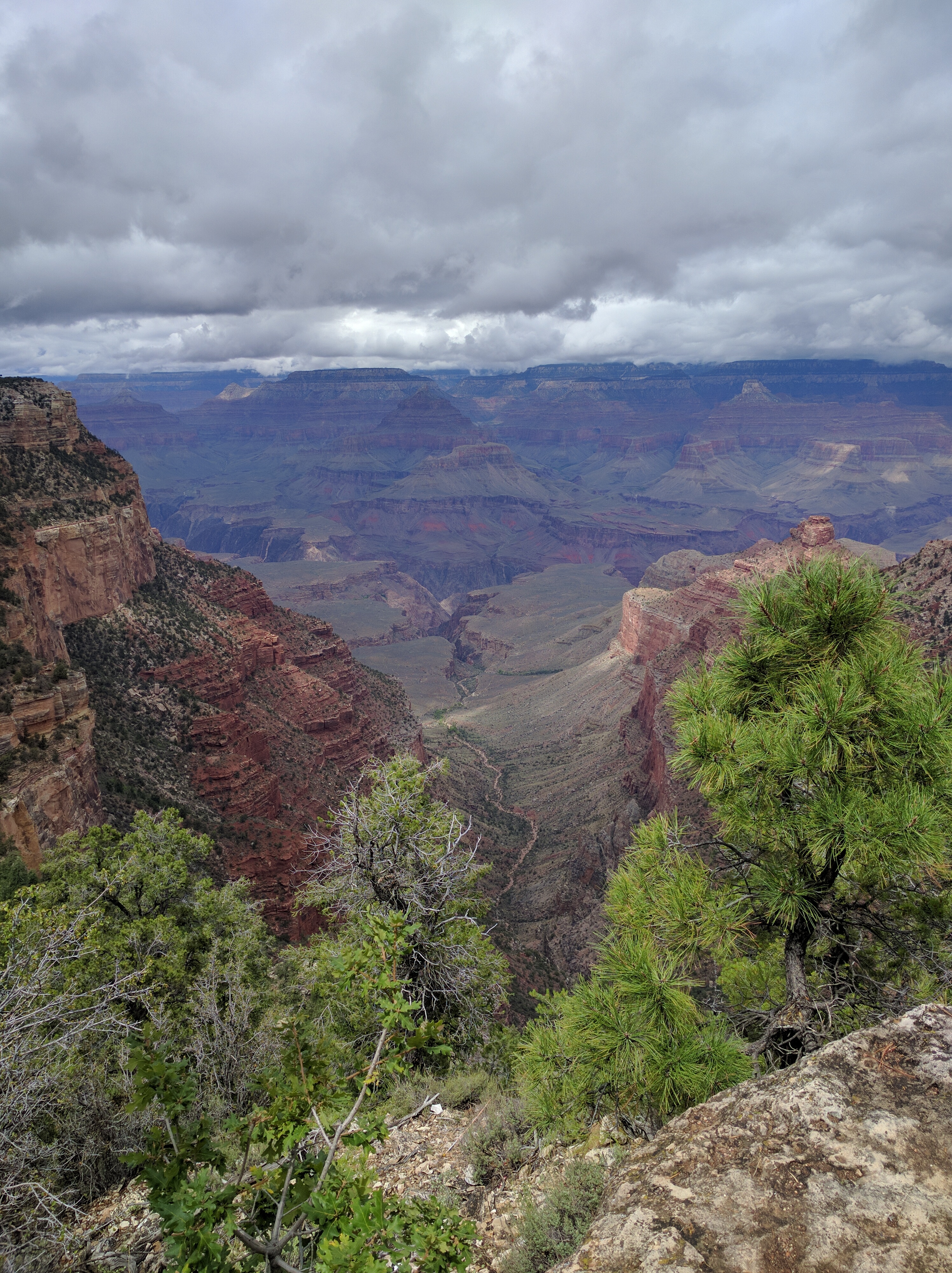
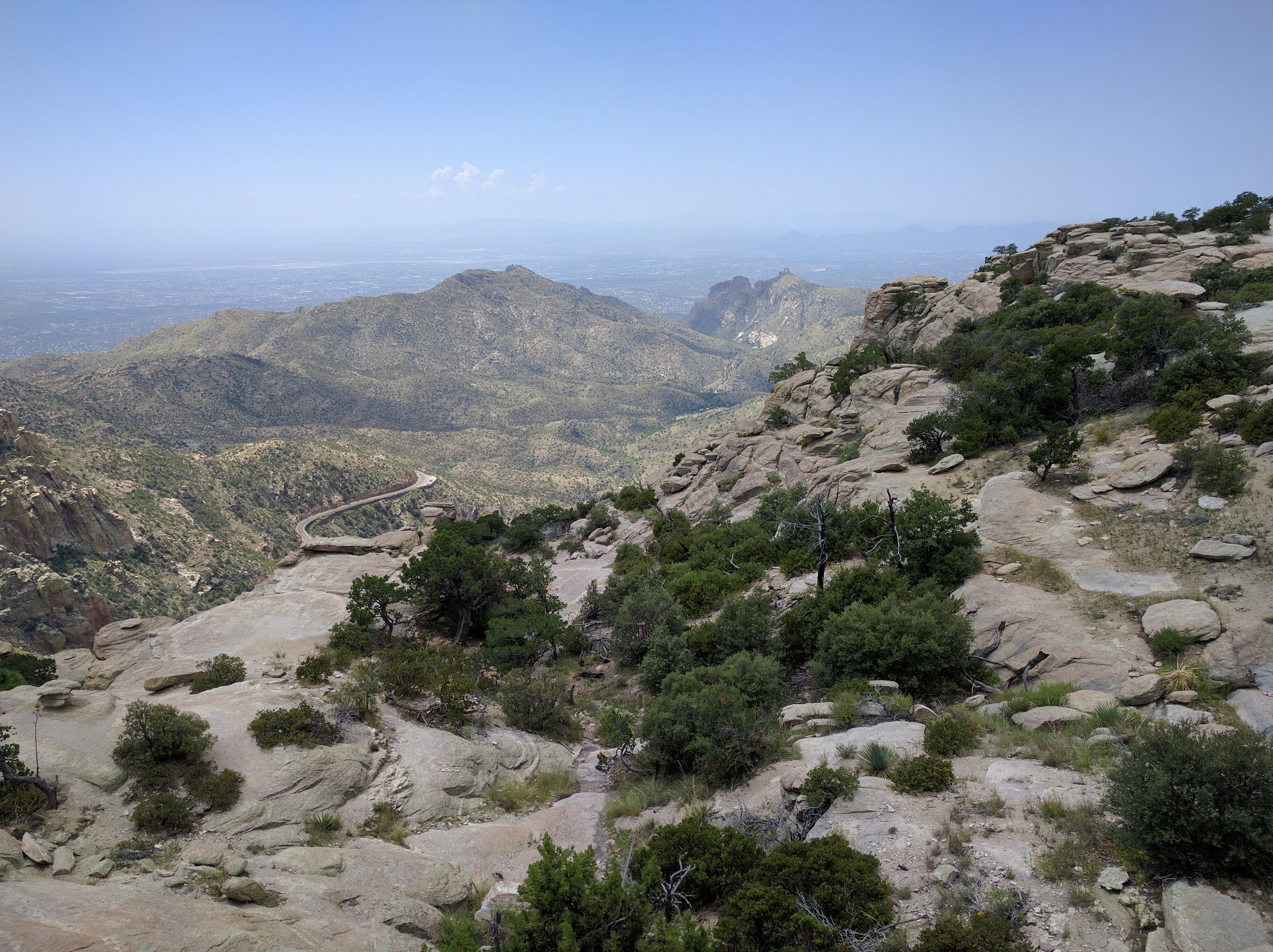
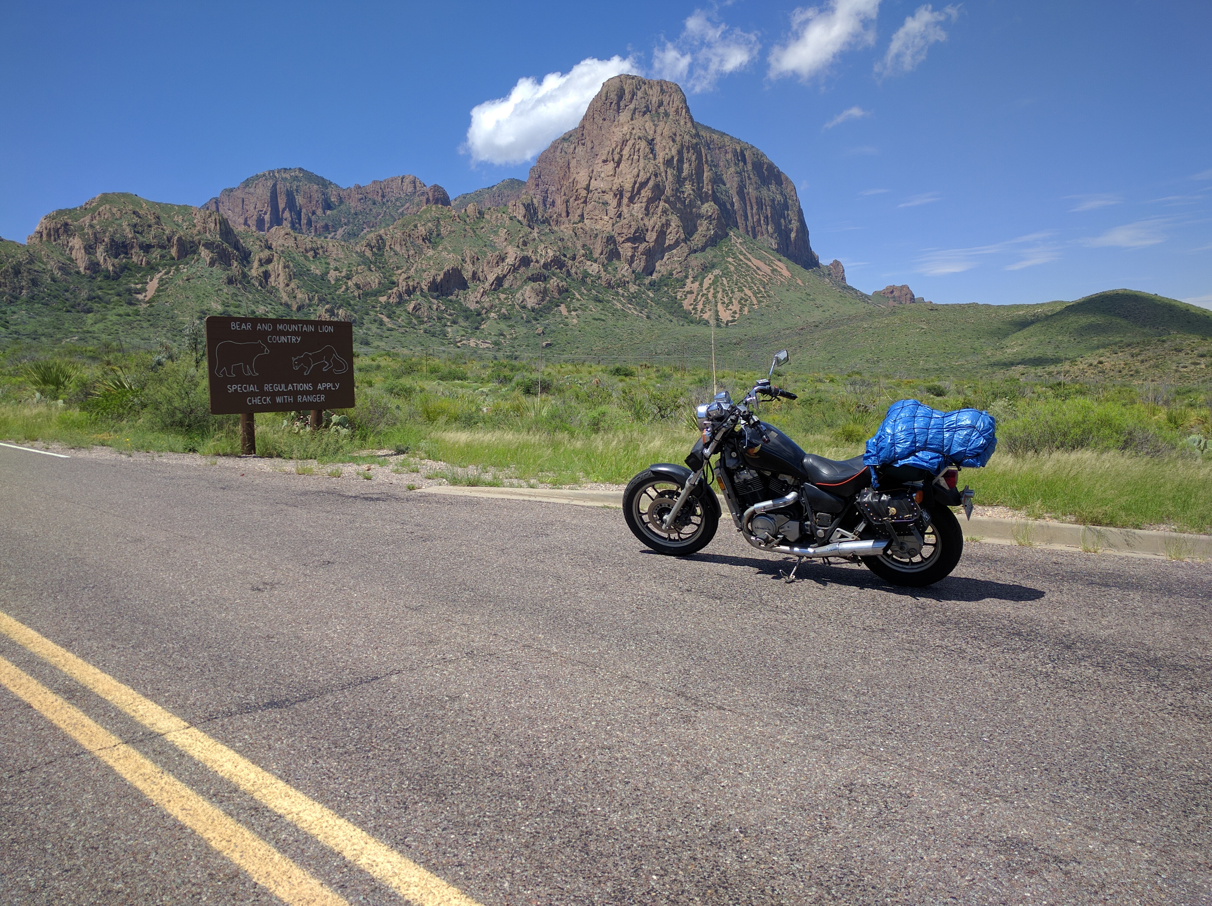
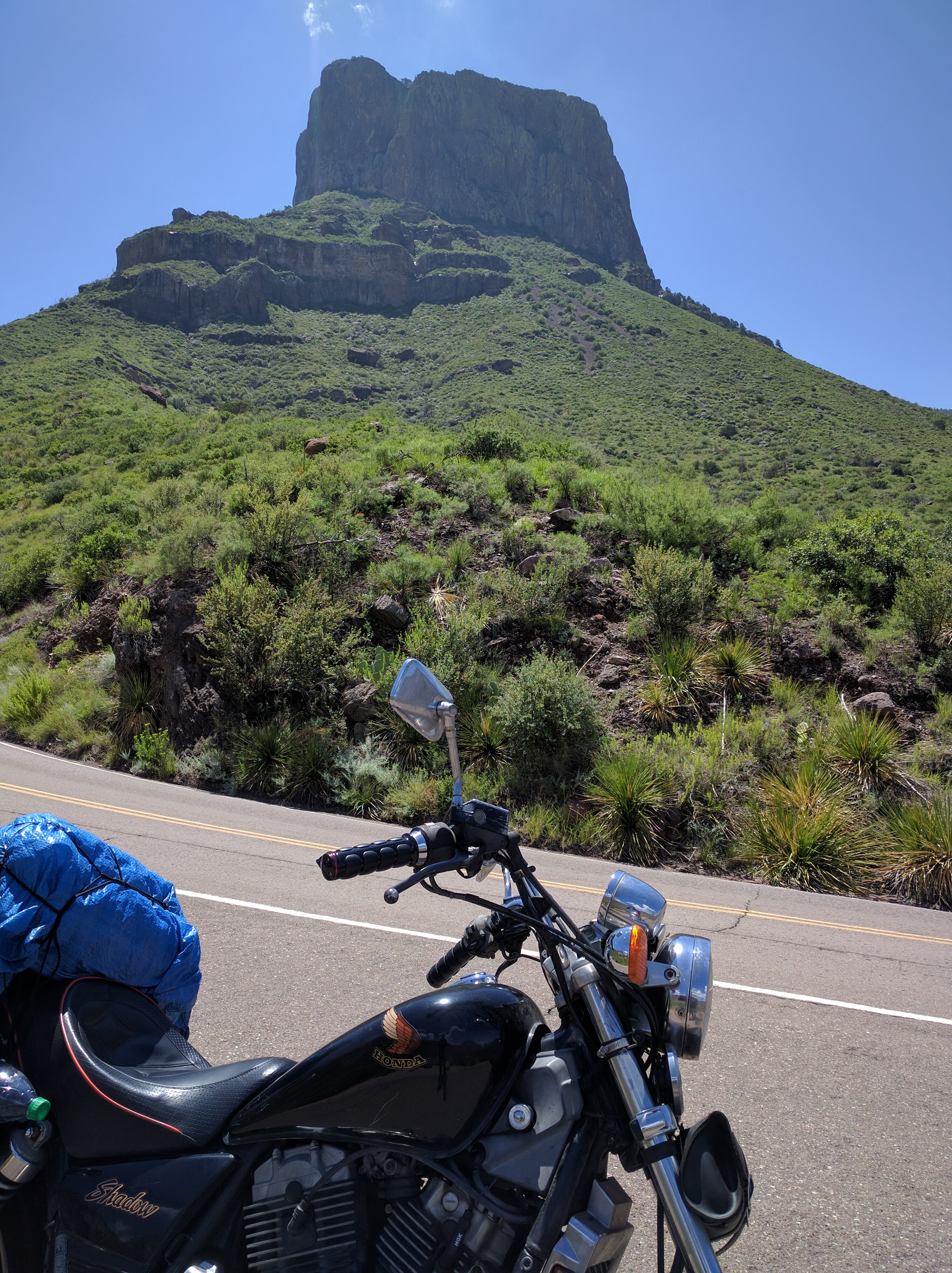
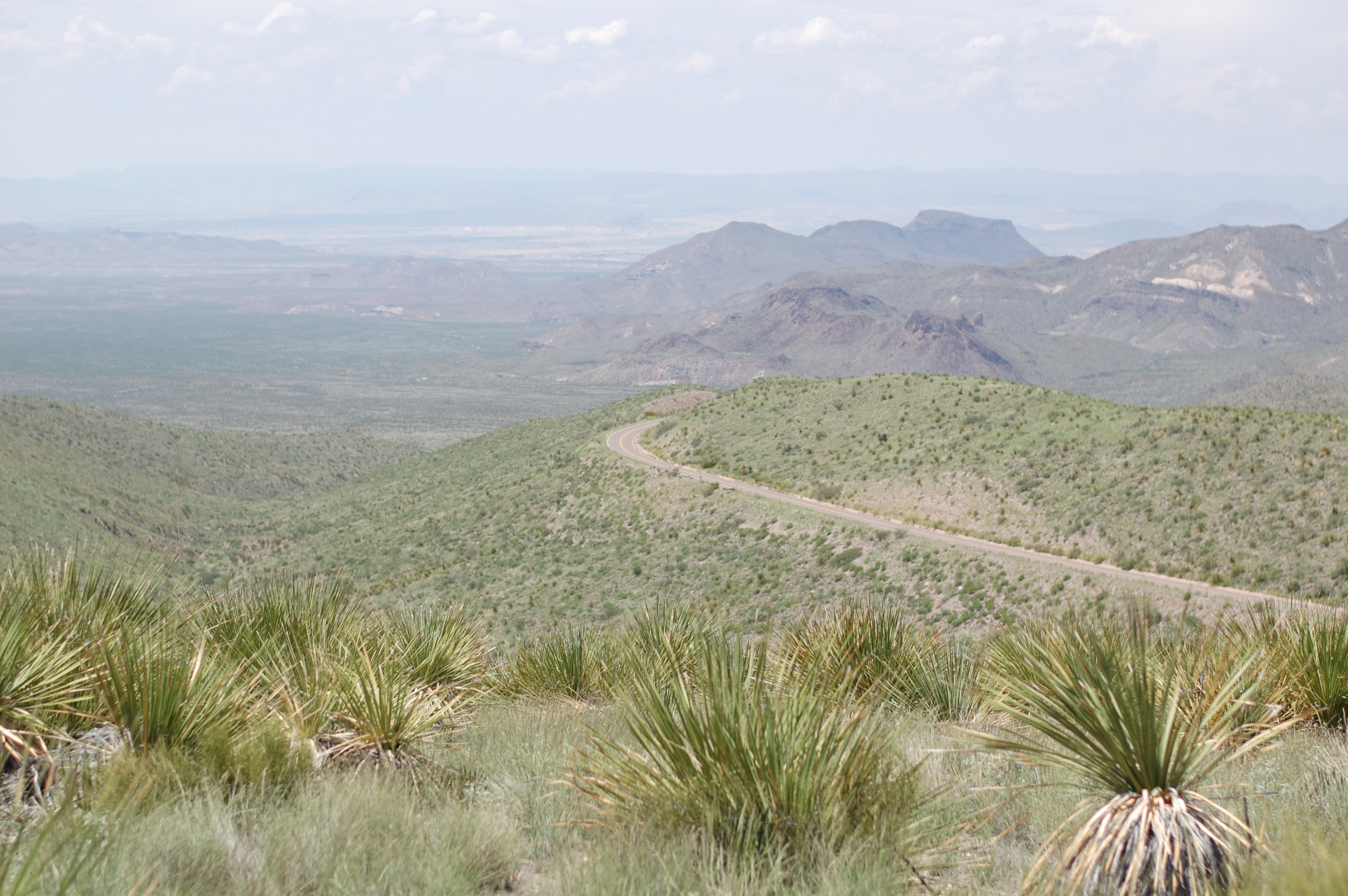
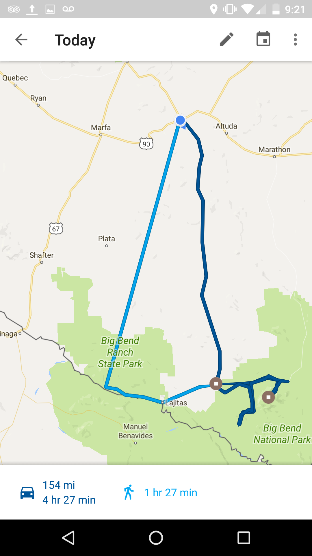
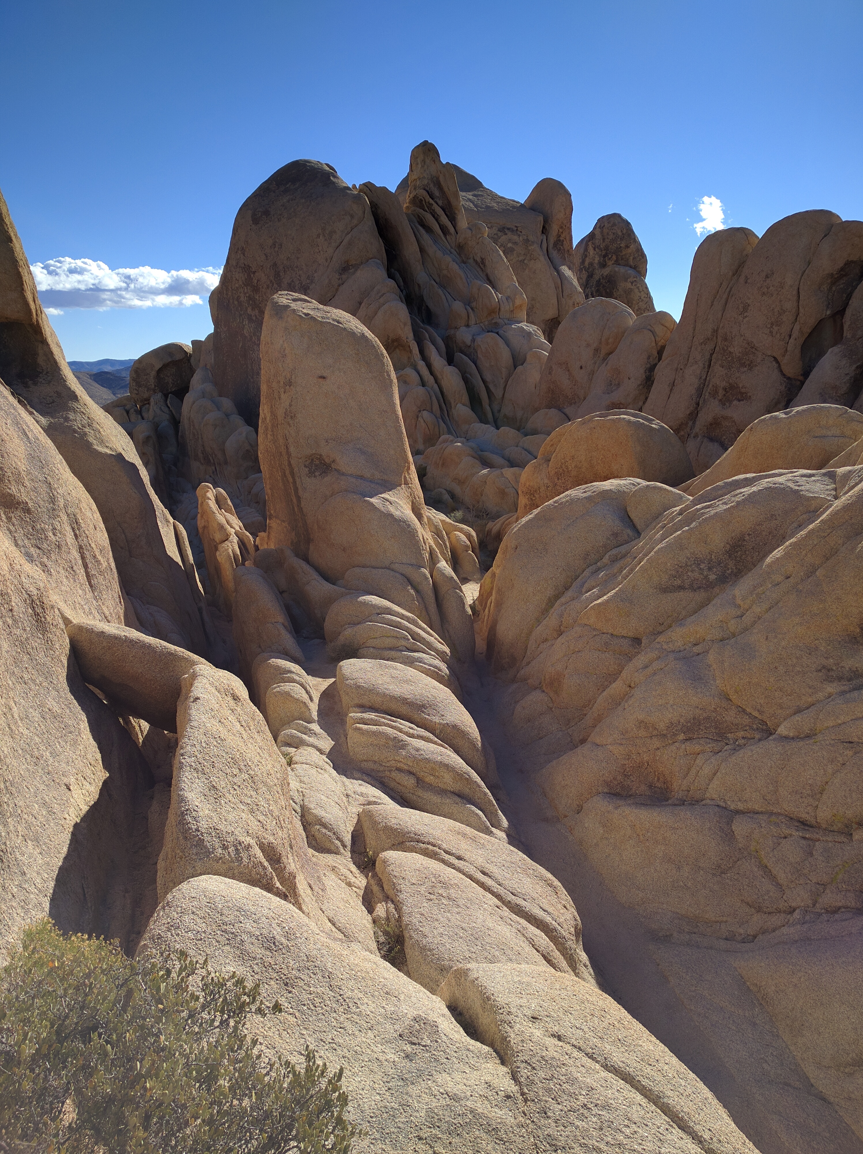
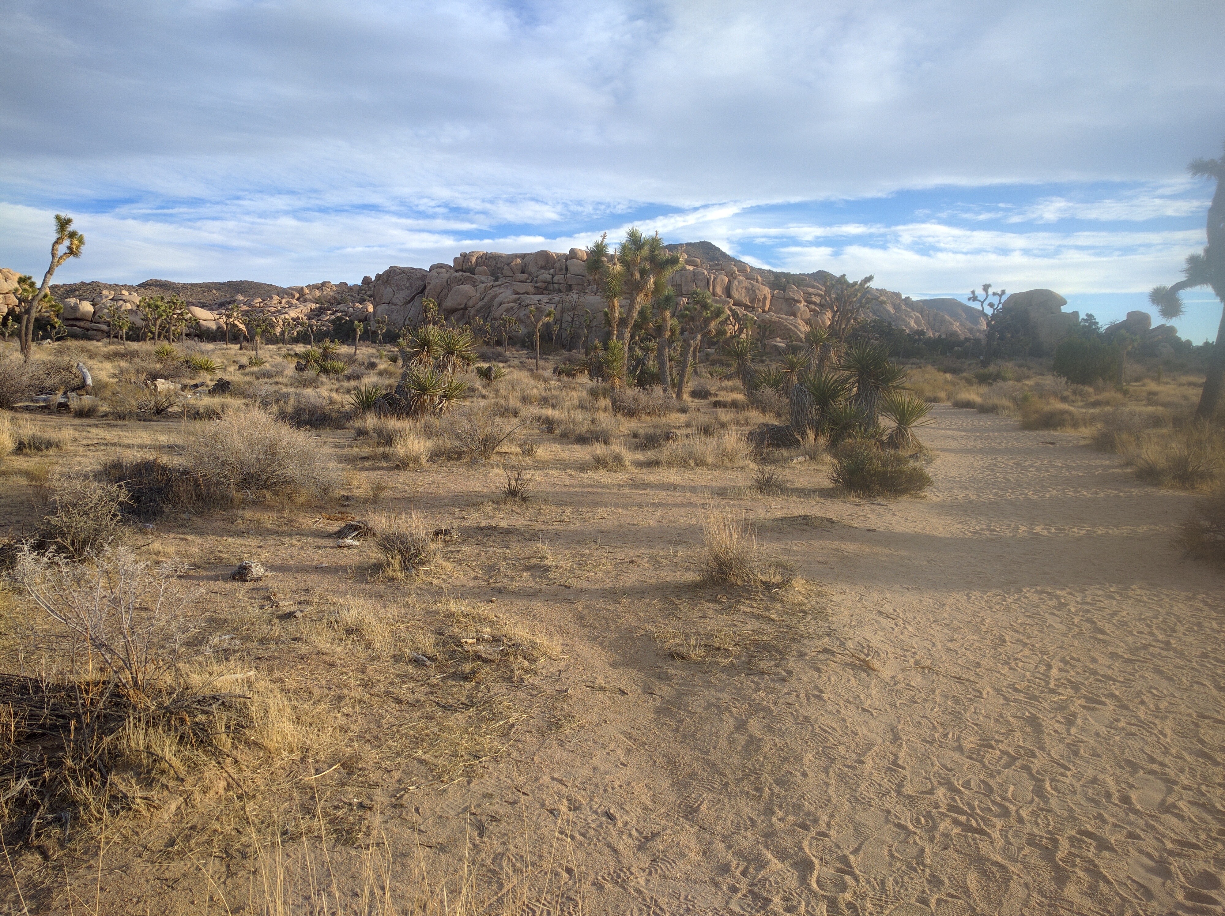
Finally what I was waiting for, a quick ride through Joshua Tree, where it was less hot and there was much more to see.

Like this stuff
Like this stuff


Thar be some joshua trees


Mountains are sweet
Mountains are sweet

Upon exiting JT on the southern side, my choices were I10 and sort of go around to Indio or go straight on box canyon road to Mecca. The latter seemed the more direct route and how can anyone pass up a road called “box canyon road?” Plus I came all this way I wasn’t about to start making it easy on myself.

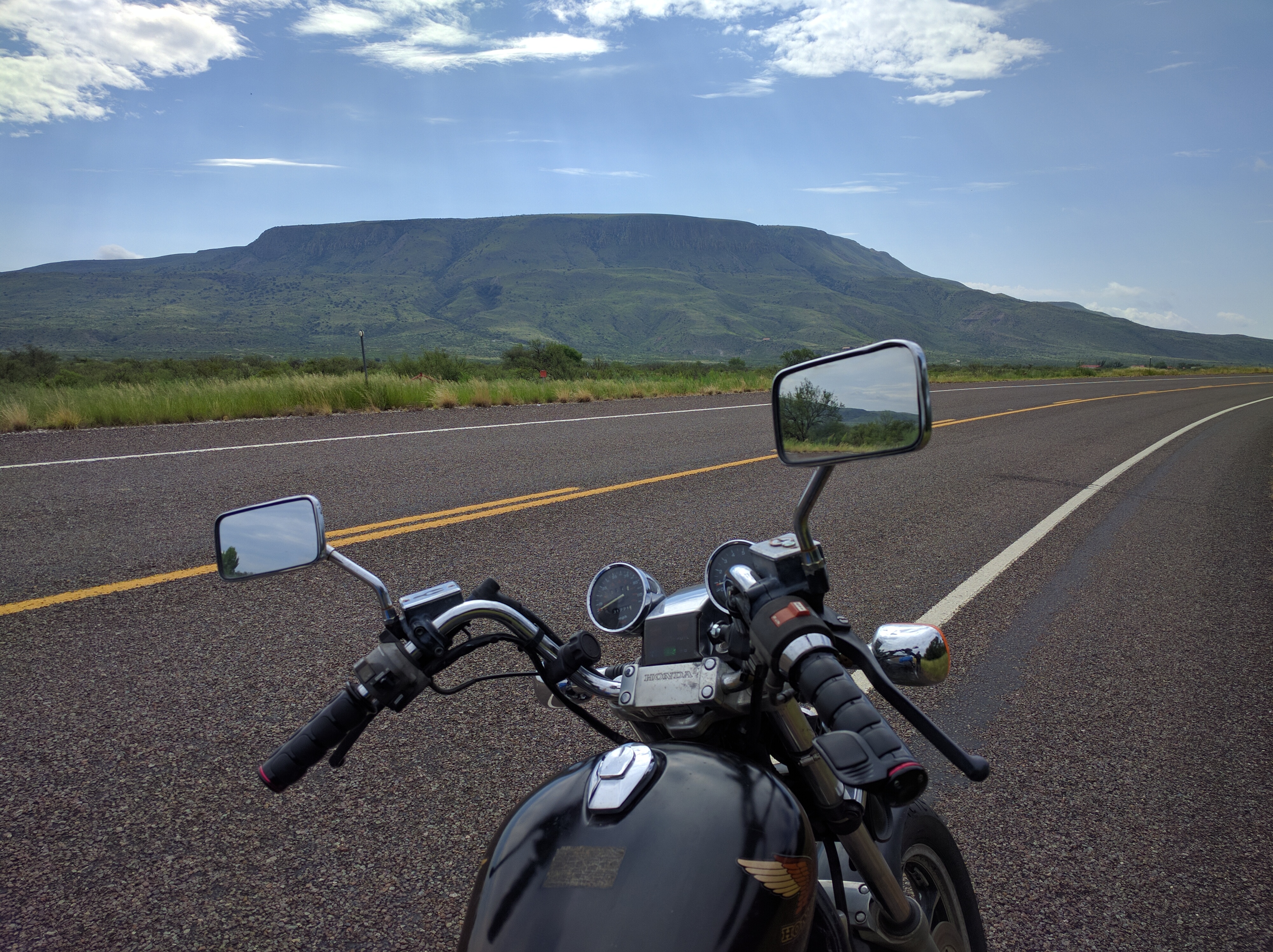
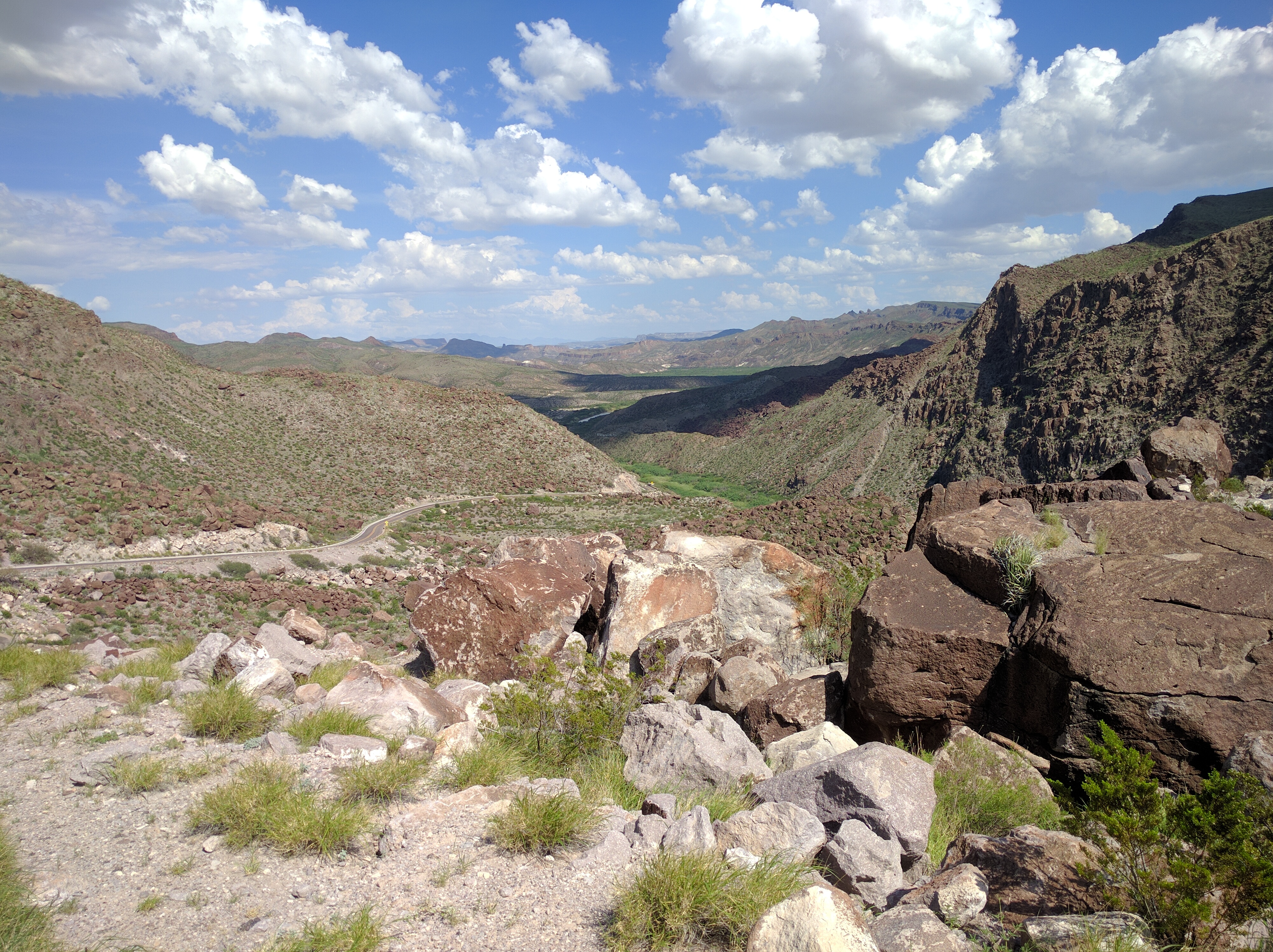
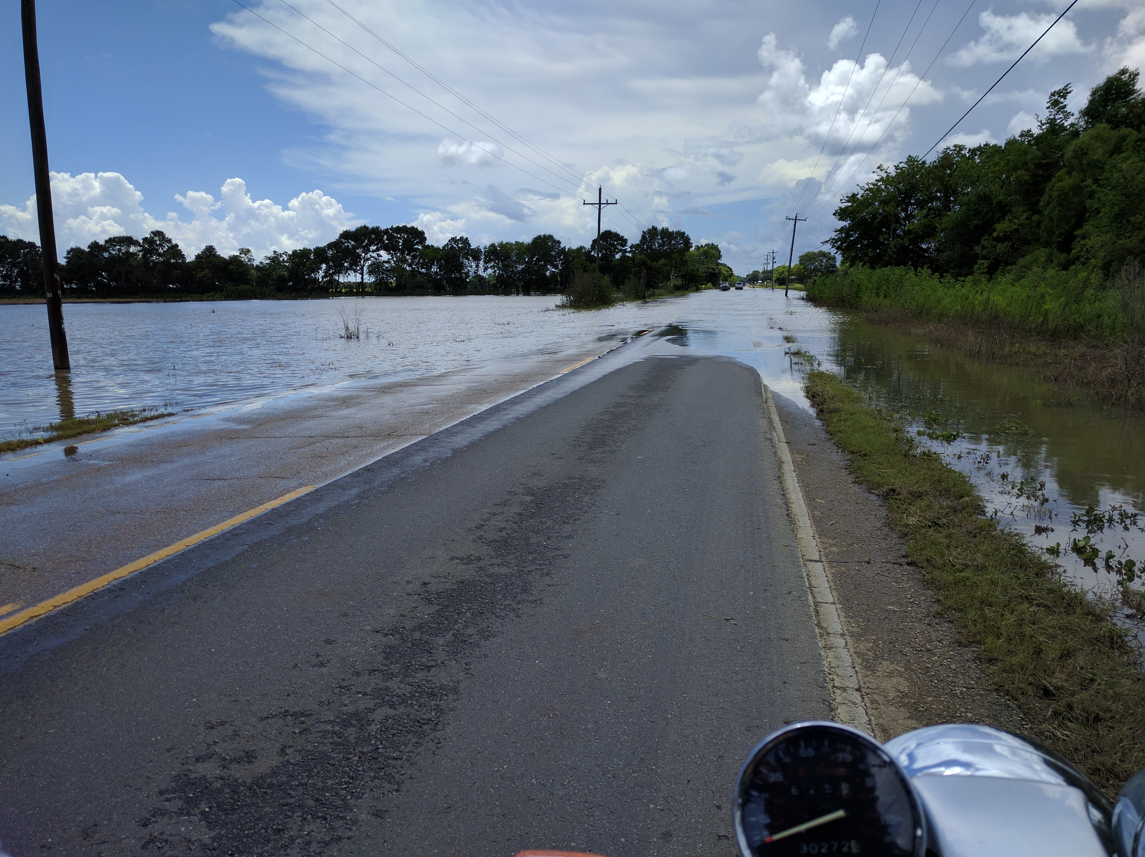
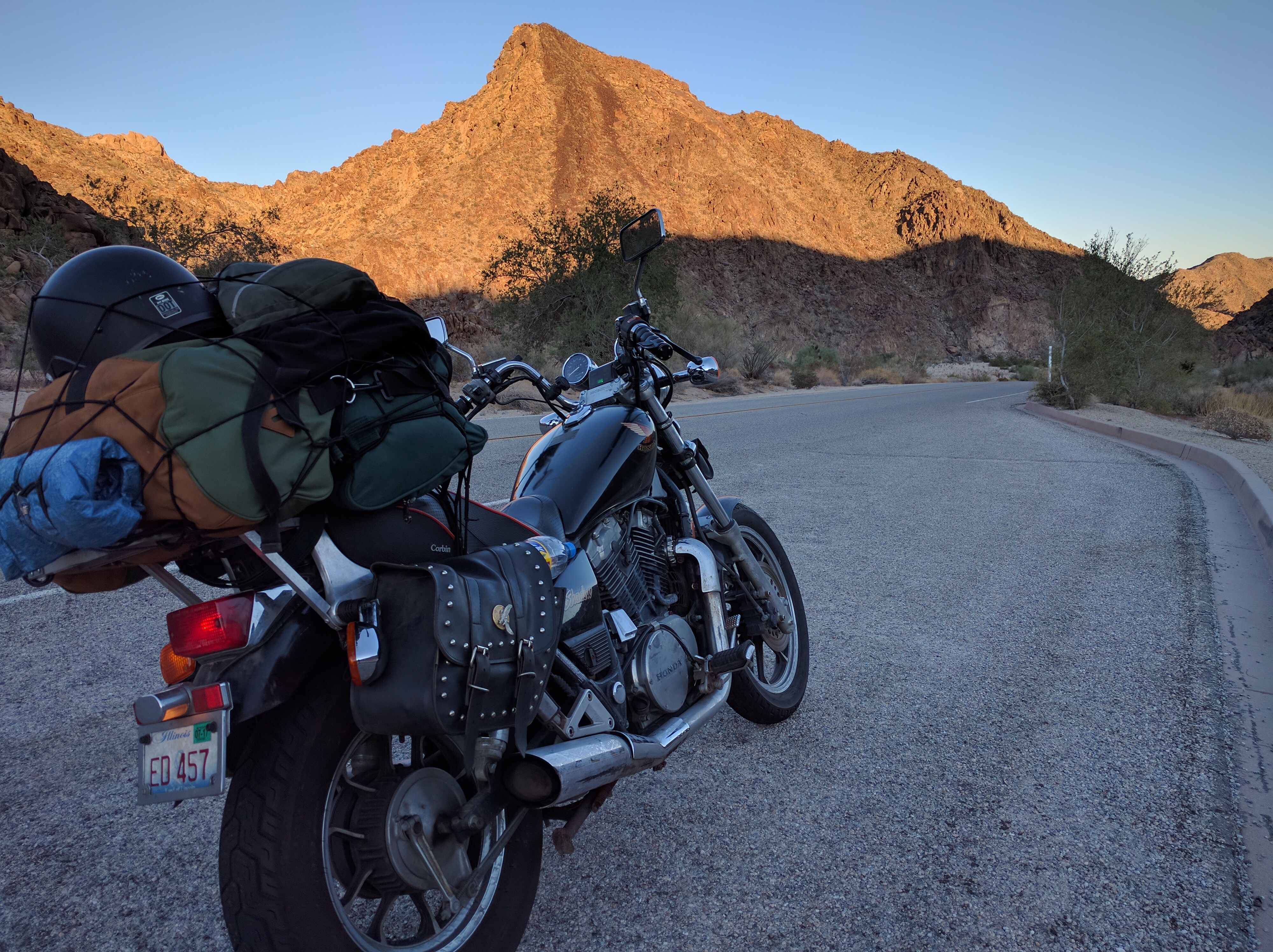
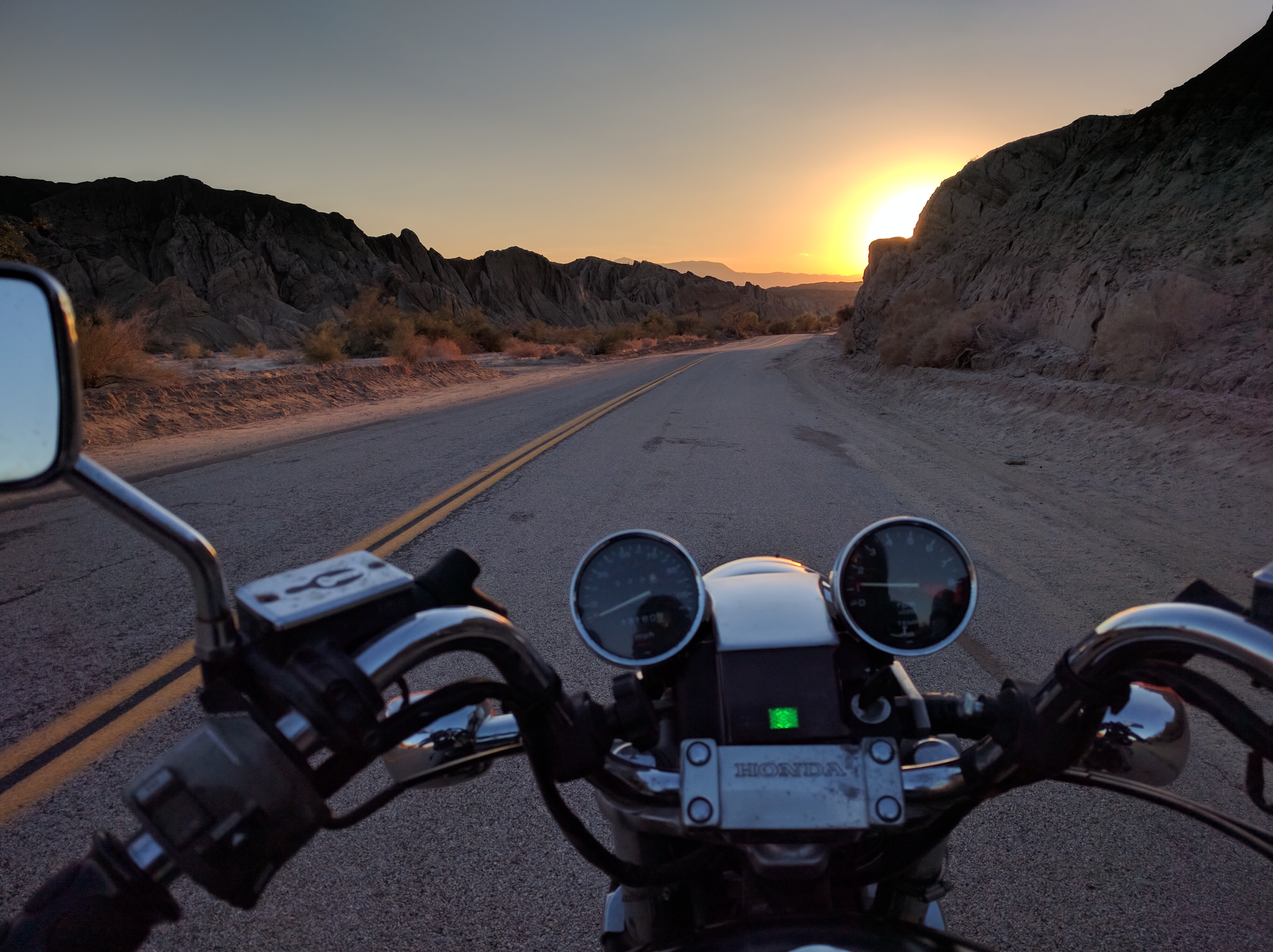
Well box canyon road made the drive through hot barren nowhere totally worth it. It was outstanding. Canyons on either side, winding roads through these canyons and a sunset in the background.

I swear a Jawa was about to jump out and zap my ass


Just before "blind the shit out you pass"
Just before “blind the shit out you pass”

Then fields of crops all of a sudden! Where the heck did these things come from? Lush green crops, bell peppers or something I think. A delicious smelling place (or maybe just a smelling place in general after having not smelled anything for so long) and a little humid/cooler as a result of all the crops. The town of Mecca and the Eastern Coachella Valley in general is apparently a huge rural farm community. Amazing anything grows here at all! They must have some pretty great irrigation systems.

A quick gas stop, some much needed cold water and a half a quart of oil in the engine, the sun was now almost gone. Beautiful behind the mountains. While the sun was setting, the day wasn’t over. I was still around 110 miles from my destination in Alpine, CA. Onward! At least it’ll get cooler outside right? Nope. Even after the sun was completely gone it was somehow still blisteringly hot. What is wrong with this place?

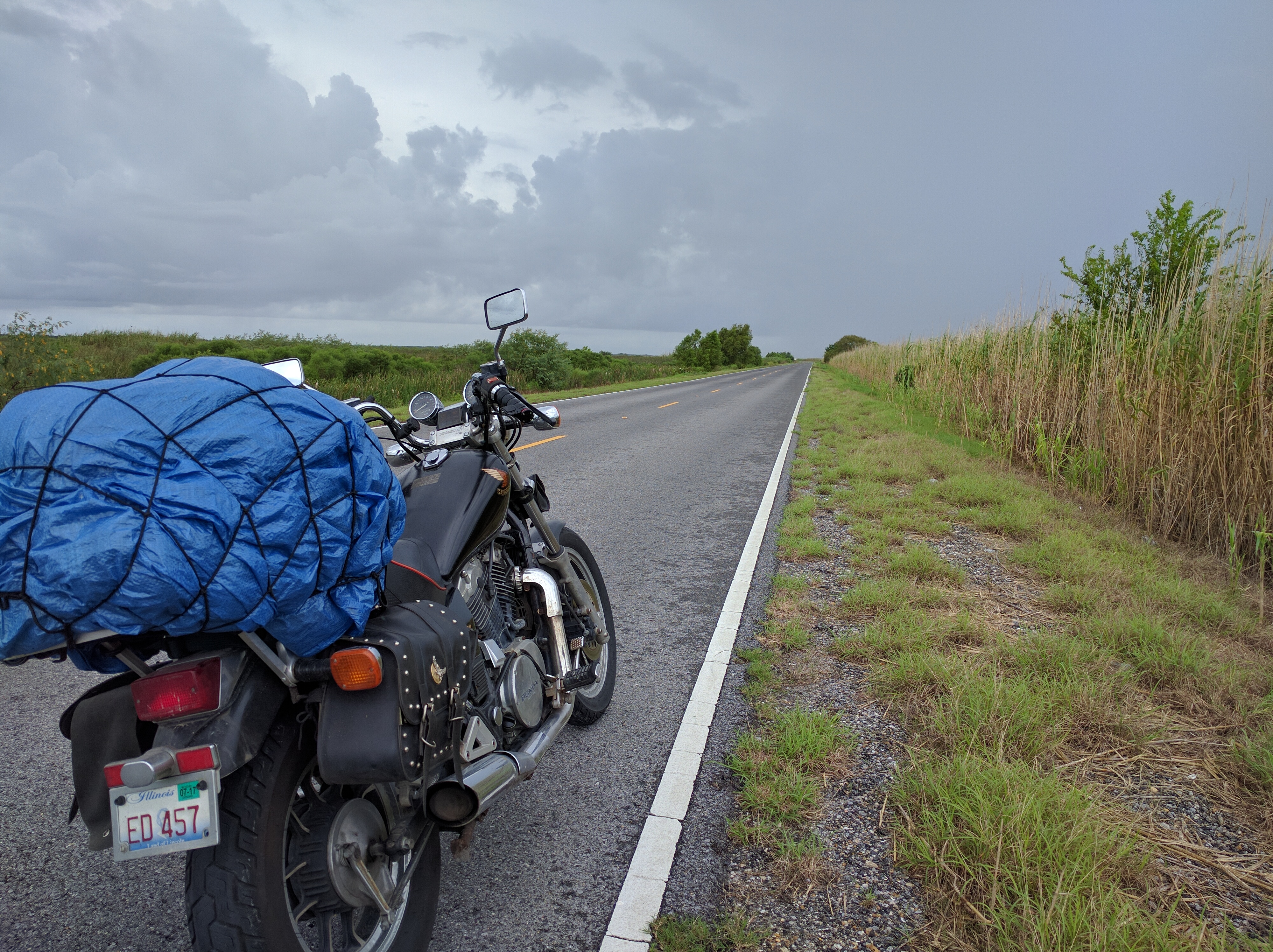
My route took me down 86 and onto a road called the Borrego Salton Sea Way, a rough road that in hindsight was not a good choice for a nighttime ride. Note to self, stay on larger roads when its pitch black outside.

In any event, a slow winding climb into the mountains and eventually around the town of Julian, it went from desert hot to mountain cold in less than a mile. It took me forever to get through these roads, just me and the stars most of the time. Awesome roads no doubt and I know they offer great views, but slightly challenging in the silent night. At one point they just gave up on offering “25 mph” or “30 mph” curve signs and just put up a blanket “sharp turns next 12 miles” sign. Cool thanks.

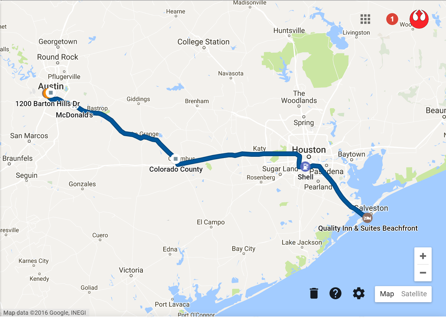
Finally Interstate 8! So close, signs for Alpine all over. After just passing the Viejas Casino, the bike started misfiring and coming to a slow. Each gear I dropped got me a little further along on the highway but eventually there was no more. I wound up rolling to a complete stop on the exit ramp for Alpine. Yay my first breakdown!

Conveniently only a mile or so away from the Barletta’s place, Mike came down in his truck and pulled me up the rest of the way with some tie downs. Slight nerve racking and not the easiest of maneuvers, but we managed to get it all the way home without dropping the bike or mangling the pete. Certainly a micro adventure in it’s own right.

From 45 degrees to upwards of 113, desert sun, mountains high and valleys low, a breakdown and tow, it was a day. A beer and some pie later and I was down for the count.

Yesterday was a day of accomplishment. After swapping the spark plugs I got in Mississippi while having my oil changed, the bike fired right back up. I couldn’t swap them while on the side of the road because I brought along a 5/8s plug socket when I actually needed an 18mm. Whoops. I was supposed to change them at 4000 miles but it was running fine so I decided to push it. Another lesson learned, just change the damn spark plugs when you’re supposed to.

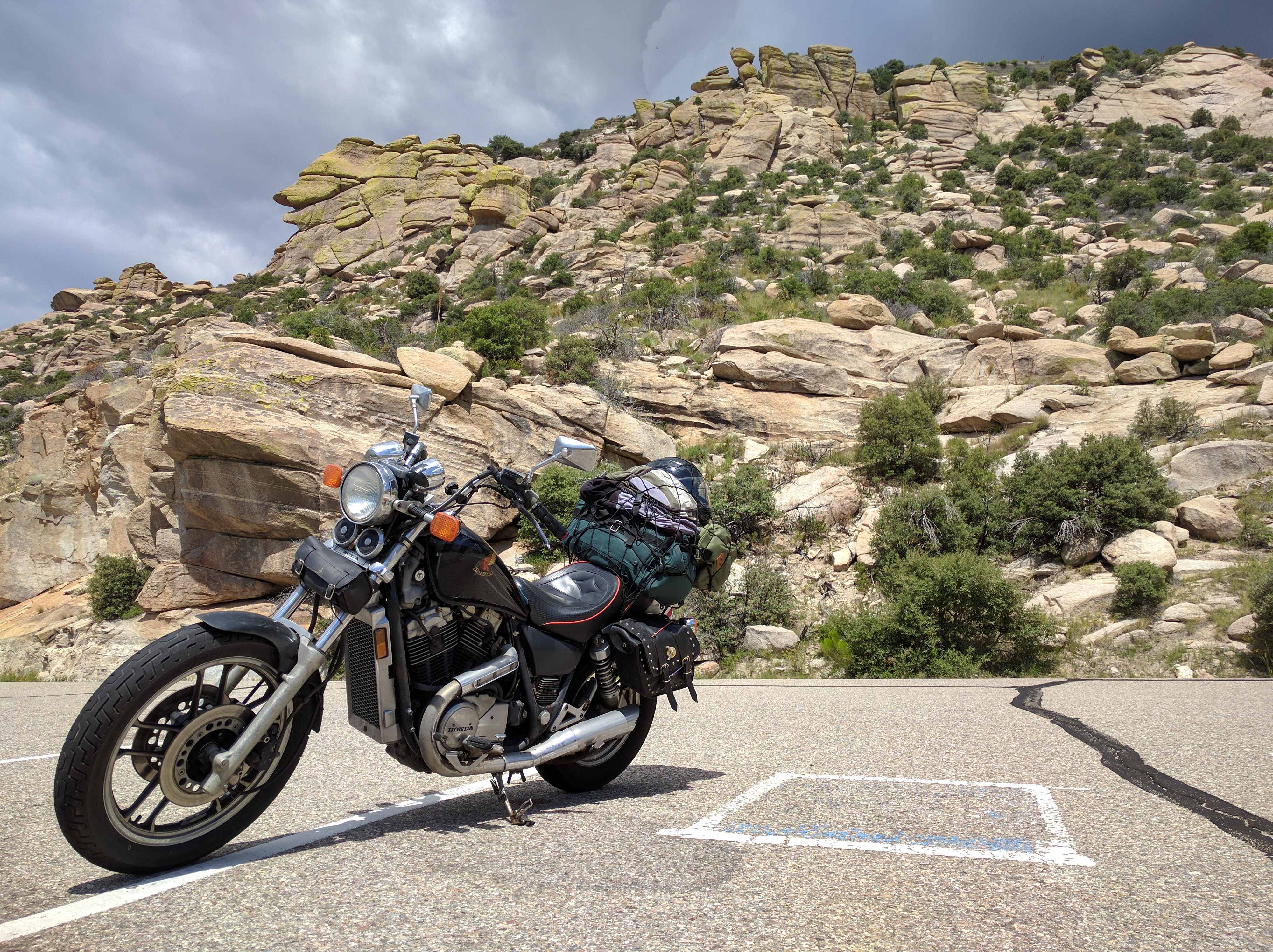
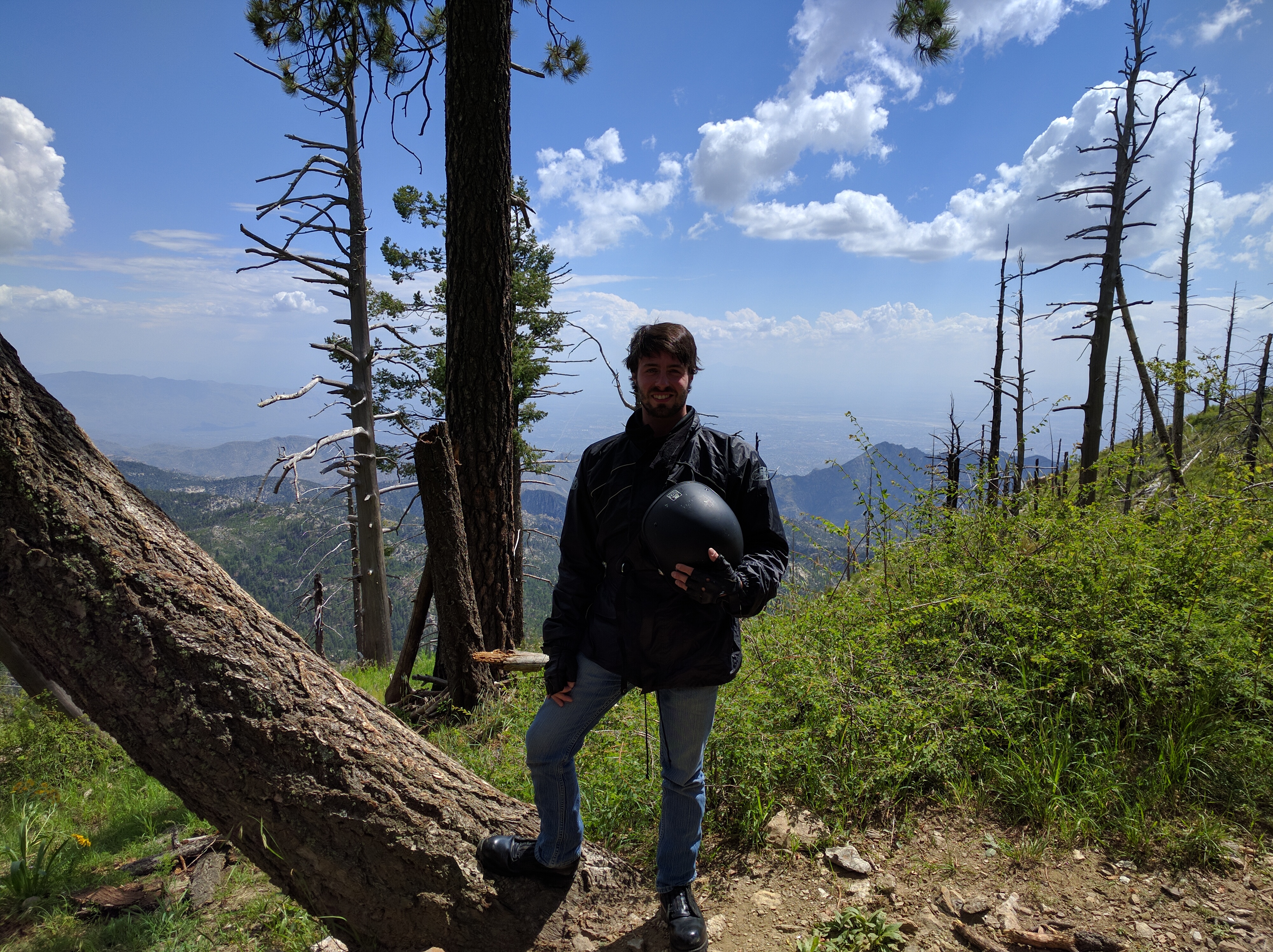
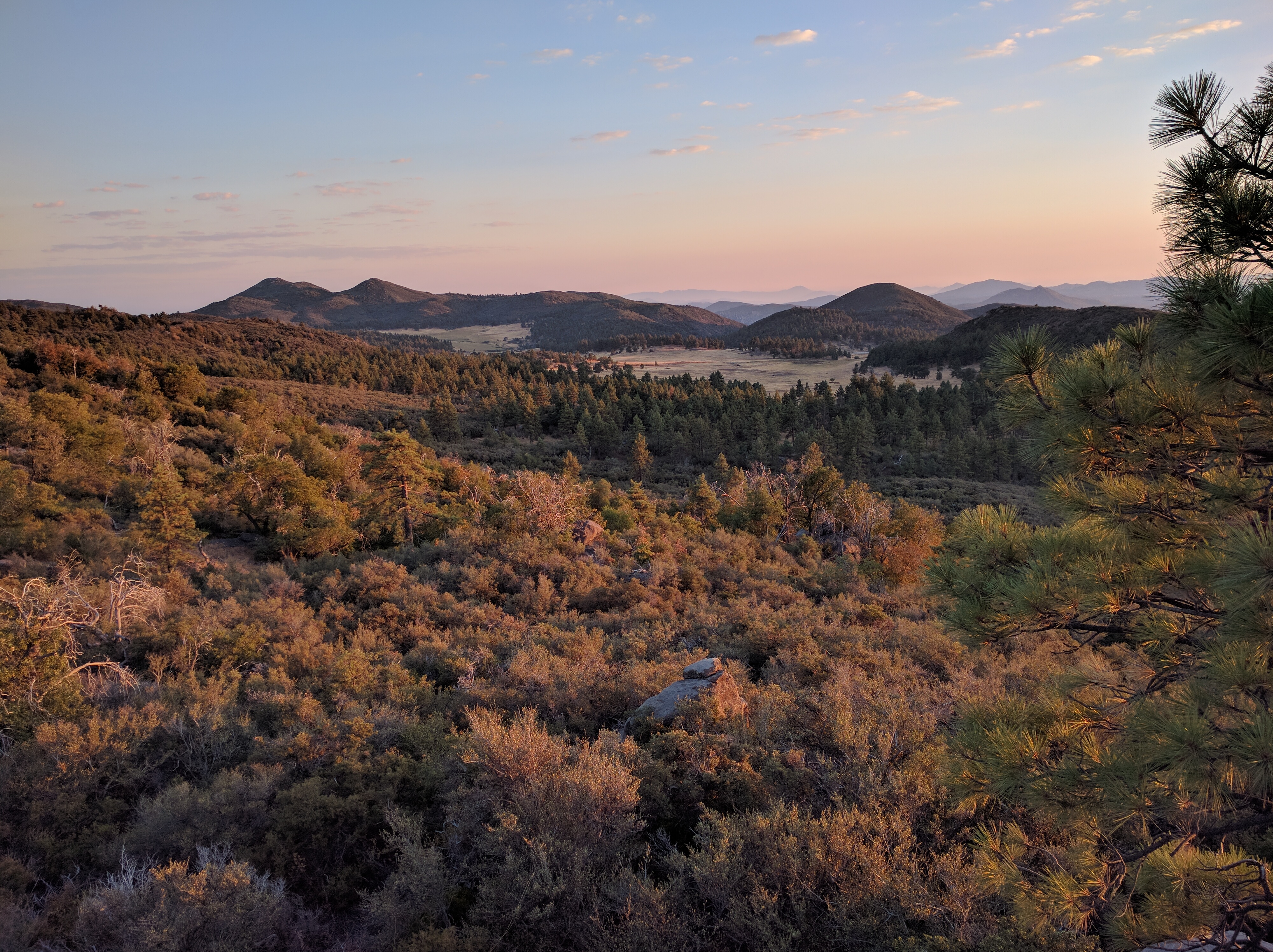
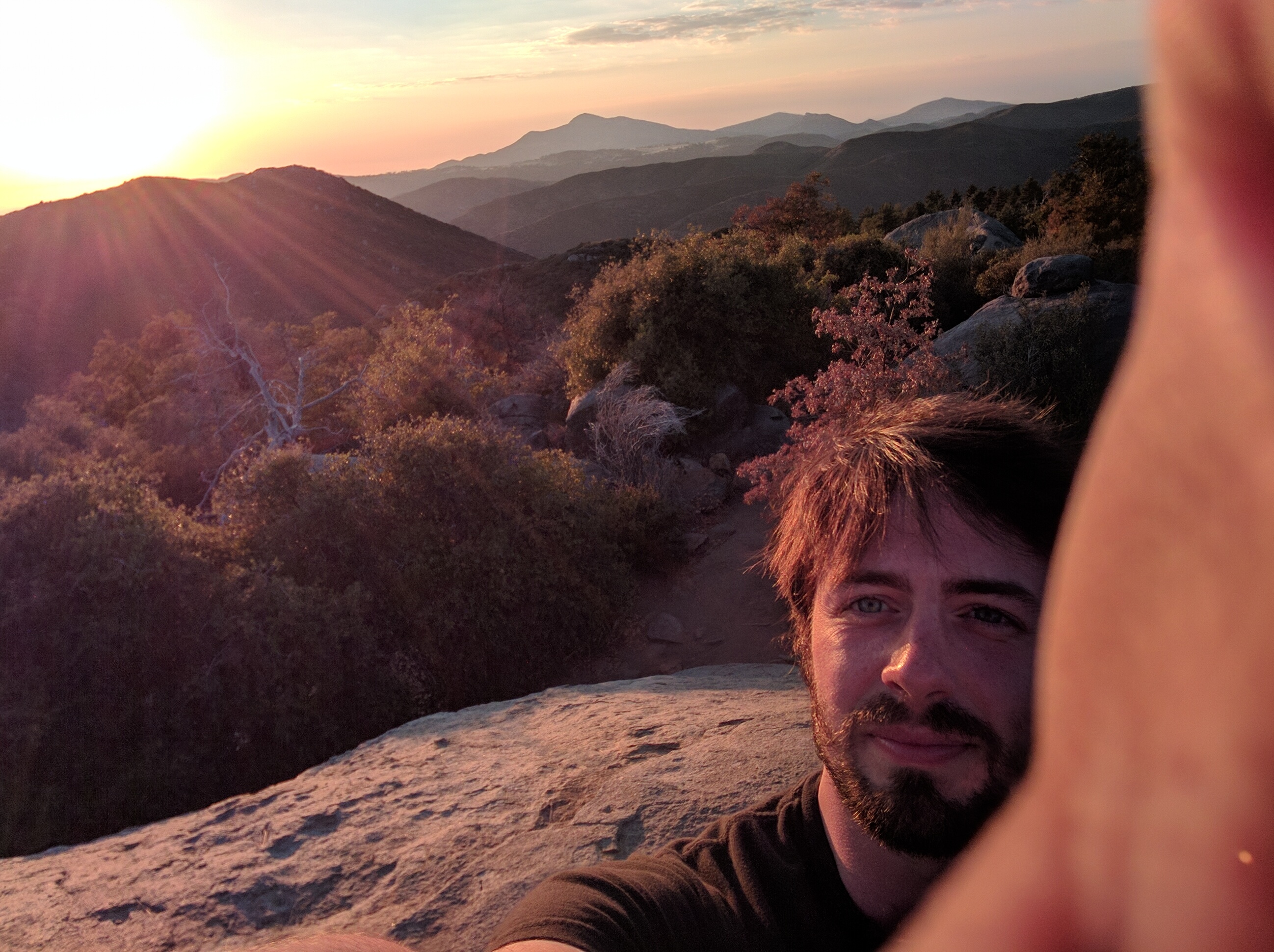
Finally a hike in the mountains for some amazing sunset views and a delicious dinner at the Alpine Beer Company Pub with the Barletta family.

alpine1 (1) alpine2

I look forward to another 2 days or so under the San Diego Sun.

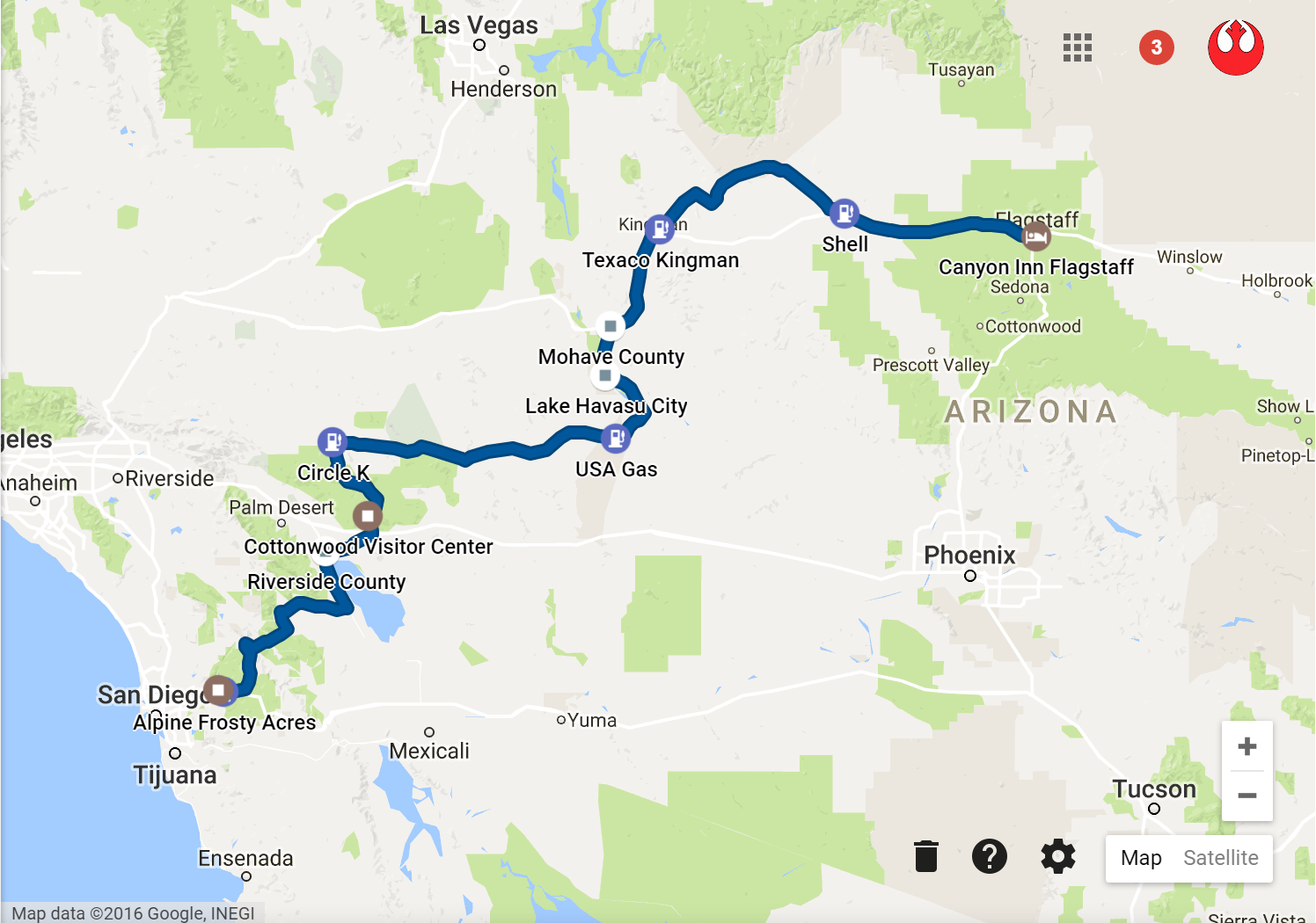
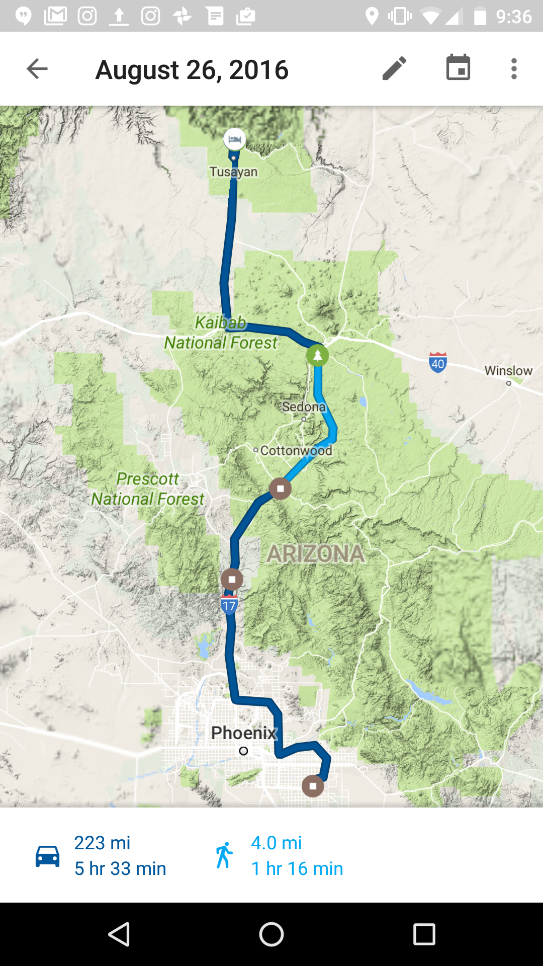
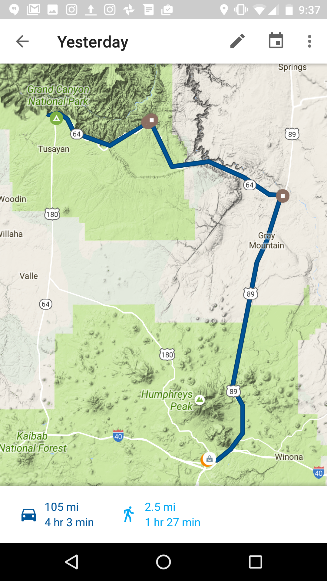
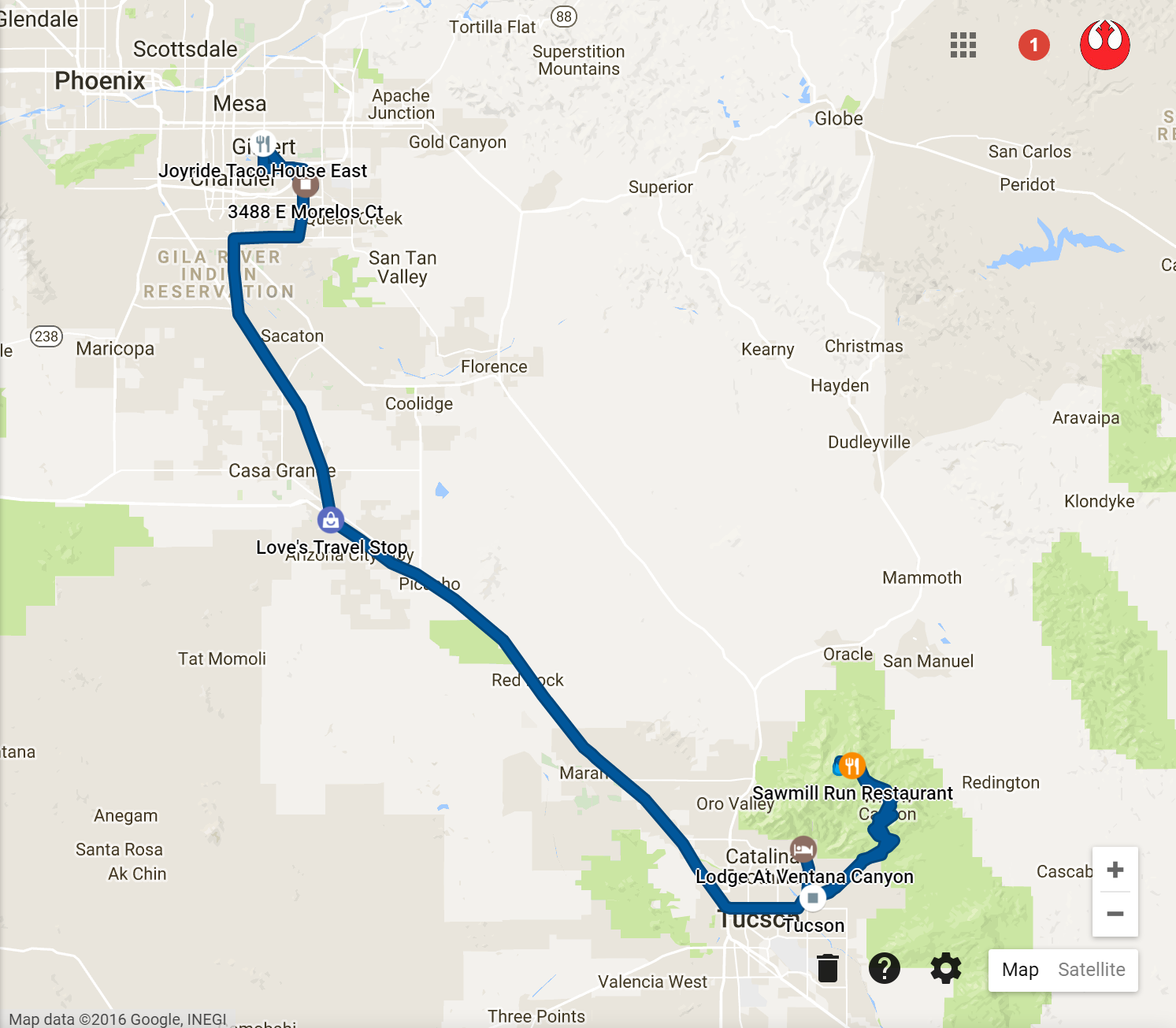
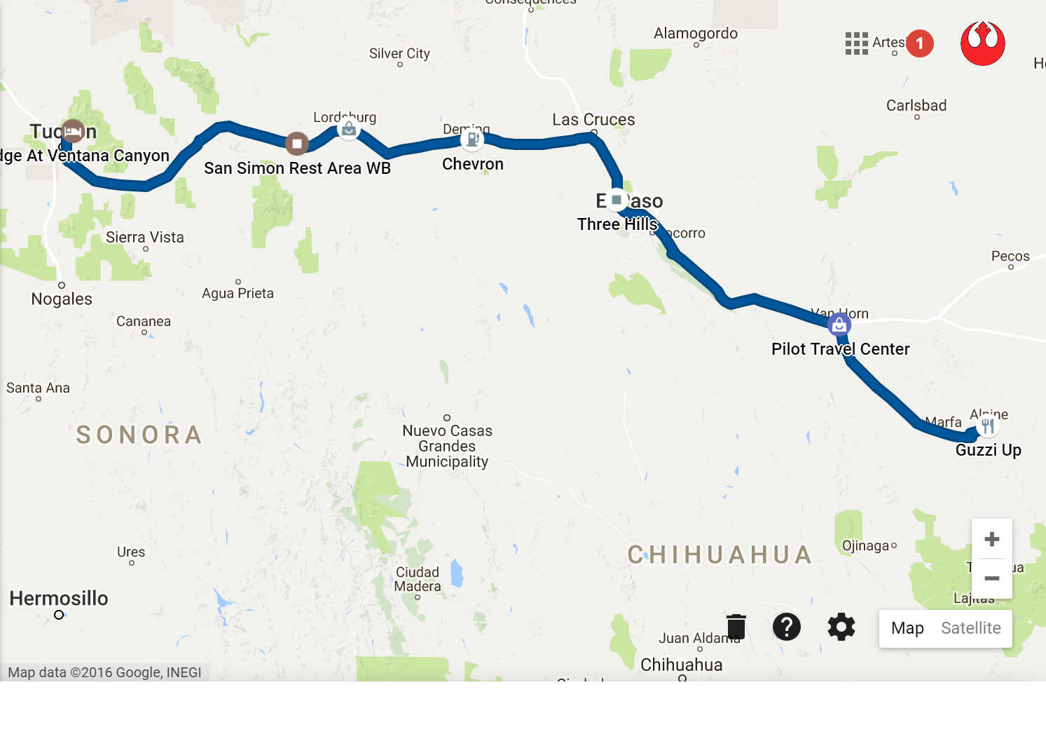
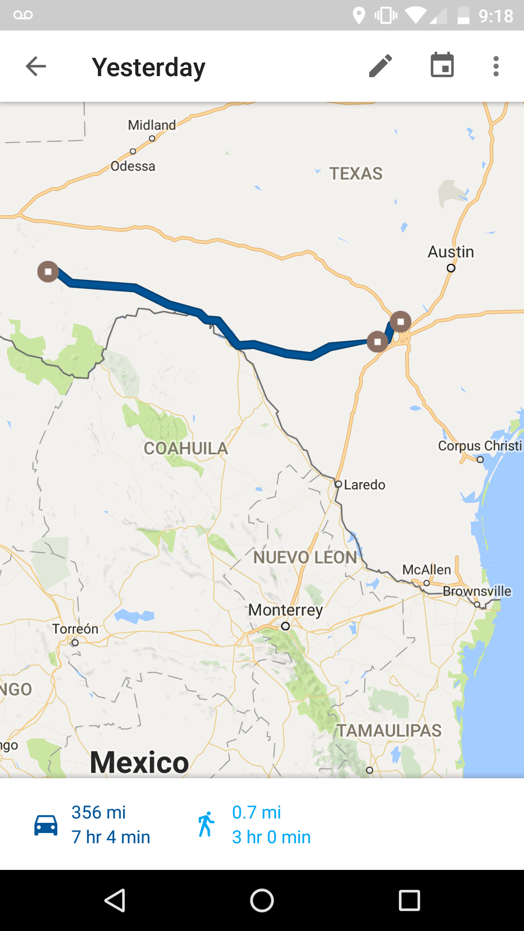
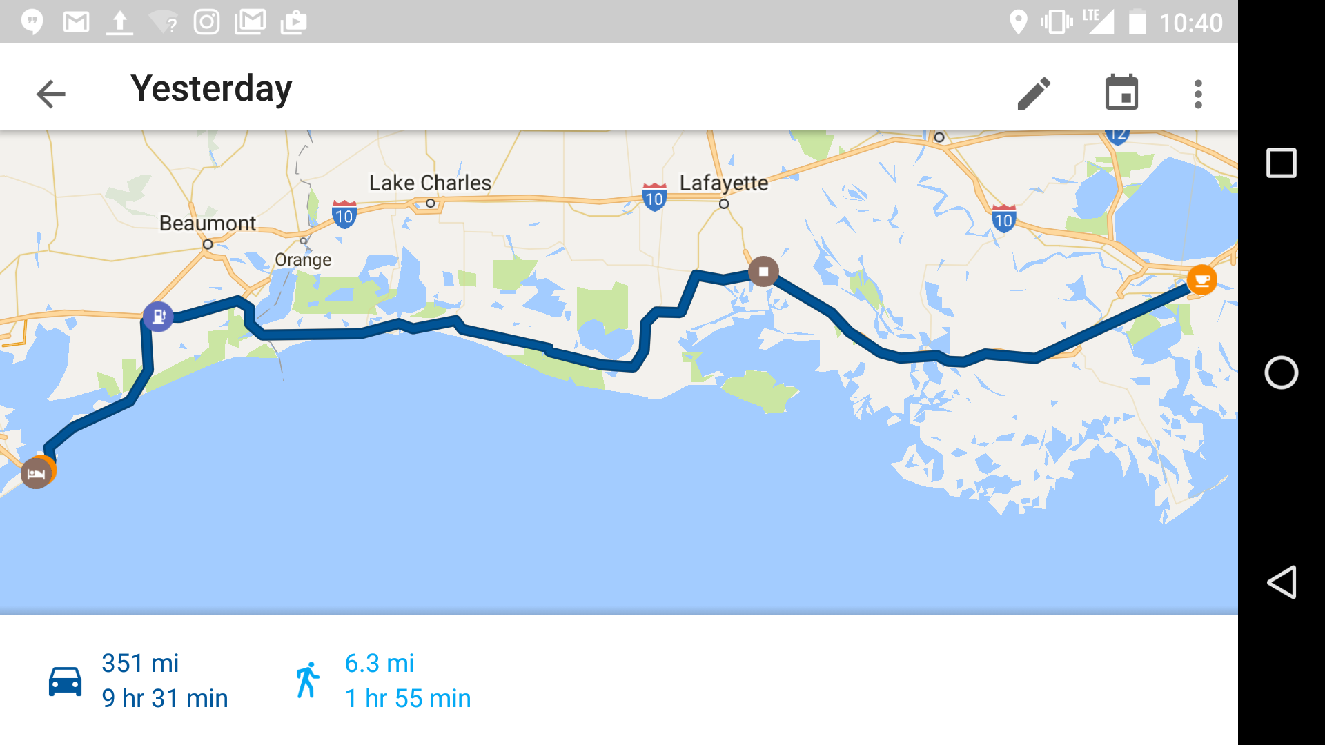
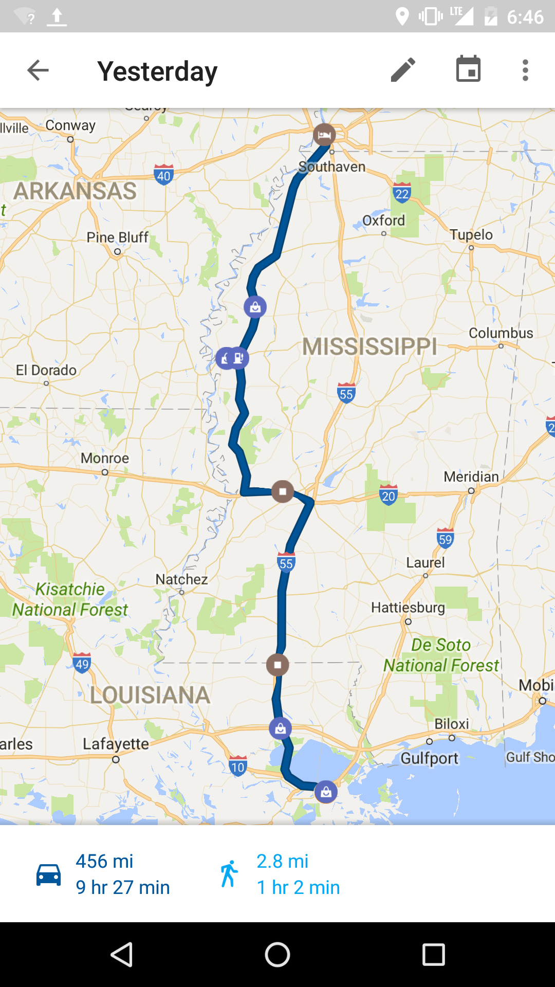
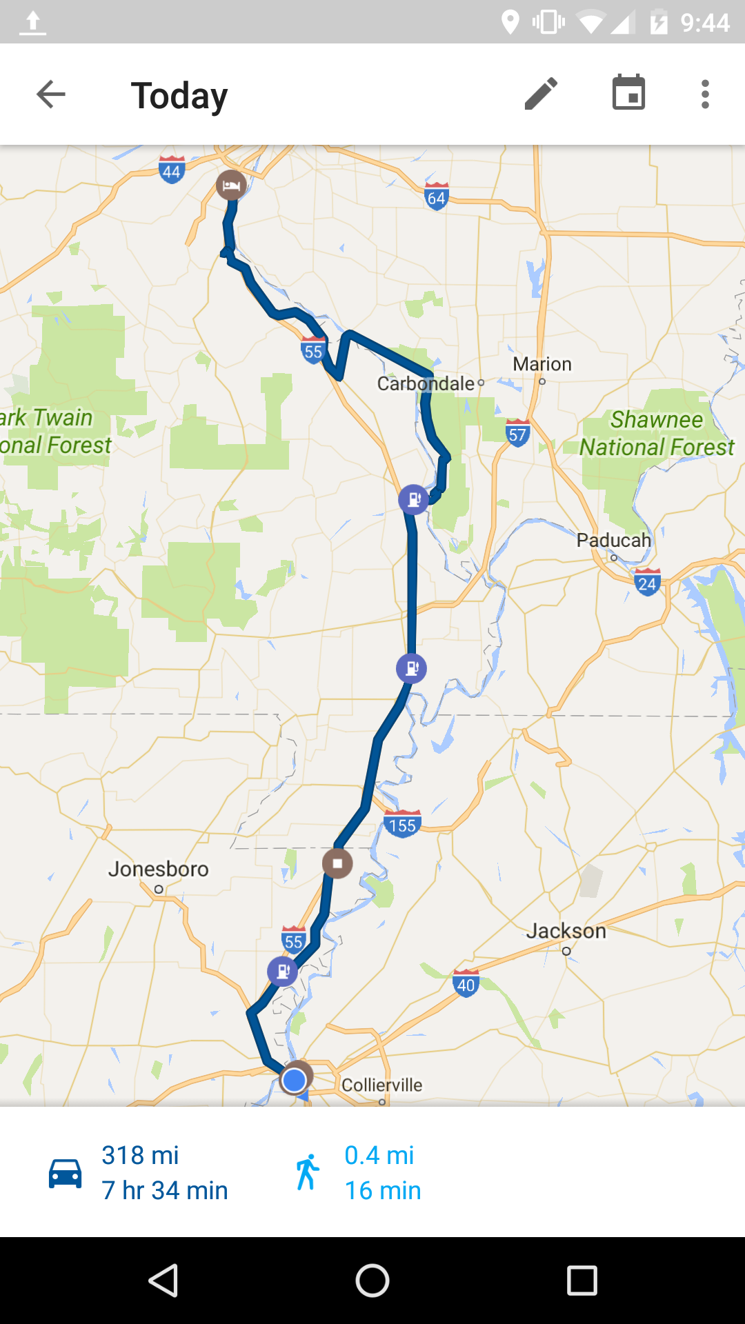
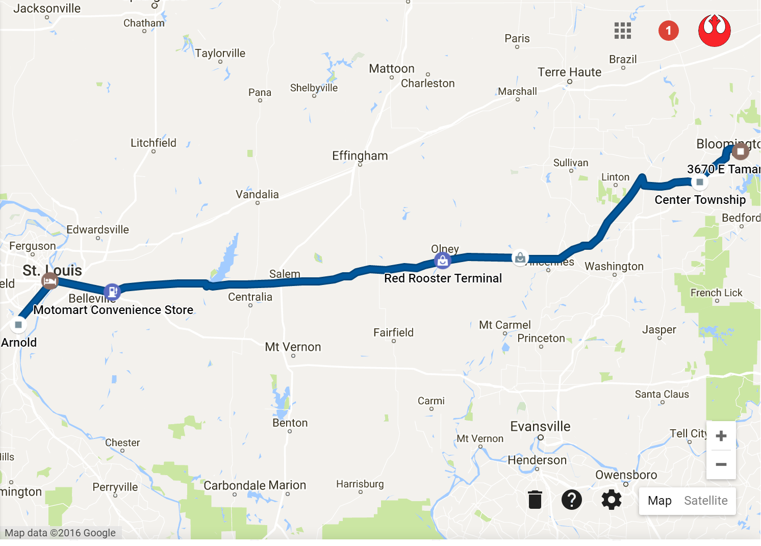
Here’s the desert route:

517 mi, 11hr 34min
517 mi, 11hr 34min


Days 19, 20 & 21: Monumental Marvels & Milestone Mania

Days 19, 20 & 21: Monumental Marvels & Milestone Mania

So it’s been a few days since my last post and there’s been so much that’s happened its tough to recall every bit and piece. The note taking idea hasn’t really panned out and I generally rely on my less than reliable brain to recall All The Things. I usually go through this “ooh that’ll be great and informative for the blahg,” followed by “shit what was it that I was thinking….” So I’ll do my best here.

After leaving Phoenix on Friday morning, the road to Flagstaff, Interstate 17, is plenty scenic and enjoyable for an interstate. There’s even a very cool little turn off/rest area with some views of the mountains called Sunset Point. After a while the desert heat turned into brisk cool air and pine tree forest all around.

I left Phoenix truly believing for a second day in a row that I wasn’t going to be rained on, despite the news talking about the rain that hardly happens but was happening around Phoenix that day. So no tarp and on we go, which brings me to my first important milestone I wanted to note here today. Naturally it did rain on me right around when I was getting close to Flagstaff and this marked 15 days in a row where I’ve been rained on at least once while riding the bike. This milestone quickly led to another, when I was lucky enough to experience my first hailstorm!

hail
Some fellow riders and I waiting it out. First time I could see my breath too!

While I wanted to check out Flagstaff real quick and find some hiking shoes, things weren’t looking great so straight west to on 40 and north on 67 toward the Grand Canyon it was.

67 was uneventful to my surprise. I was thinking as we got close to this grand canyon thing that the scenery was going to change a bit. Grassy fields almost the entire way before hitting pines again.

Mather campground where Ruffles and I were staying for the next two nights was great. Perfectly spaced out spots, plenty of tree cover and just a beautiful place in general. The rain didn’t stop us from lighting up a fire and enjoying the fresh air.

Saturday was a day full of adventure. Google maps says we spent a total of 9 hours and 9 minutes walking 11.4 miles. Unfortunately we were advised against the trail we wanted to tackle since there was a 75% chance of thunderstorms which could result in flash flooding along the hiking trail. We still had a great time exploring the rim, climbing rocks and hiking down quite a ways anyway via the South Kaibab trail to Cedar (pepe) Point (marking the 5th national park I’ve hiked in). All the while keeping dry despite the warnings.

Go away rain clouds
Go away rain clouds

I took quite a few pictures of this magical place, but none of them do justice in representing the scale and magnificence of this place. Neither can I really describe it in anyway that can  truly convey breathtaking wonder that exists in every frame of vision. But here are some pictures anyway:

I'm pretty sure a T16 can fit through this one

gc3

gc4
Pretty sure a T16 can fit through this one

gc5

On the hiking trail we met 2 young Romanian guys that were walking all the way down from the north rim up to the south rim. Something that’s supposed to take 3 days that they’d started earlier that morning. They were also hitchhiking across the united states and had all of their travel supplies with them. Crazy! They are a huge inspiration for adventure.

We managed to catch both a sunset and sunrise over the canyon, the latter involving waking up at 5:15 and literally running to make it on time. Worth it though.

While we didn’t see any womprats, the wildlife (and non-wildlife) was still abundant. Lot of mountain squirrels, some small lizards, tons of elk chilling out on the side of the road, a Coyote that stood in the street at 6am and just watched us, mountain bluebirds, chickadees, california condors, turkey vultures and probably things I’m forgetting. No bears though…

Oh and of course a few amusing signs including your run of the mill bear crossing, multiple variations on the mule crossing, elk crossing, the elusive mountain lion crossing and of course more warnings on the poisonous snakes, insects and lizards that inhabit this beautiful but deadly area.

If you ever have an opportunity, this thing, this Grand Canyon is nothing you can possibly fathom. You have to see it in order to understand the infinite majesty of the place.

Somewhere over the weekend I hit 5000 miles on the bike since departing Chicago on August 8th, a milestone that marks roughly half way on this adventure.

Last night I was back in Flagstaff to check out the things I’d missed out on and recover from our grand weekend excursion. It’s a cool place, much smaller than I thought but a neat little downtown and sprawling ranch houses all around.

The way back in was not the same as the way I took in, instead this time going east through Cameron, a little desert town in between flagstaff and the GC. The ride was neat though, 67 going wast offered lots of views of the canyon and some great riding with little traffic.

Here are some routes:

route17

route18

Today I make my way to Sunny California. Later!


Day 18: A Quick Mountain Climb

Day 18: A Quick Mountain Climb

Usually on my way into wherever I’m going, I check tripadvisor.com for some of the more highly rated touristy things to do. On my way into Tucson, I noticed that #4 out of like 290 things to do was a scenic drive, specifically the Mt. Lemmon Scenic Byway. I figured this would be a great start to the morning before heading off to the Phoenix area.

And boy it was. So much so that I think it would absolutely be worth it to fly into Tucson, rent a car, drive up and maybe do a hike and right back to the airport.

The drive starts with an infinite number of Seguaro Cacti. These things grow like weeds around here but the entrance to the drive is littered with them, every few feet for as far as you can possibly see.

Cactus, in action
Cactus, in action

As you start to maneuver the perfectly winding and climbing road, the views only get better. I say perfectly winding because unlike big bend, it’s like this road was crafted for the rider in mind. An easy 40 mph into an angle that the bike just wants to naturally follow.

mtlem1

Pretty soon the Cacti disappear and we’re left with desert shrubberies, but the views! Oh and the added benefit of every turn, ever minute getting cooler and cooler as you climb.

Lookin good Billy Ray!
Feelin good Louis!
Feelin good Louis!

Cool cool cool, but wait, there’s more! Desert shrubs turn into small tress which turn into full blown pine tree forest. Ah yes, and the return of bear crossing signs. I couldn’t believe the change in scenery and temperature in a matter of only 30 miles.

It was the first day I started off with no tarp on the bike. I thought for sure, without a doubt, this would be first completely dry day since Traverse City. Nerp, even in the desert it rains on me. It wasn’t any ordinary rain either, frigid mountain rain that hits the bone. Luckily it only lasted for about 20 minutes.

Along the way I met a gentleman from Idaho riding a decked out Goldwing heading up the same way. After some good conversation around halfway up, we eventually found each other toward the top and enjoyed a lunch in the mountain town of Summerhaven (there’s a whole town up  there!). Eventually just past the ski resort near the top, you can follow a tiny snaking road that ends right around 9000 ft for some good views and excellent weather.

Mountain man
Mountain man

Mt. Lemmon took quite a bit longer than expected, but had a lot more to offer than I expected too. It was time to head back into the desert heat and make my way to Gilbert AZ where I had some great company waiting.

The heat was real. Road was hot and the little bit of stop and go traffic was borderline unbearable. Oh and just as I was nearing Gilbert I got to experience my first dust storm. Sort of felt like a right of passage in these parts LOL.

In Gilbert I found Cami’s Aunt and Uncle (and dog, of the furry black lab type). An excellent dinner, some turn signal surgery and hangout with these amazing folks (and dog) to end a great day. Thanks again guys <3

Le Route:

route16

Today I begin with searching for some stronger sun screen for my white ass and some hiking shoes before making my way to that thing featured on the state motto. Later!


Day 17: Signs Signs Everywhere There’s Signs

Day 17: Signs Signs Everywhere There’s Signs

Whew, made it Tucson and it was a haul. The Marfa lights were slightly disappointing but apparently they don’t occur every night 100% of the time. Regardless, the night sky was tremendous and I finally got a taste of what we Chicagoans sorely miss out on.

The morning started naturally with a brisk thunderstorm, but after that things were quite temperate and enjoyable the whole way. US 90 remained scenic to Van Horn and even Interstate 10 had a lot of pretty views, mountains off in the distance the entire time. I realize I’ll eventually be surprised once there aren’t mountains in the distance at some point.

vanhorn

There have been quite a few interesting and cool signs along the way but yesterday was an exception in ridiculous posts along my route. I thought nothing would top the bear crossing signs in Big Bend but alas.

Along my way on US 90 after Marfa, there was a sign that just had a little dude in a cowboy hat riding a tractor. It resulting in a audible chortle, just a funny sign.

That's the one
That’s the one

Then a surprise was I10’s posted speed limit at 80 mph, which I didn’t even realize was a thing.

Also somewhere along 10 there was a sign that read “Prison Area, Don’t Pick Up Hitch Hikers.” Another laugh out loud resulting from that gem.

Once I was in New Mexico the landscape was a little more barren, with mountains way off in the distance. The first interesting sign in New Mexico was “Dust Storms May Exist Next 15 Miles.” Didn’t expect that one.

Later NM went on to elaborate with signs like “ZERO VISIBILITY POSSIBLE,” “USE EXTREME CAUTION.” While thankfully I did not get caught in a dust storm, I did see what looked like just that way off in the distance a few times.

Another good one was just as I was approaching Arizona, after getting blown all over the road for essentially the entire time I was in New Mexico, “Gusty Winds May Exist.” Ah ya don’t say.

And finally, my first rest stop in Arizona greeted me with a “Poisonous Snakes and Insects Inhabit the Area.” Good stuff.

Approaching Tucson was excellent. One part of 10 goes through this bouldery mountainous region that was insanely cool to see. I unfortunately didn’t stop to snap a pic. regret.

Then as the sun was setting, the clouds and light were doing amazing things resulting in a sublime view of the land. I had to stop for this one:

Looks kinda like the flag no?

Here’s the route:

540 Miles, 10 Hr 12 Min

Off to Phoenix are after riding up to Mt. Lemmon. Then to see what this canyon over yonder is all about.

Days 15 & 16: Hidden Gems in the Southwest

Days 15 & 16: Hidden Gems in the Southwest

First off, go ahead and take everything you think you might know about Texas and sweep that shit right out the door. Second, fill up your cup of coffee or grab another beer because I’ve got stuff I want to tell you about.

I wound up waking up and getting started later than planned on Monday morning which created a requirement to shuffle around some loosely scheduled destinations. I noticed a little town called Alpine which is right at the start of where I’ve read is quite a scenic ride. I figured it would be perfect to start here rather than try and rush through all the things I wanted to do and see.

The road I jumped on leaving San Antonio is US Highway 90 and there wasn’t a whole lot to see aside from highway and gas stations until just after a boarder town called Del Rio. Before this town was my first boarder patrol check station. Was a little nerve racking for no apparent reason whatsoever other than I guess this is just a first for me. I went to pull out an ID and the guard simply asked if I was a US citizen. “Yes Sir,” Ok see ya later.  After Del Rio there was an infinite expanse of ranch-land, what I would describe as lush grassy shrubbery, fenced off for the length of the abyss and the occasional Texas style ranch entryway.

Then things started to get pleasantly less flat and slightly less green, and happened upon this magnificent bridge just after a town called Comstock.

Crossing was as fun as looking at it

I was really lucky with an overcast day that never necessitated the rain gear. Perfect riding weather for someone coming off that weekend bender. Eventually things became more and more mountainous, a really delightful surprise, I had no idea Texas could be this tranquil and beautiful.

alpine1

The close I got to Alpine the better things were looking. I couldn’t believe when I rolled into town, it was nothing like another town I’ve been to thus far. It’s a little college town, home of Sul Ross State University with a downtown area inclusive of trendy bars and boutiques, everything in walking distance (Galveston still haunts me, never did hear back from anyone of those council members). The Holland Hotel is what I eventually wound up snagging on booking.com and it was absolutely the right choice. A historic hotel and building, right in walking distance and everything around and probably the most character/charm in a hotel I’ve been to, certainly on this trip so far. Take a whiff

hollandhotel

Whew now this was only my way into Alpine. It only gets better once things are light again and I make my way south.

Texas Highway 118, a road where fairytales come when they need some inspiration. At least for the first 30 miles or so. It was beautiful, a perfect/boarderline brisk 72 ish degrees and lots to look at. I didn’t stop to take too many pictures because I was mainly enjoying the ride and I knew once I got to the National Park there’d be plenty to gawk at. Here’s one from 118 though

118

Interestingly enough, about 5 miles outside of the Town of Terlingua, the temperature went from my cool 72ish to like 95 almost instantly. We went from comfortable AC to hot hair dryer quite quickly.

Terlingua is interesting after being in Alpine. All of a sudden you ride around one more mountain and there’s this dusty desert town with places that are a toss up as to whether they are a functioning businesses or abandoned shack. Was a neat place. Also home of a little outskirt town called Terlingua Ghost Town, which was not actually a ghost town but a little desert town area with old looking business and whatnot.

So, in to Big Bend National Park. I was absolutely correct when I figured there’d be more stuff to look at once I got here. Like bear crossing signs.

bb1 bb2

DSC_1208

After riding around in the park for a while and checking out the visitor center, I was off to FM170, the sole purpose for my venturing this far south in Texas in the first place. It goes from Terlingua to beyond a town called Presidio, where I was planning to head back north toward Alpine.

Did I mention I booked another night in Alpine? I liked it so much here I thought why not stay another day and take my time getting out.

Anywho, 170. After 118 and Big Bend, I figured nothing coming my way will really surprise me. Welp, I was wrong. No wonder this road is talked up, in fact it is no road, it is a ride and it takes you. Aside from riding in a furnace at like 105 degrees, the road was out of this world. Steep hills, crazy sharp turns, side-winding cutbacks and views of the Rio Grande all along. Oh and signs for cattle crossing, loose livestock, 15% grade, rock slides, falling rocks and flash floods (they actually had “Flood Gauges” which were like giant rulers in case there was water you could tell if it was 1 ft or 5 ft deep). Lucky for me though it was still a sunny furnace.

The pictures hardly do it justice

Along 170 there are trail markers for the Big Bend State Park system. I talked with a station ranger right at the beginning for some tips on cool sights along the way, and one of the recommended to-dos was a .7 mile trail called “Closed Canyon.”

I found the pull off for closed canyon and thought for a second. I have to leave all my stuff on the motorcycle a stone’s throw away from the boarder, I’m in 105 degree sunny heat, have long pants and steamy leather boots, no cell phone signal, a bottle of hot water. K lets do it. Bring the sunscreen.

It turned out to be totally worth it. A narrow passage of sheer canyon on either side of you, pools of grimy green river water, silence at some points and shaded most of the way.

cc

Not sure you could fit a T16 through there though

Alright time to high tail it back to Alpine, feeling tired and hungry and about done with this furnace. Presidio was interesting, jumping onto 67 I could have went south straight into Mexico or north back toward a town called Marfa. You could see the town on the other side of the boarder. Neat.

About 10 miles or so outside of Presidio, the heat was ticking down until I had to stop and put on the damn rain gear, after which it became surprisingly chilly. Weather says 73 but seems colder to me at the moment. Very cool drastic changes in temperature.

Here I am back in town writing this post, but it doesn’t end here. Outside of that town called Marfa there’s a unique anomaly known as the Marfa Lights, a sort of unexplained display of dancing balls of light off in the ranch-land. Sounds like something I’ll have to check out.

Yesterday and today’s routes:

route13

route14
Apparently the phone lost connection. I went actually to 67 up to Marfa then 90 back into Alpine. Or maybe that was a fabricated memory. #marfalights

Thanks for the time Texas! Much more glorious than I imagined. Tomorrow I set forth toward Arizona. Later!

Days 12, 13 & 14: Friends in Texas

Days 12, 13 & 14: Friends in Texas

Leaving Galveston marked the end of scenic roads and interesting landscape for a while. This was partly my doing of course since I opted for the insterstates in order to get to Austin as quickly as possible, since there were familiar faces to see and fun to be had.

And that’s just what the weekend consisted of; a great time with great food, great people, great beers, great places, thanks to some great friends. Austin is a cool town and I look forward to returning for another look at the city.

Stevie Ray Vaughn Just Hangin

Yesterday (Sunday) I made my way early to San Antonio, where for another time on this trip I had some friends that I’d never even met waiting. After a Sunday Funday Brunch that extended well into the evening, I was ready to put an excellent weekend in the bag, but also quite glad I was around for the ride, able to see friends old and new.

My plan was to depart early this morning and make my way further southwest but now I think I’ll take some time to check out San Antonio a little further before heading out toward Big Bend National Park. Looking forward to the (dry) natural beauty of that area.

Being couped up in a helmet offers a decent amount of time to reflect and ponder. Much of my time on this trip has been spent doing just that, and honestly I look forward to every future moment of doing so. I suppose I have the weather to thank for fueling this habit, but it’s been a good habit to get into. In any event, its worth a try even if you aren’t riding a motorcycle or wearing a helmet.

Its always difficult to say farewell to friends, but a new day and new adventure awaits wherever the next stop might be.

217 Mi, 4 hr 33 minutes


99 Mi, 2 Hr 38 Min
99 Mi, 2 Hr 38 Min
Day 11: The Great All American Ferry Tour 2016

Day 11: The Great All American Ferry Tour 2016

It was the first morning that included sunshine since being around the Traverse City area. It didn’t last long though, at one point on 90 going west toward Lafayette a sort of microburst thunderstorm thing rolled through. 2-3 miles of raining as hard as it could and then sunshine again. This was the theme really throughout most of the day.

The ride on 90 wasn’t bad, but it was relatively high traffic and fast speeds. At one point though the highway was elevated with thick marshlands on either side, the trees with the hanging moss were all around and nice to look at.

I meant to check the Louisiana Department of Transportation notices about my route before leaving but it slipped my mind so I was a little nervous as to what I’d find. Flooding was happening mostly to the north and west of New Orleans and I was staying pretty far south, but it was also raining all along this route the previous 2 days.

My first attempt at jumping on Louisiana 82 confirmed my worries. The road was under maybe 10-16 inches of water for a few hundred feet and it looked a little deeper than I wanted to attempt, though trucks were plowing through it no problem.

Nope
Nope

Luckily there was another way to get on 82 after going a few miles further through town, and this was looking much better. The area around here was affected quite a bit by the high waters. Around the towns of Perry and Esther, parking lots and driveways were under quite a bit of water, people seemed to be going on with their lives anyway though and just parking in the shin deep water.

Most of the houses along the route are built on stilts, sometimes only a few feet off the ground, sometimes a few stories off the ground. They look like the typical rectangular mobile home, except in the air. I think they call em cajun high rises.

82 was a neat ride altogether, I’m really glad I decided to come this way. Also called the Spur Byway, large portion starting about halfway between Lafayette and Galveston consists of the Creole Nature Trail. Nature was certainly present for most of the ride. It was mostly grassland/bayou/swamp all around, aside from residences and business occasionally along the way. I saw turtles crossing the road, a snake doing snake stuff in the middle of the road, tons of large crane-like birds and pelicans. And these were only the living ones. Quite a diverse road-kill scene around these parts as well. No gators though, damn.

One portion of the highway that goes east/west just after Esther is in rough shape, but it was also quite scenic. I also had to ride through a few small streams crossing the highway though as a result of the highwater. After this stretch though, the highway was in good shape and clear the whole way.

Stopped to suit up for impending rain. It was so quiet, the rustling of the grass was loud

Eventually around the town of Cameron, I came to a ferry crossing. $1 to get on a ride across. Or don’t get on and ride across and go back the way you came. It was pretty awesome, just me and two other cars. Apparently you can spot dolphin pods around the area. It started to pour rain for like the 6th time though right after I took this picture.

ferry1

Then all of a sudden the Gulf Coast shows up and kicks your right in the eyes. It was an amazing sight, seeing the beginning of such a massive piece of water.

gulf

822

A few more miles of this and back to grass land and the occasional gas station. Eventually after crossing a few awesome bridges, the Lone Star State.

texas

Riding into Port Arthur was like something out of a science fiction horror movie. Factories and refineries and smoke stacks as far as the eye could see, tons of them taking complete control of the landscape. Fire spewing from some, smoke spewing from others, oil derricks here and there. Quite the change from coming out of the Creole Nature Trail.

Eventually after a short time on Texas 73, I was headed down 124 on the Bolivar Peninsula. The same style of houses on stilts were all around, except these looked like big nice modern houses, only they were 30 feet in the air. Entire towns of stilt houses, pretty cool.

And another ferry! I’ve never been on a ferry in my entire life, at least that I can recall, and here was #2 for the day. Ferry #2 was much larger, probably 30-40 cars on the one I was on. It goes from the Bolivar Peninsula right into Galveston.

Finally I made it to Galveston. It was a long ride through swamps, heat, multiple rainstorms and a couple of bodies of water that no one bothered to build bridges for. But it was totally worth it, the ride was quite scenic along 82 and I’d recommend it to anyone, car or motorcycle.

galv

Though Galveston is cool, their lack of Uber/Lyft and availability of Taxis, in addition to no sort of bus/shuttle to take you down the miles of Seawall Dr left me a little pissy. It was about 2 mile hike to the restaurant, another mile or so to the pier and then all the way back to my hotel. I was drenched in sweat and tired. Apparently at one time they did have Uber, but have since decided to employ protectionist policies for the cab industry that wasn’t even anywhere to be seen anyway. Thanks Galveston! Sweaty Pete crafted a delicately insulting email to the city council members upon return to hotel room.

Here was the day’s swampy route:

route10

On to Austin TX today and I’m quite excited to see some familiar faces!

Days 9 & 10: Hola Nola!

Days 9 & 10: Hola Nola!

I was a little disappointed in the blandness of highway 61 after Memphis. It was like being on a regular interstate with nothing but corn on either side most of the way through Mississippi. I suppose the lack of traffic made up for it.

Right around Vicksburg things became a little more scenic, and I was surprised to find that Interstate 55 was actually decently scenic. Despite the larger amount of cars, it was enjoyable with dense trees lining the road all the way into Louisiana.

Then things got really interesting as the highway became elevated on concrete pillars and there was swampland down below on either side. At first I thought all of the water under the highway was due to the recent rain and flooding, but then I noticed a lot of people had pontoon boats parked under their swamp-shack canopies, so I’m pretty sure it was always like that.

The only signs of flooding I noticed were a few exit/on ramps closed here and there with some water lingering around them.

Then the highway crosses over Lake Pontchartrain, very scenic the entire way. I don’t have any pictures of this stuff because there wasn’t really any great place to stop and take them and it was on the verge of getting dark and wasn’t in the mood to stop anywhere aside from my final destination in the French Quarter. Anyway, you should come take the ride and see for yourself.

If you’re a rider, be sure to gas up before the highway becomes elevated. At that point, there aren’t many exit ramps or places to pull off in search for some fuel, until you hit the city. I’m sure the swamp people are accommodating but I don’t even know how you’d get down there to find out.

I decided to swank it up a little bit with a room at the Wyndham after noticing a pretty sweet deal on booking.com. This and I haven’t had super great luck with the couch surfing requests lately. I think everything has been just too last minute, so I figure having the room is a good chance to catch up on these sorts of things for future destinations.

Finally after arriving I was able to strip off the rain gear, put on some normal shoes and find a place to stuff my face full of cajun style deliciousness. And I did just that, at Coop’s place with a sampler which included a cup of seafood gumbo, shrimp creole, cajun fried chicken, red beans & rice with sausage, and rabbit & sausage jambalaya. I was satisfied.

The heat was on along bourbon street, in more than one way

Today was a lot of strolling around town, having coffee and beignets, being a tourist and sweating my butt off in the sun. Oh and one of the sole reasons for my trip to NOLA, to find the beet lemonade. It was delish. Definitely a fun city, I could totally see assembling the boys and having a time.

At one point there was what appeared to be an impromptu swing band jam session in the middle of the street right in front of the hotel I was staying at. Police closed off the road and everything, people dancing and naturally being drawn in by the music. I walked by an hour or two later and it was like nothing happened. You crazy NOLA you.

Now after this wall of text, have some pictures!


St. Louis Church right in the heart of the French Quarter


riverboat
A butt


The New Orleans Skyline. Driving into this as it was getting dark was excellent.

I’m off to get some BBQ with some friend’s I’ve yet to meet, and then tomorrow an early start towards Texas! My planned route is known for gators chilling out on the road. Wish me luck!

Yesterday’s Route:

route8

Today’s walk around town, thought it was funny:

walkroute1


Day 8: Highway 61 Visited

Day 8: Highway 61 Visited

The rain is getting a little old, and to bat, most of the day was windy as well making for a ride that was less than enjoyable. It wasn’t until about half way to Memphis that things finally started to dry up a little.

This being said, highway 61 was a pleasure and I’m glad I finally got to experience it. Coming out of St. Louis, there were some great curves and hills and some of the views really showcased the southland.

h61

I wanted to try and stay along the Great River Road National Route most of the way, which incorporates 61 for a large portion, but jogs across the Mississippi river and ties into other roads as well. At one point I was back in Illinois along Highway 3, another cool road, not a lot of traffic at all and some great views of the big muddy.

h3

I must have crossed 4-5 bridges today, each one maintaining it’s own rusty character. It was interesting to see parts of the river that weren’t attached to major cities. Even out in the middle of nowhere, it’s a pretty industrious shoreline most of the way with factories spewing interesting odors and barges carrying who knows what.

A valuable lesson learned today along Highway 3. With the rain and rain gear, my fuel economy was not quite what I thought it was. The fuel light came on unexpectedly around a little town called McClure and after driving around looking, there was no gas station in sight. Fuel light means reserve tank which means about 20 miles left. Luckily I found a guy that happened to be gassing up his truck in the driveway and he was kind enough to hook me up with a gallon or so to get me back across the river to nearest station. Thanks Joe Livingston, wherever you might be.

The GRR was neat but it was also super time consuming. It was almost 2pm and I wasn’t even halfway to Memphis. Interstate 55 was a good chance to dry off and gain some ground, and happened to also tie right back into 61 eventually. I think it got back on the scenic byway just as I entered Arkansas.

The closer I got to Memphis the hotter it became, almost hit 90 and quite humid. A big change from leaving St. Louis at 73 this morning. The landscape was flat most of the way but it was a great ride and the scenery was beautiful, wild flowers and fields and different colored grasses all over the place. I’d recommend jumping on 61 to any cyclist. Arkansas in general is probably a great place for riding.

Finally Memphis was in sight and the stomach was rumbling. Luckily Beale Street is home to some fine BBQ and Blues. I couldn’t help but to indulge.

Lookin Lit!
Lookin Lit!

Today’s Route:

route7

Tomorrow the plan is Louisiana. Originally I was going to make a quick stop for the evening in Baton Rouge via 61 the whole way, but considering the current state of affairs around that area I’ll probably split off to 55 around Jacksonville and ride all the way into New Orleans.

Day 7: Crossing the Great Plainness

Day 7: Crossing the Great Plainness

It was so good seeing Nick & fam. Amazing that only a few years ago we were romping around Loyola, and now this guy has a wife, house, two fuzzball doggers, a meatball baby and arrests people. While he may have rapidly transformed into a super adult at an unparalleled rate, it was good to see he’s the same old funny character. Don’t ever change, love ya bud. Yip!

It was a wet morning yet again, and on and off throughout the day but overall a decent day for riding. Just outside of Bloomington I dealt with my first bout of motorcycle maintenance. Nothing serious, the left handlebar grip came loose and after a little bit of emergency gas station super glue treatment, we were good to go. I also took this opportunity to pick up a tire patch kit, something I meant to have on the packing list before I left.

There wasn’t a whole lot to see along the way, only the occasional “mud creek” or “crooked creek,” maybe a river crossing here and there. The plains are beautiful in their own right, but not too exciting for a cyclist. Roads that are uneventful, straight as an arrow, sometimes not exactly brand new, no gradient whatsoever, nothing to see but farmland and the occasional weathered town.

I did make a quick stop in Carlyle Illinois, home of the largest lake in Illinois (who’da guessed?) and snapped this picture of a historic suspension bridge crossing over the Kaskaskia river.

carlyle

Other than this, Lebanon was OK. Central Illinois isn’t exactly scenic I suppose.

That’s alright, because St. Louis made up for it.

arch1

arch2

Crossing the Mississippi river was pretty sweet, the city is littered with different types of bridges all over the place. I decided the goal was first to just check out the Arch and be a tourist downtown for a while. After getting closer, I remembered you can actually go up to the top and I am not one to pass up a good view.

13 bucks to get in and get a ride up seemed totally worth it. You’re assigned a time on your ticket and either a South Tram or North Tram. After standing in line for a while, you hop in one of eight space pod looking things that seat up to 5 people in a very tight space. Definitely cramped and not for people with claustrophobia. Then you sort of jiggle your way up to the top as strange clanks and creeks are happening all around you. Was pretty sweet. Very much worth it for the views though:

No sand here
No sand here
Apparently Paul McCartney played at the stadium just last night!

In line to get to the top, I met a fellow Star Wars fan, he appreciating my shirt and I appreciating his star wars shoes (now that I know that’s a thing, I need them) and eventually conversation led to grabbing some dinner at the Hard Rock Cafe down the street.

Here’s the route for today:

route6

Tomorrow I start down along the Mississippi toward Memphis TN.