Days 29 & 30: O Capitan! My Capitan!
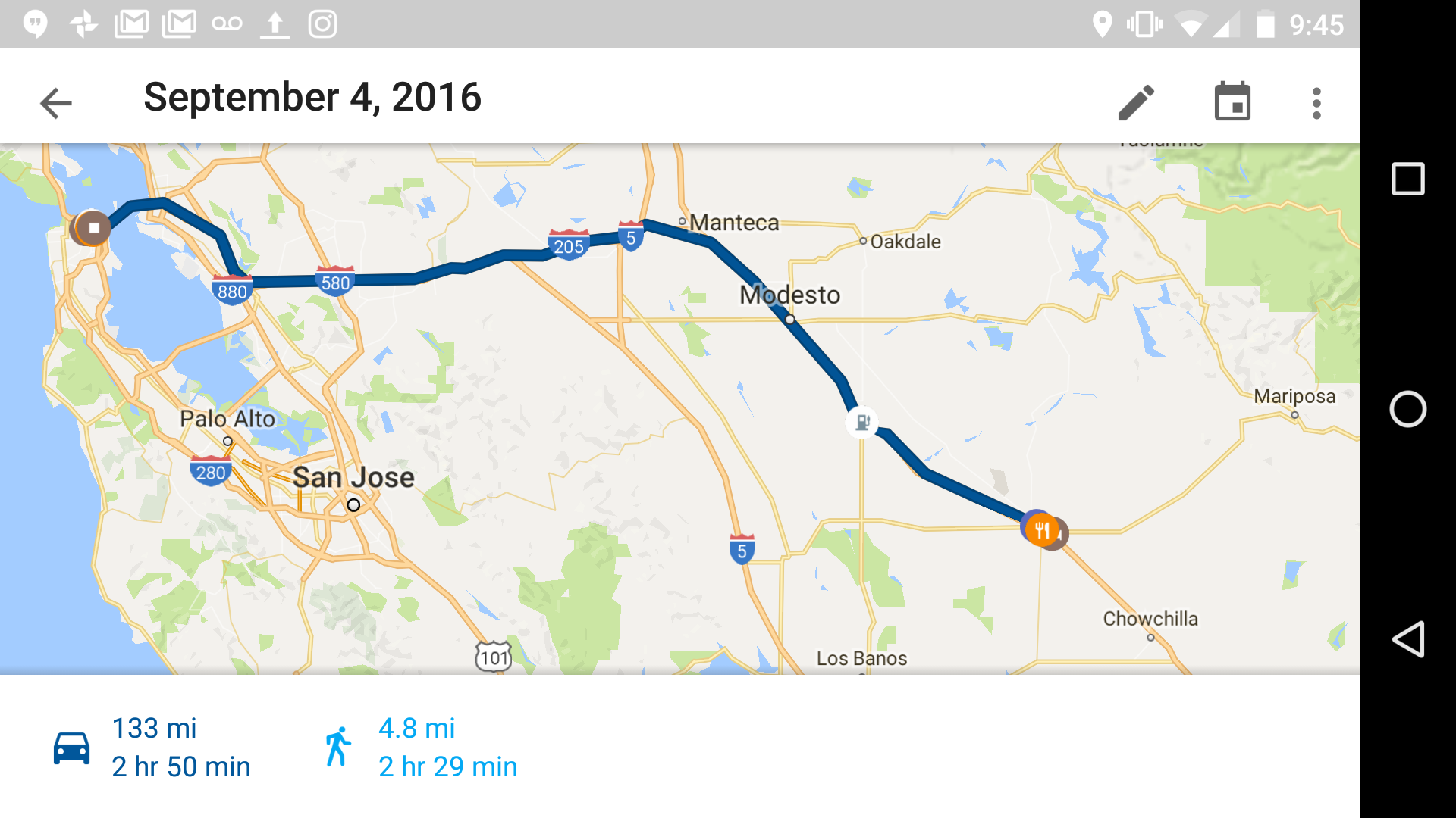
I am in a perpetual state of blog debt. Where were we…. Sunday I rode to a town called Merced, southeast of San Francisco and ~80 miles outside of Yosemite Valley. Aside from leaving the city and crossing the bay bridge, the ride was not very eventful. Hills and mountains turn to yellow barren plains for most of the ride. A quick stop for gas near Oakland was an interesting experience. It reminded me of the time Blindman and I stopped for some caffeine in Minneapolis/St. Paul on the way to Morris and I bought a mountain dew for 50 cents through an iron gate.
Merced is one of the last larger towns before things start to turn to expensive lodges and towns of only a few hundred people, so cheap motels were abundant but there wasn’t really anything else there. There was an In-N-Out though! It was the first one I stopped at since passing my first on the way from Austin to San Antonio. How I lasted this long I have no idea. I’m not a fan of going back the same way I came so it was nice to be able to ride 140 into the park and 120 out when it was time to leave.
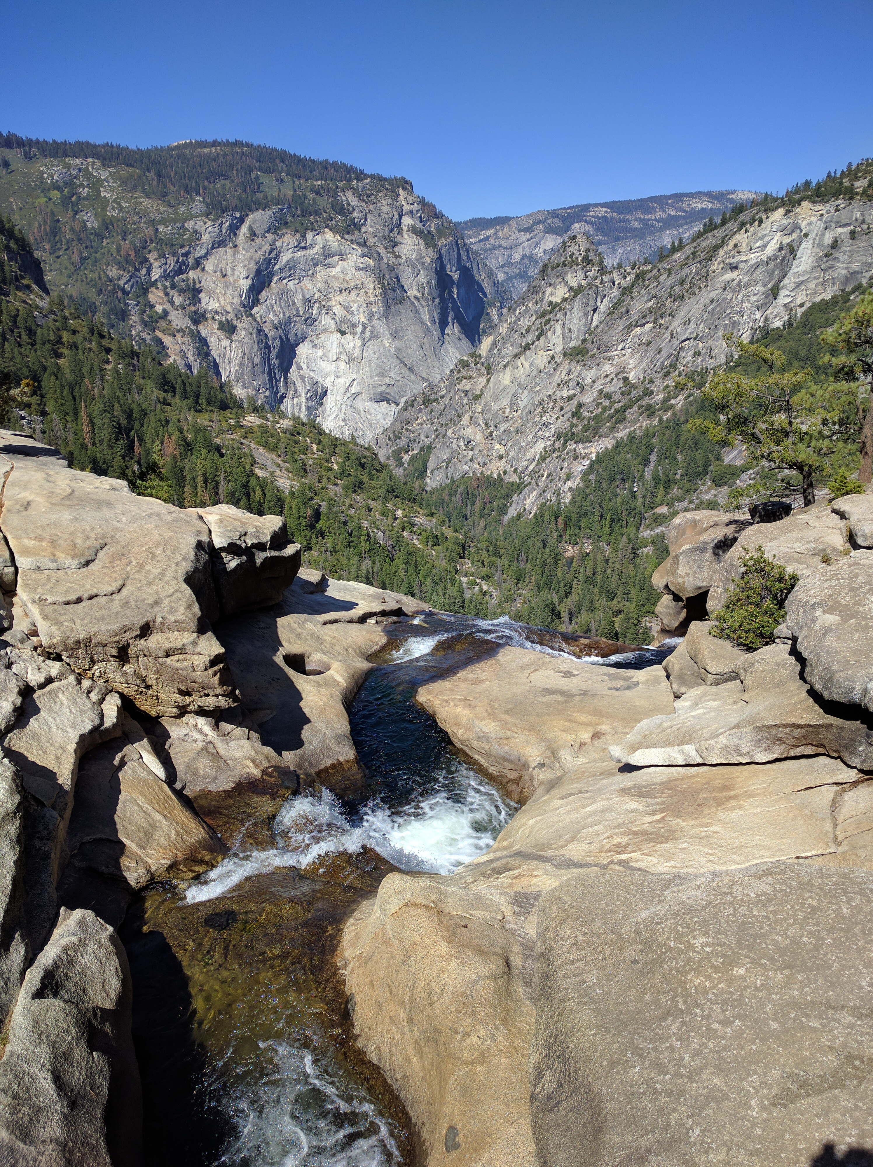
Only about 20 or 30 miles outside the valley did the drive start into the mountains and begin to be scenic. It wasn’t until basically in the Yosemite Valley that you get slammed in the face with some majestic views of the surrounding mountains and rock structures.
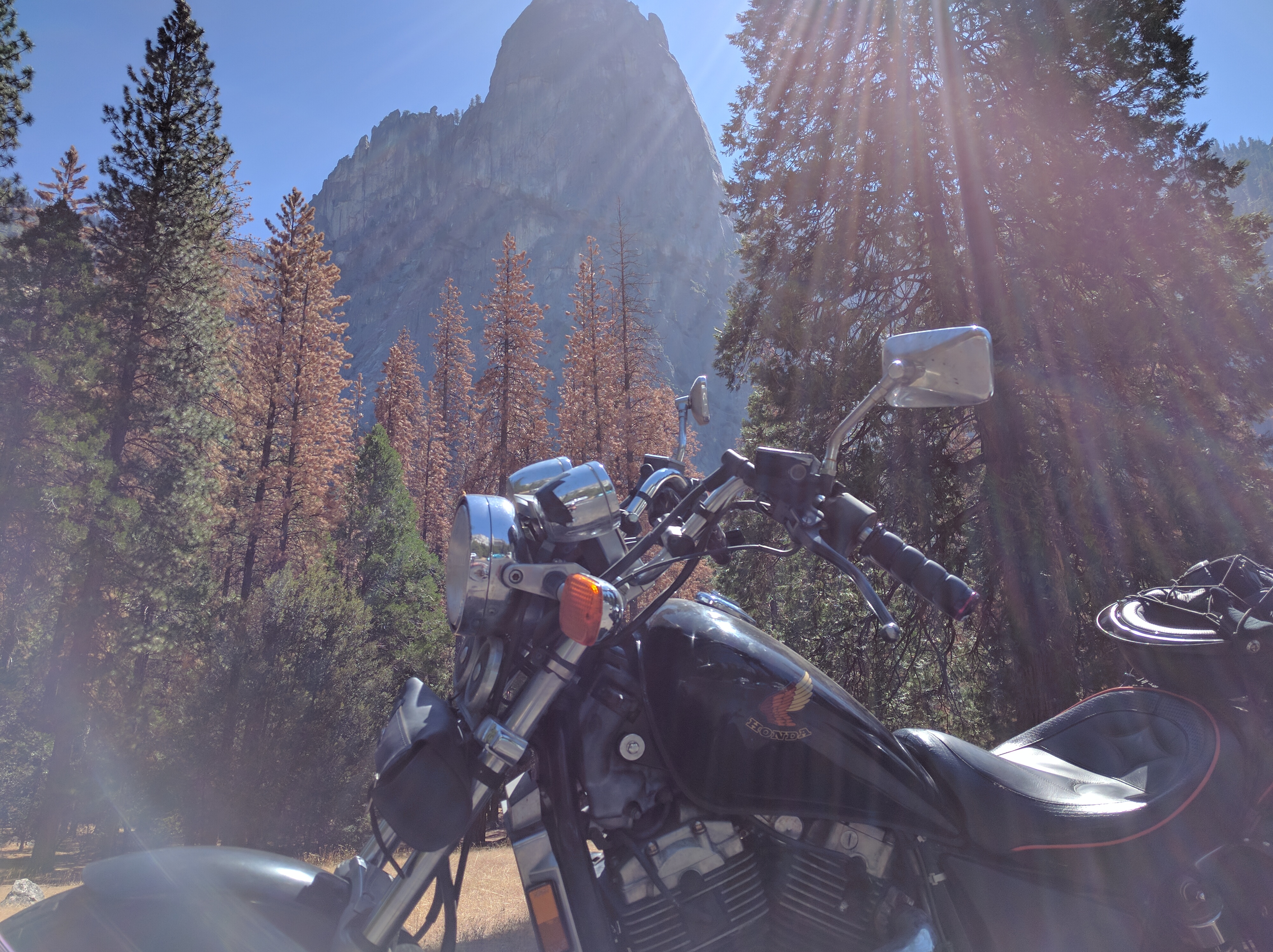
The gate ranger said first thing I should do is look for a camp spot since all of the reservation spots were booked up. Luckily the first place I tried, Camp 4, had available places. Kind of a weird situation though, each spot is pretty large and can hold up to 6 people. So if you’re a party of 1 you’ll likely be placed with 5 other random people. Cool though, got to meet some interesting people. Apparently Camp 4 is big with climbers too, having a few boulders with holds for bouldering and stuff. 3 of the people at my spot were there for climbing and the other 2 knew the lingo, so there was a fair amount of trying to absorb alien language when they got on their climbing stories and rants.
I arrived just in time to get settled and head out for a decently long hike. I met up with a friend before heading out on this adventure for some advice on where to go and what to hike in Yosemite, so I knew exactly where I wanted to hike first. Thanks Kim!
Armed with the BEAR MACE (which I definitely didn’t need, trail was so busy) I headed out to 4 mile trail, which was actually about 4.8 miles (9.6 there and back) and ended up at a place called Glacier Point about 3200 ft later. Views were spectacular the entire way.
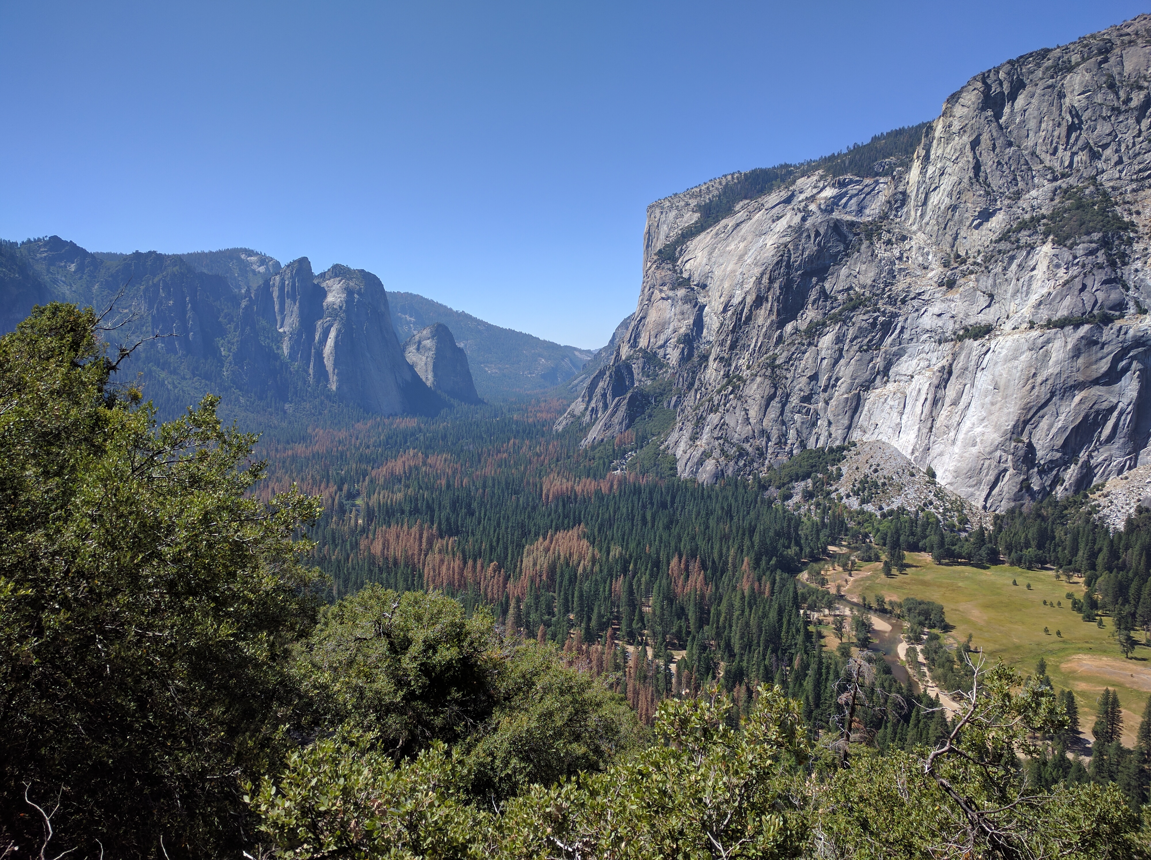
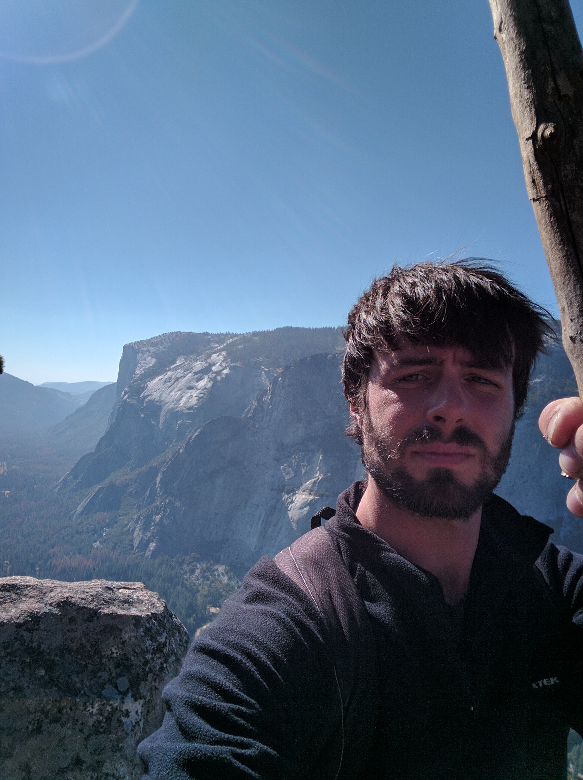
I swore I was hallucinating when I saw people walking around with ice cream near the top, but there’s actually a gift shop and stuff up there. Plus you can drive all the way up to Glacier Point and enjoy views without the trek through the forest.
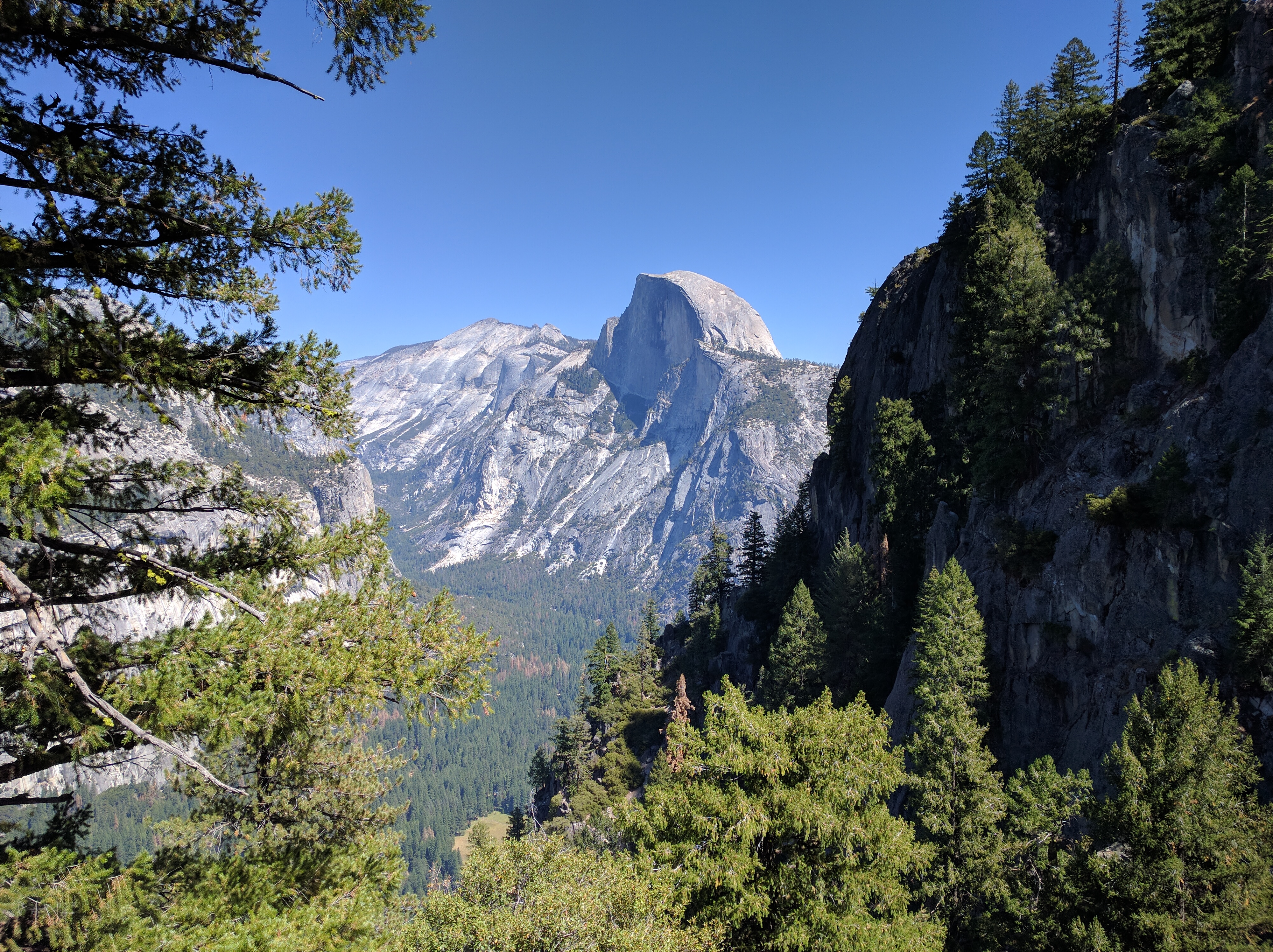
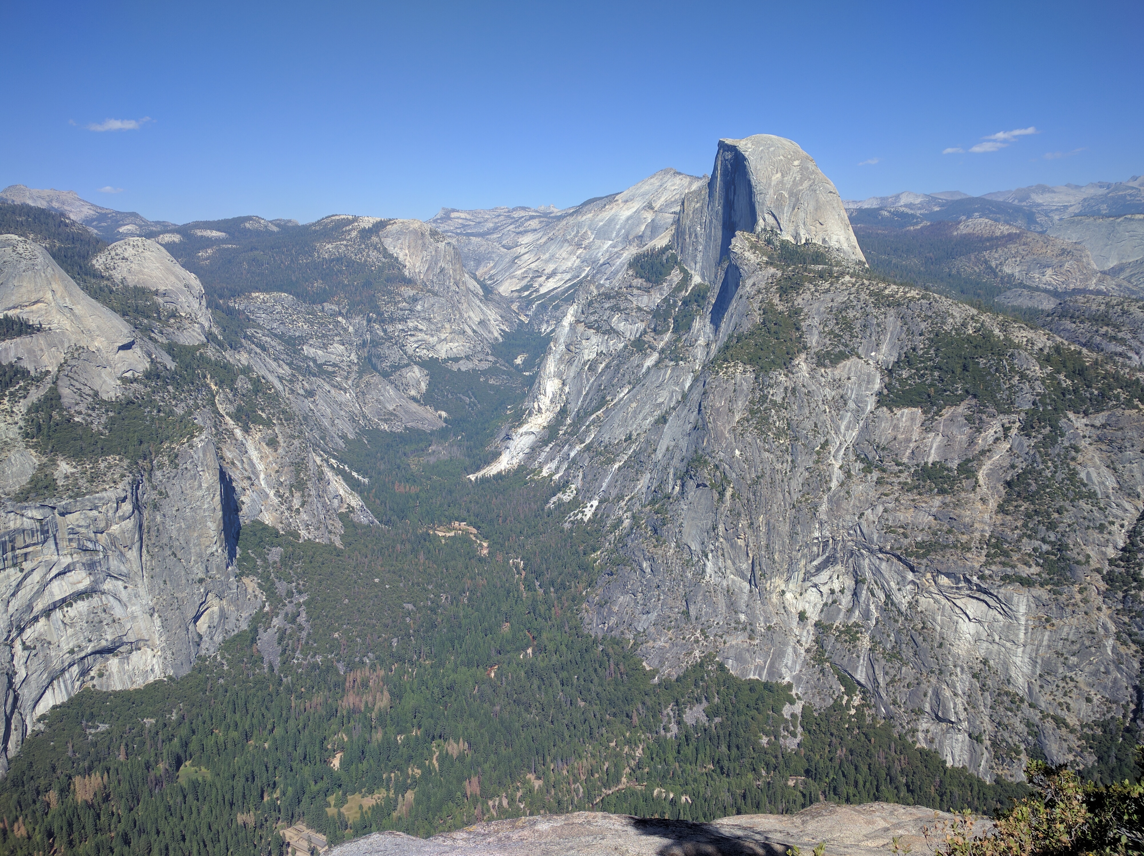
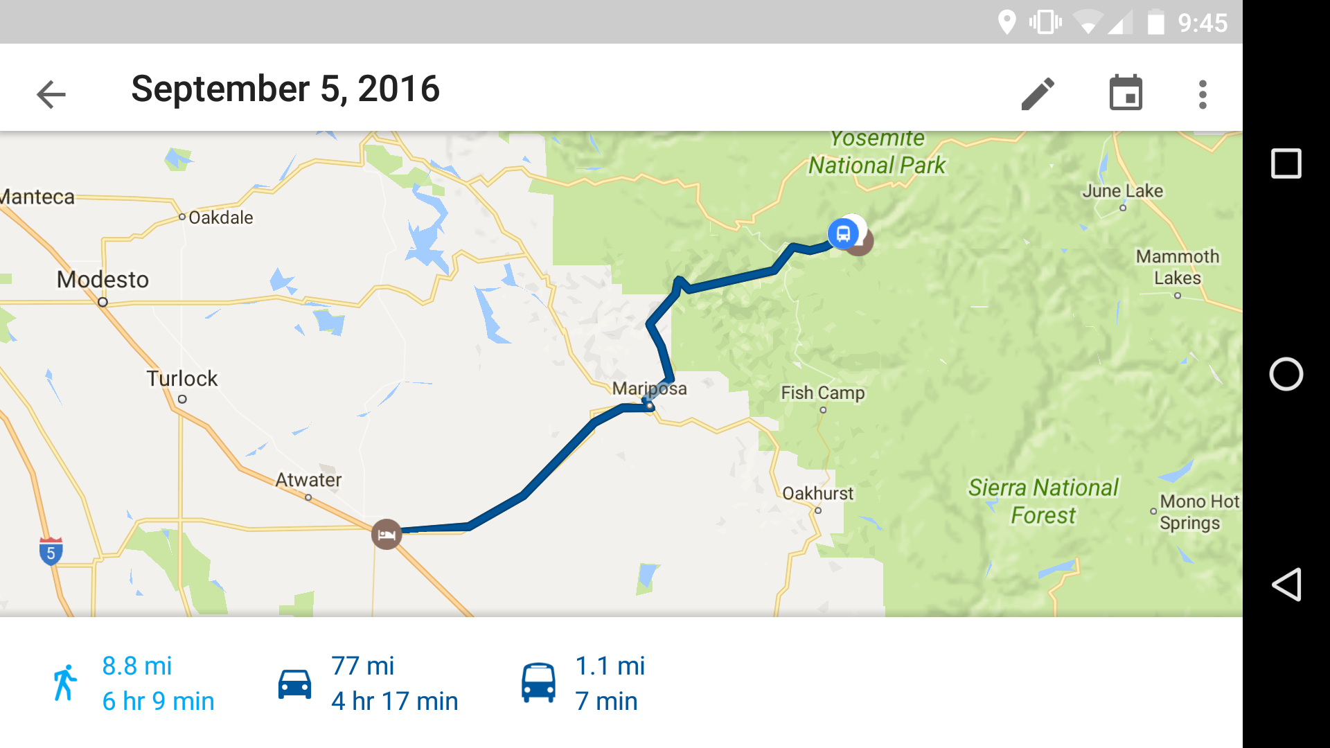
In the morning I had time for one more good hike before the noon checkout. I decided to go with the Mist Trail for some waterfall views and it was definitely a cool choice. Going early was good too, this is apparently one of the most popular hikes in the park. On my way out there was tons of traffic coming into the trail.
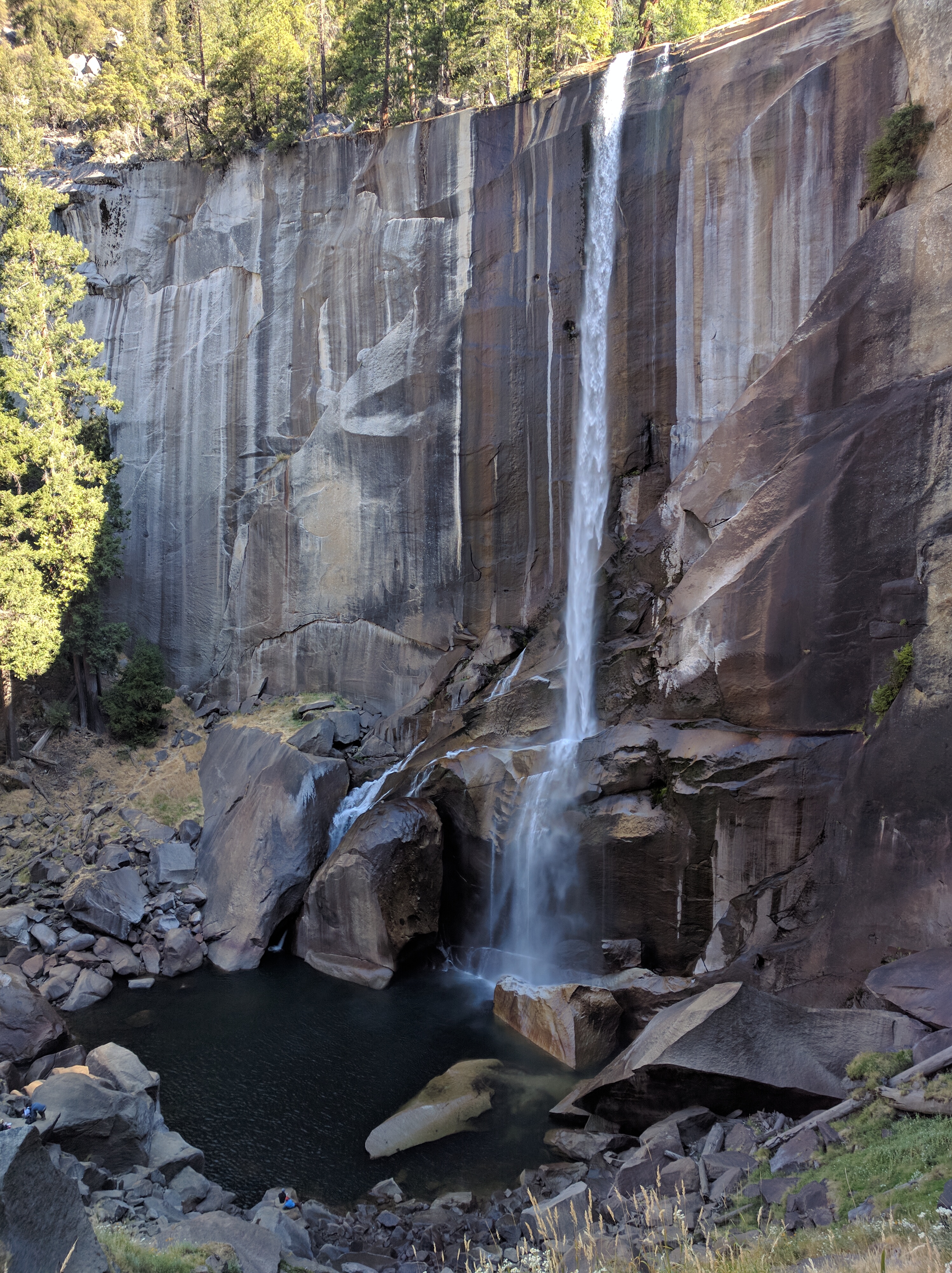
The trail should be named the stair master 9000 since a good portion of it is literally climbing stairs forever. After 7 miles and a 4000 ft climb, I had my fill and was ready to pack it up. The park was ready for me to pack it up too I guess after being greeted with a nasty pink note about getting out or having my junk impounded. I was only a few minutes late!
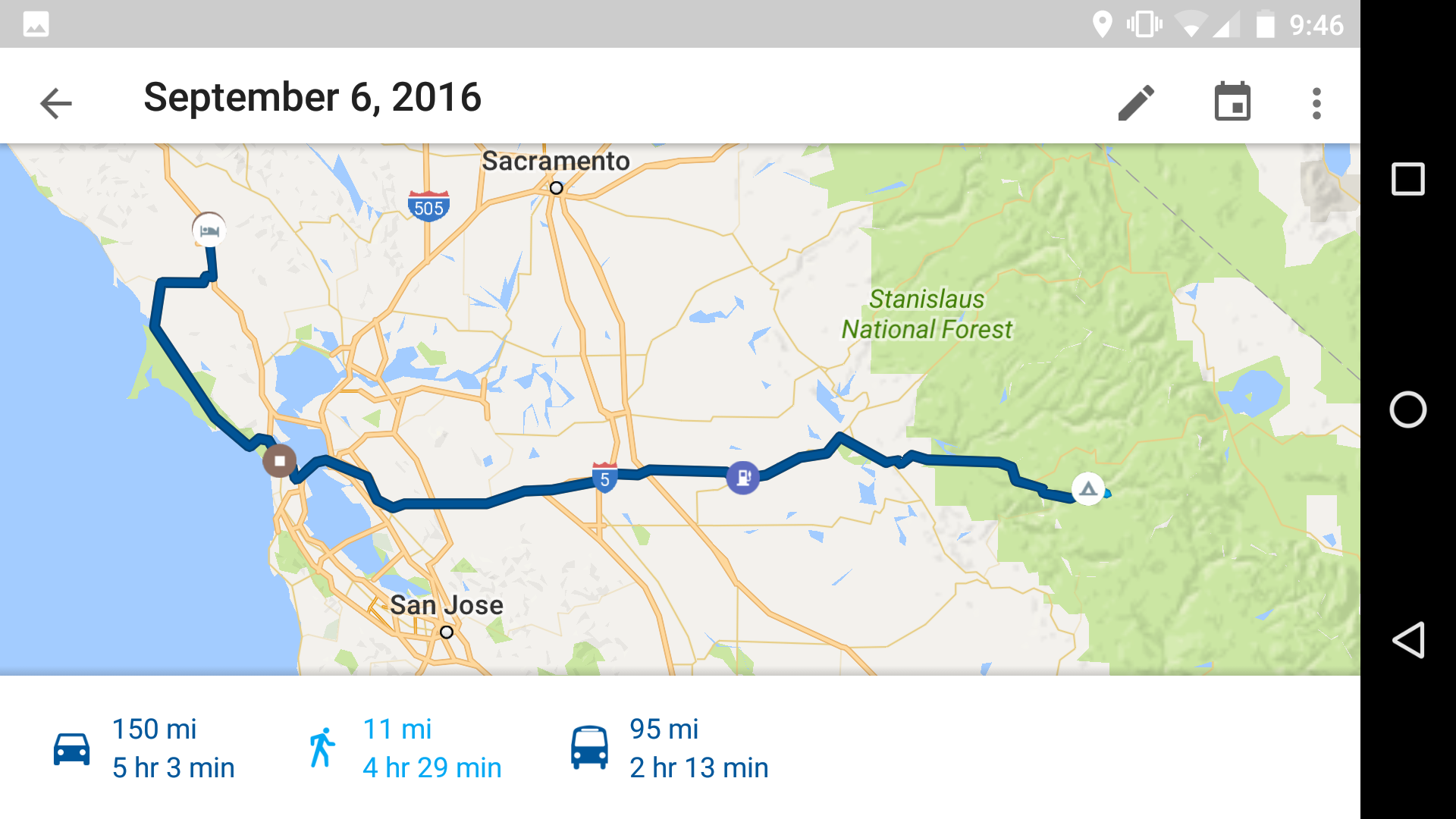
Back to San Francisco to take care of some unfinished business. HWY 120 coming out of the park was notably cooler than 140 coming in. The views were completely different, had you elevated looking over into the mountains much of the time and of course that winding mountain road feel.
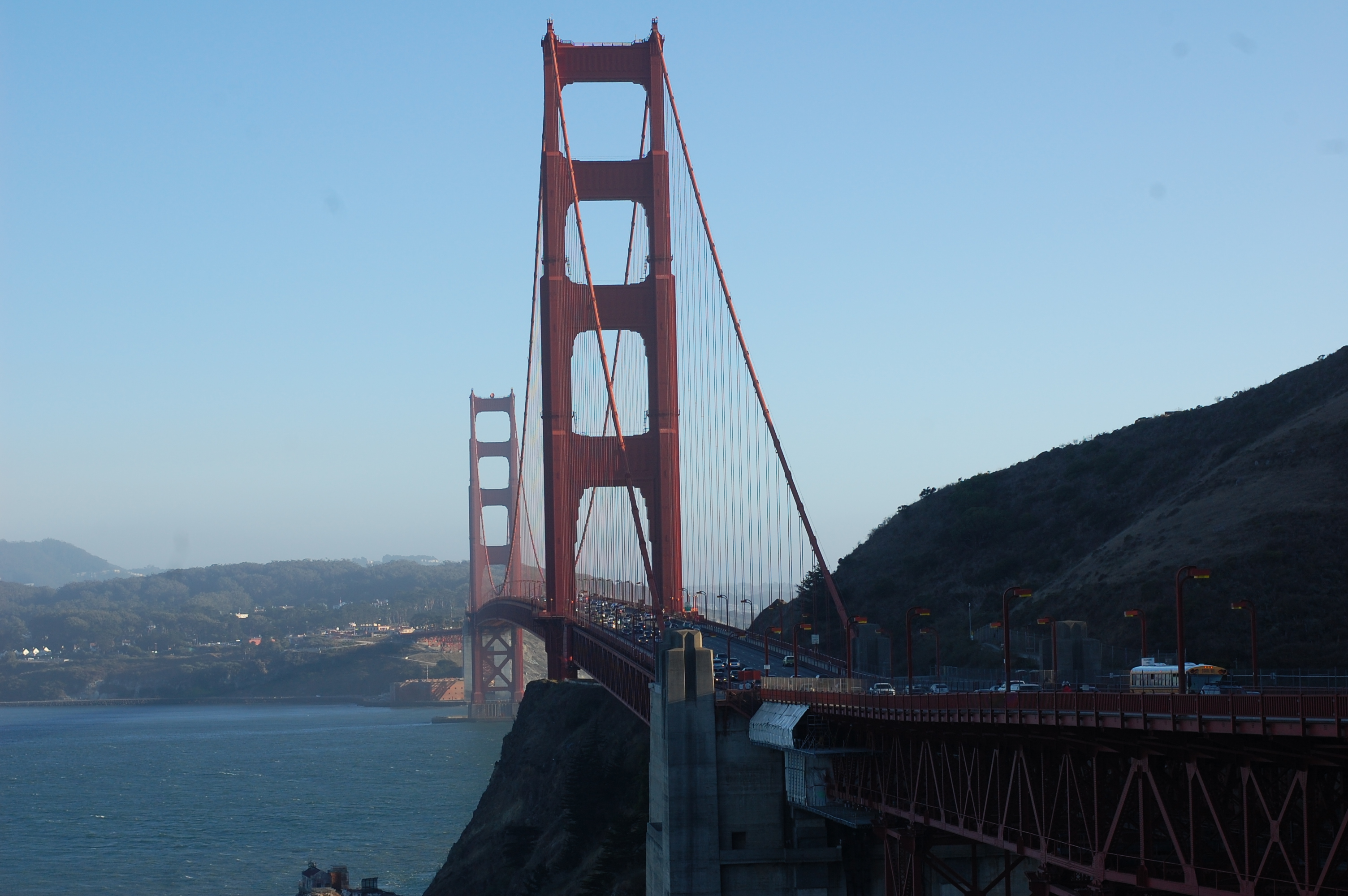
Then a bunch of nothing until the bay bridge back into the city. After getting a little lost and touring that ripe tenderloin once more I found the Golden Gate and crossed the shit out of it.
The sun was setting as I met back up with Highway 1 and went through the John Muir Woods and Golden Gate National Recreation Area. The views were instantly good and the sunset just made them better.
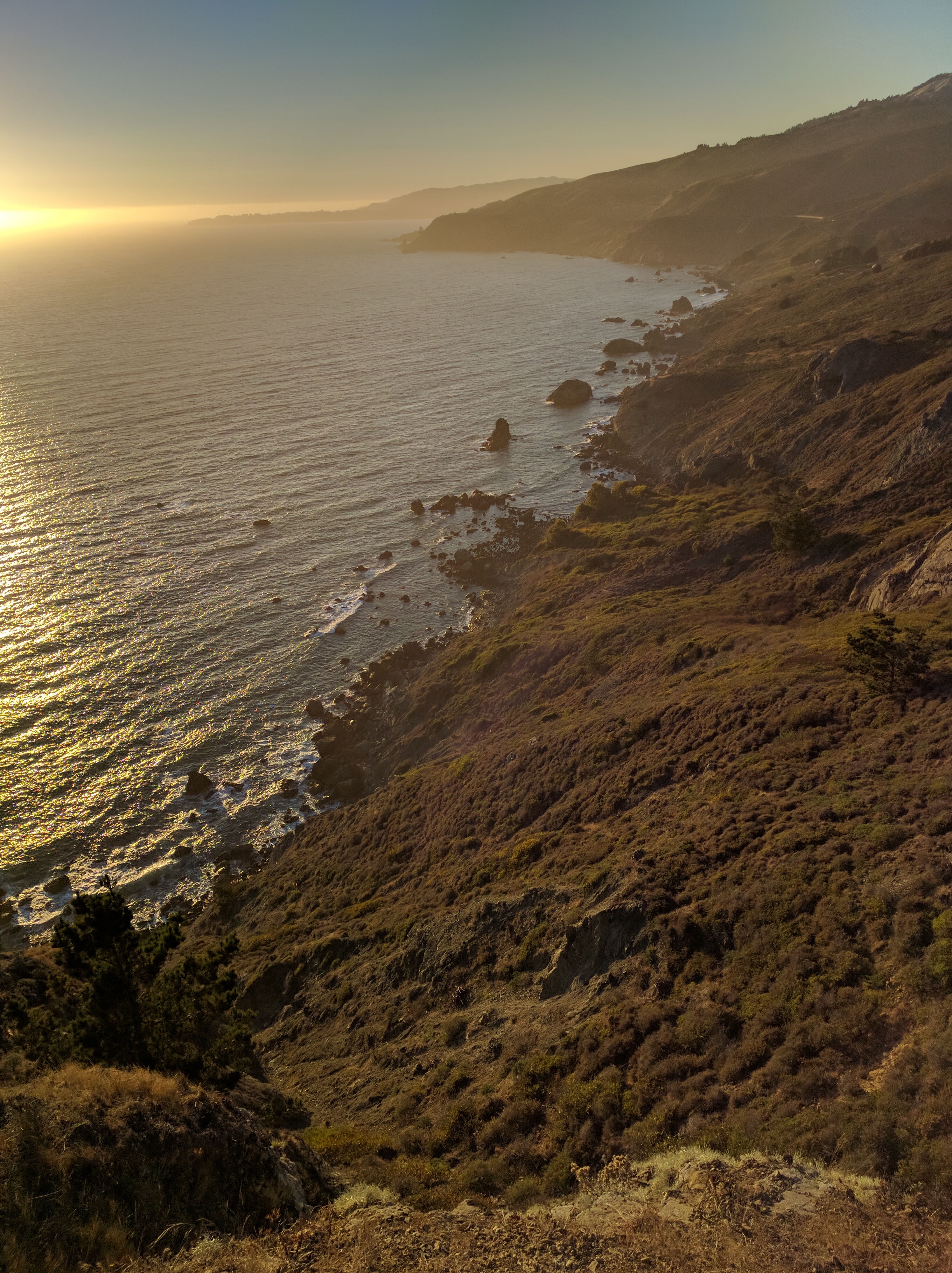
Point Reyes National Seashore along Tomales bay was particularly cool. It reminded me of being back on the Gulf Coast with water right next to the road. I started looking for vacancy signs on the little inns that came up every so often but at some point it seemed like things were just kinda shut down. The dark, cold and uncertainty as to whether I’d find a place forced me inland to Santa Rosa for the night.
Get them routes:
Maybe later today I’ll catch up on yesterday’s drive too. It was a good one. Salad, some might say.