Browsed by
Year: 2016

Day 3: I’ll Cross That Bridge When I Get There

Day 3: I’ll Cross That Bridge When I Get There

It seems like so many things are happening in one day that it’s tough to recount everything! Going to have to start making notes I suppose.

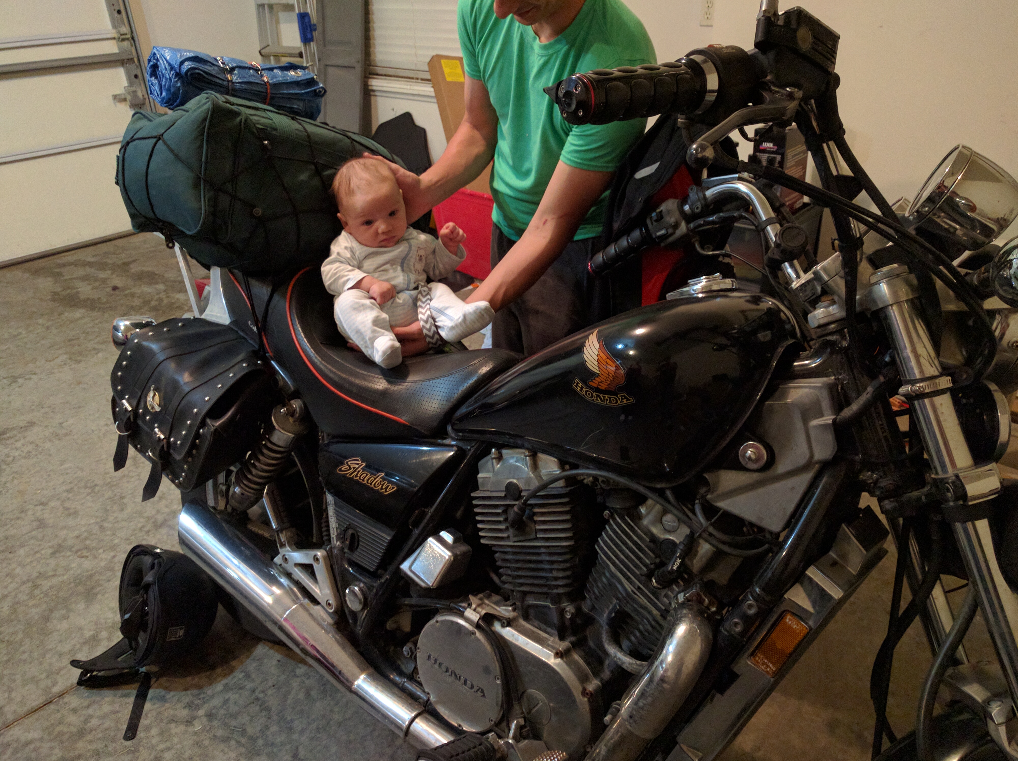
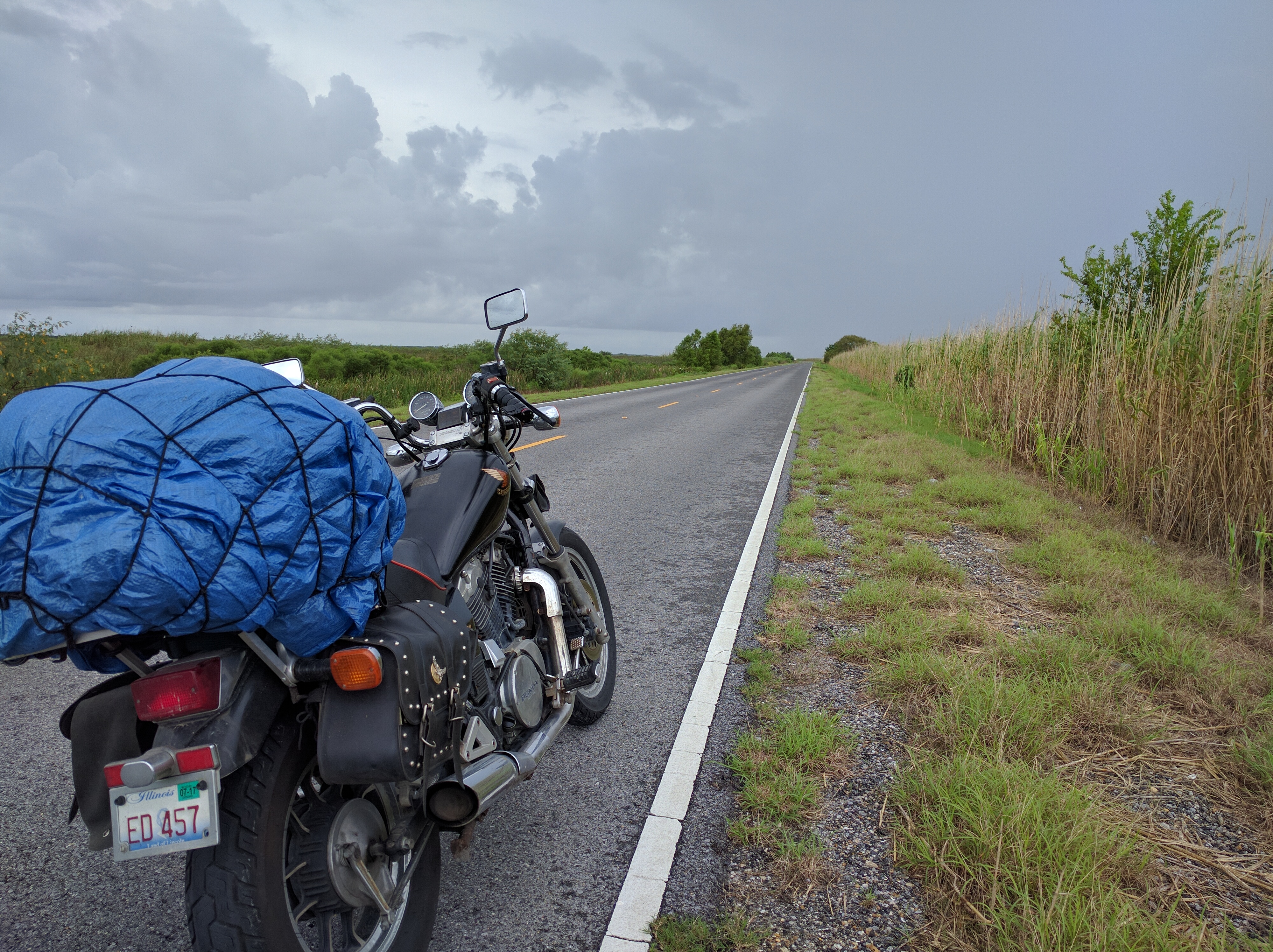
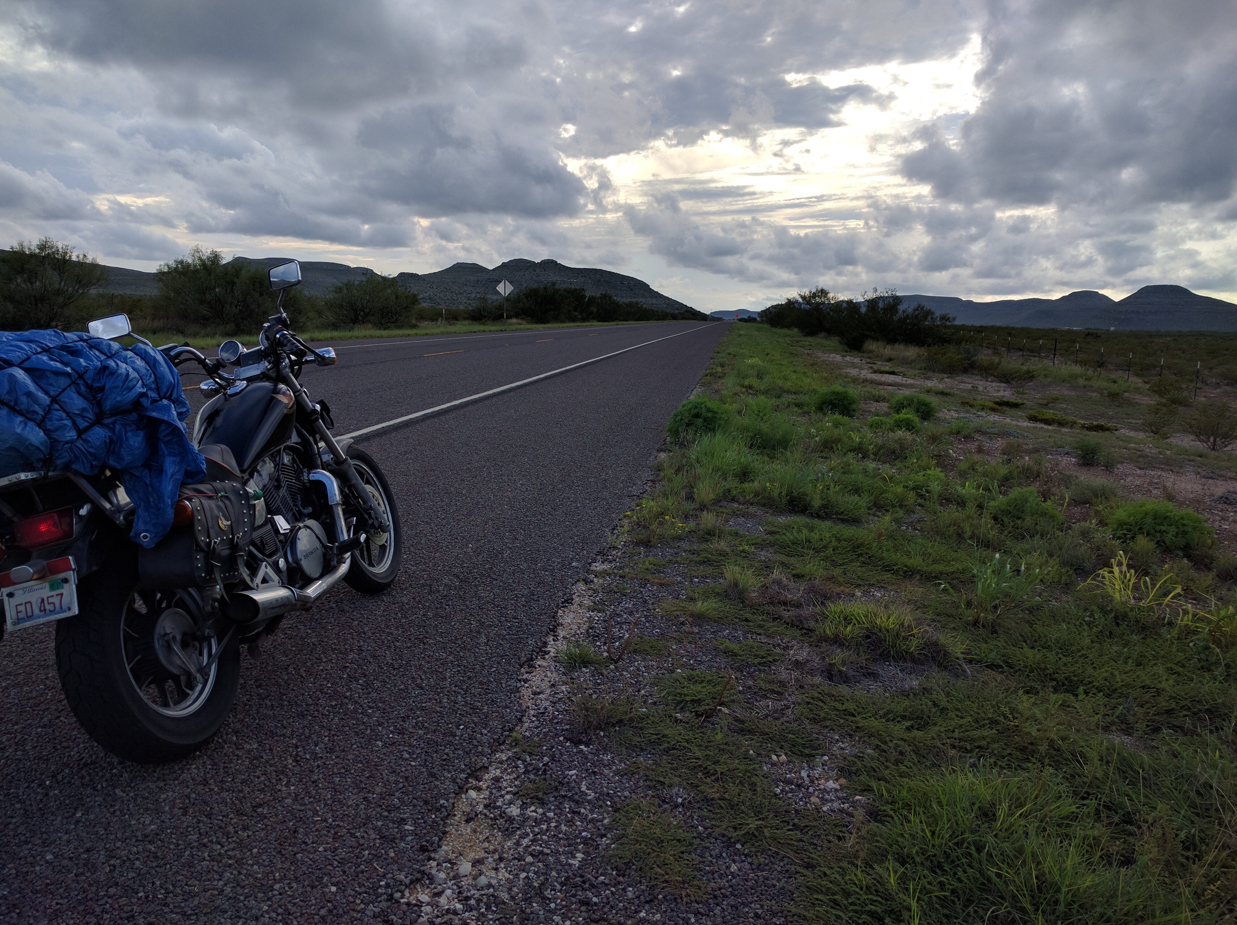
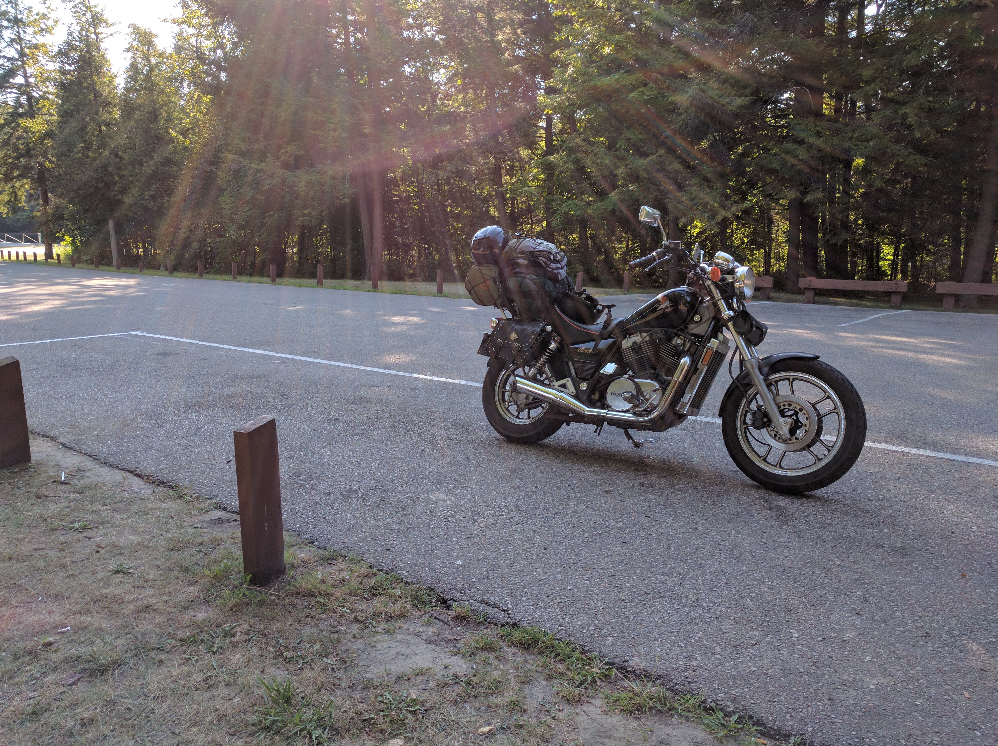
It really looked like it was going to be a rain gear sort of day early on. The air was chilled but heavy, gloom and gray everywhere. I spent a good portion of exiting Marquette stopping every few miles to check to make sure the tarp that was covering all of my gear was secure enough for the highway.

That superior shoreline

Dylan mentioned using a backpacking cover, which might be a lot more painless than the tarp. It works but its quite the hassle in pulling over and securing it. Not to mention if I needed anything from under there it’d be a whole thing in getting it out and re-securing the complicated network of bungee nets and chords, presumable while it was raining.

The thermal under layer for the jacket really worked out, it was definitely brisk this morning and this little jacket insert made all the difference, totally worth it.

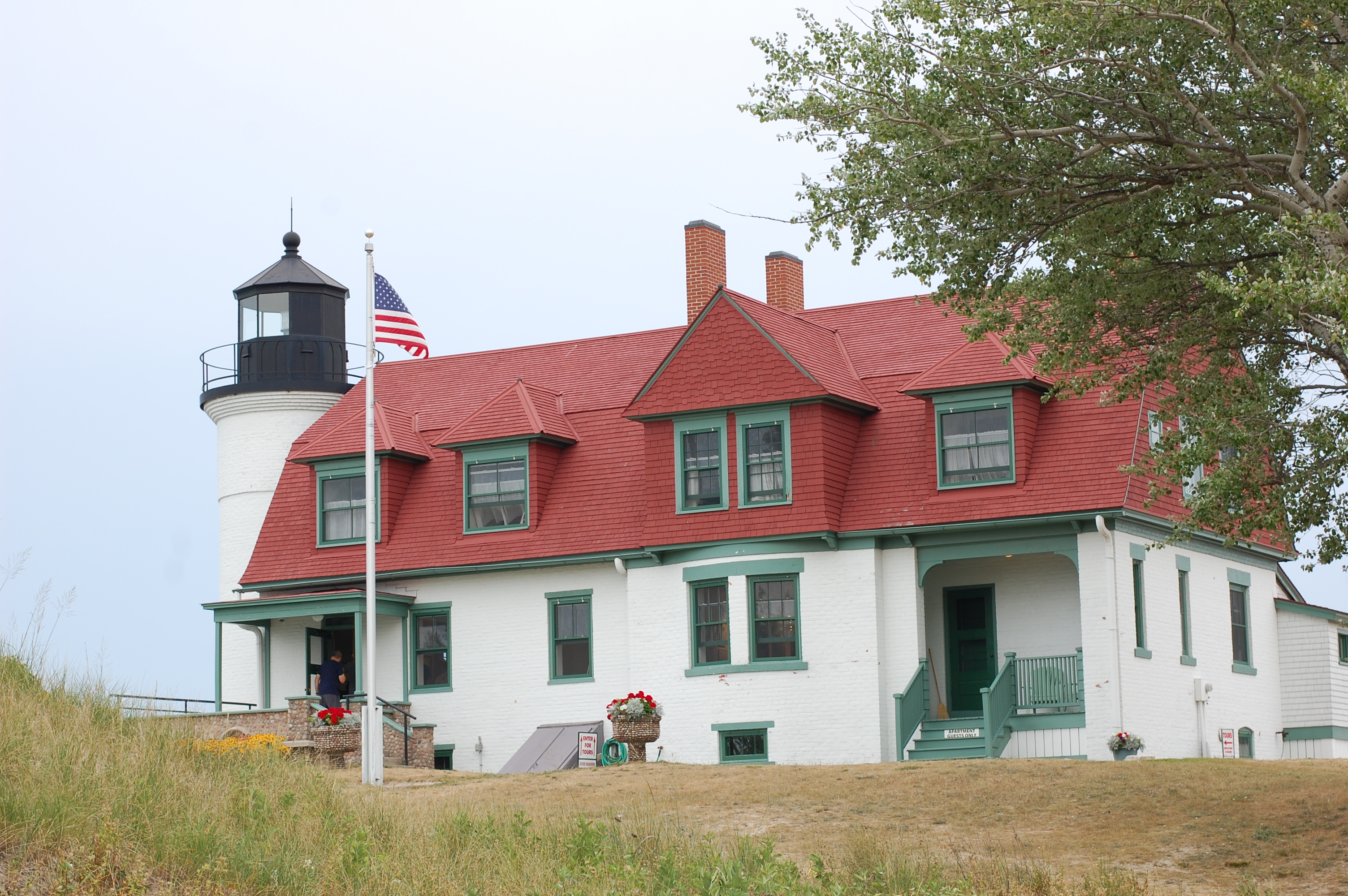
The options for leaving Marquette were back the way I came along 41 or follow Lake Superior coastline for some time until jogging south. The Lake seemed like the better option since I hardly get to see this one and a super friendly gas station attendant was really talking up Munising, home of the Painted Rocks. While I didn’t get to see the rocks since it required getting on a boat and I was short on time as it was, Munising was definitely a neat little place.

learning new words is fun

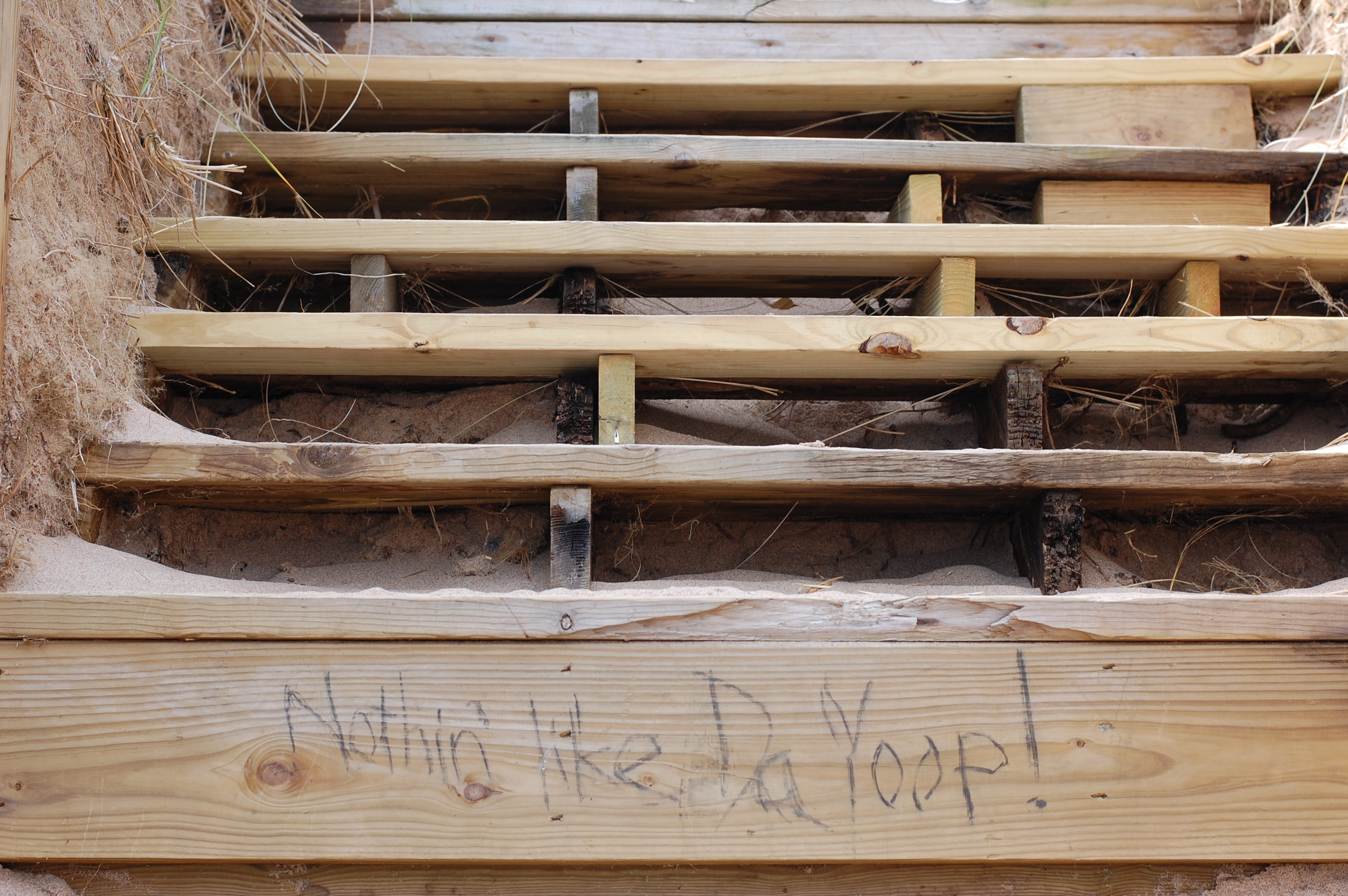
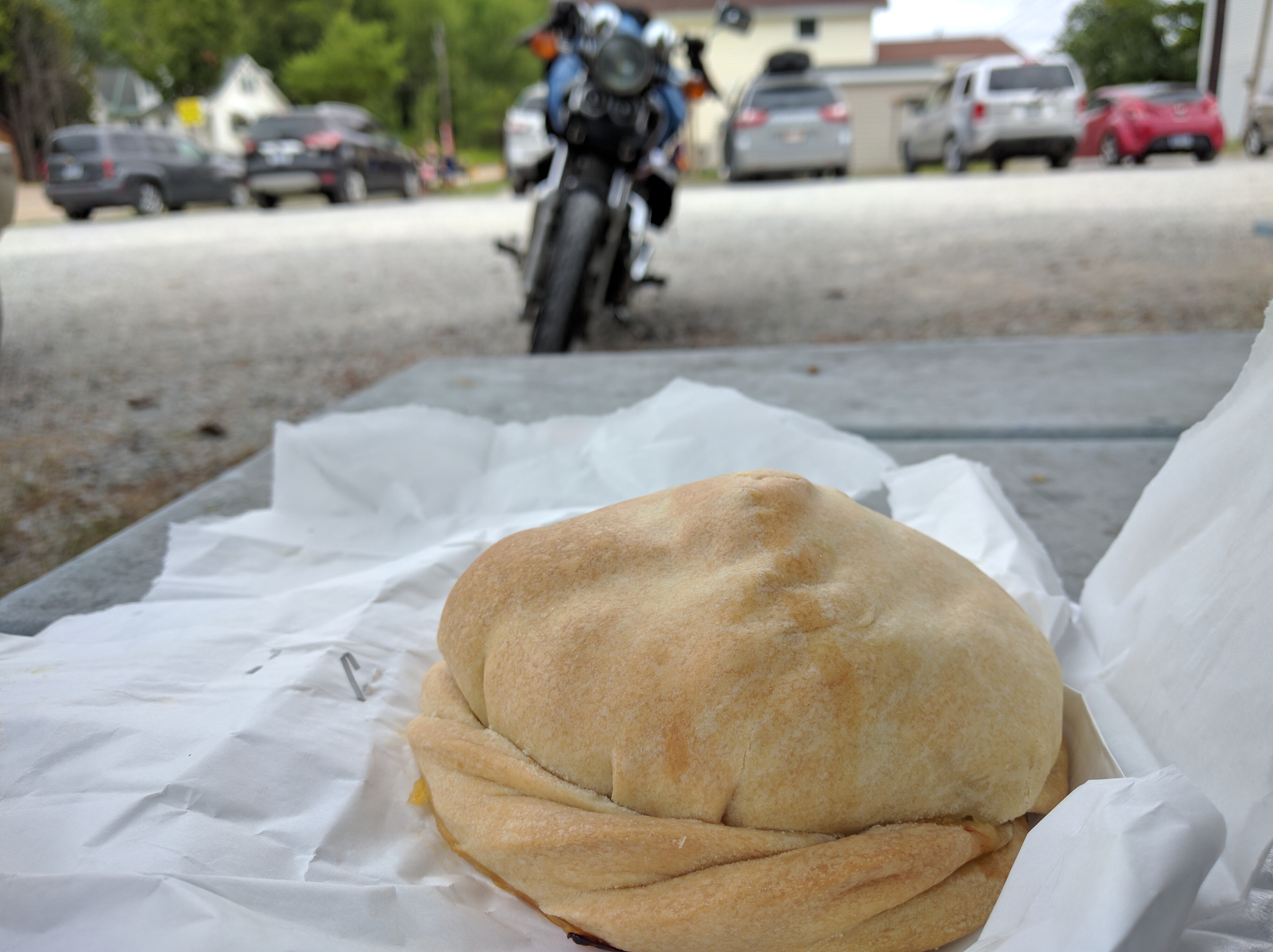
I had my first ever pasty (pronounced past-ee, a traditional yooper treat ^_^) after hearing about them for the first time the night before in Marquette. As you could imagine, seeing the words pasty and pasties without context brought about some interesting questions as to what was being bought and sold.

pasty

Google maps wanted me to head further down 28 before going south but there seemed to be a road that went directly through the Hiawatha national forest. Indeed there was as confirmed by kind gas station lady #2; highway 13 cut right through and it was an endless row of thick pine-tree-covered forest. Love me some trees. Very few cars on this road, was totally worth it.

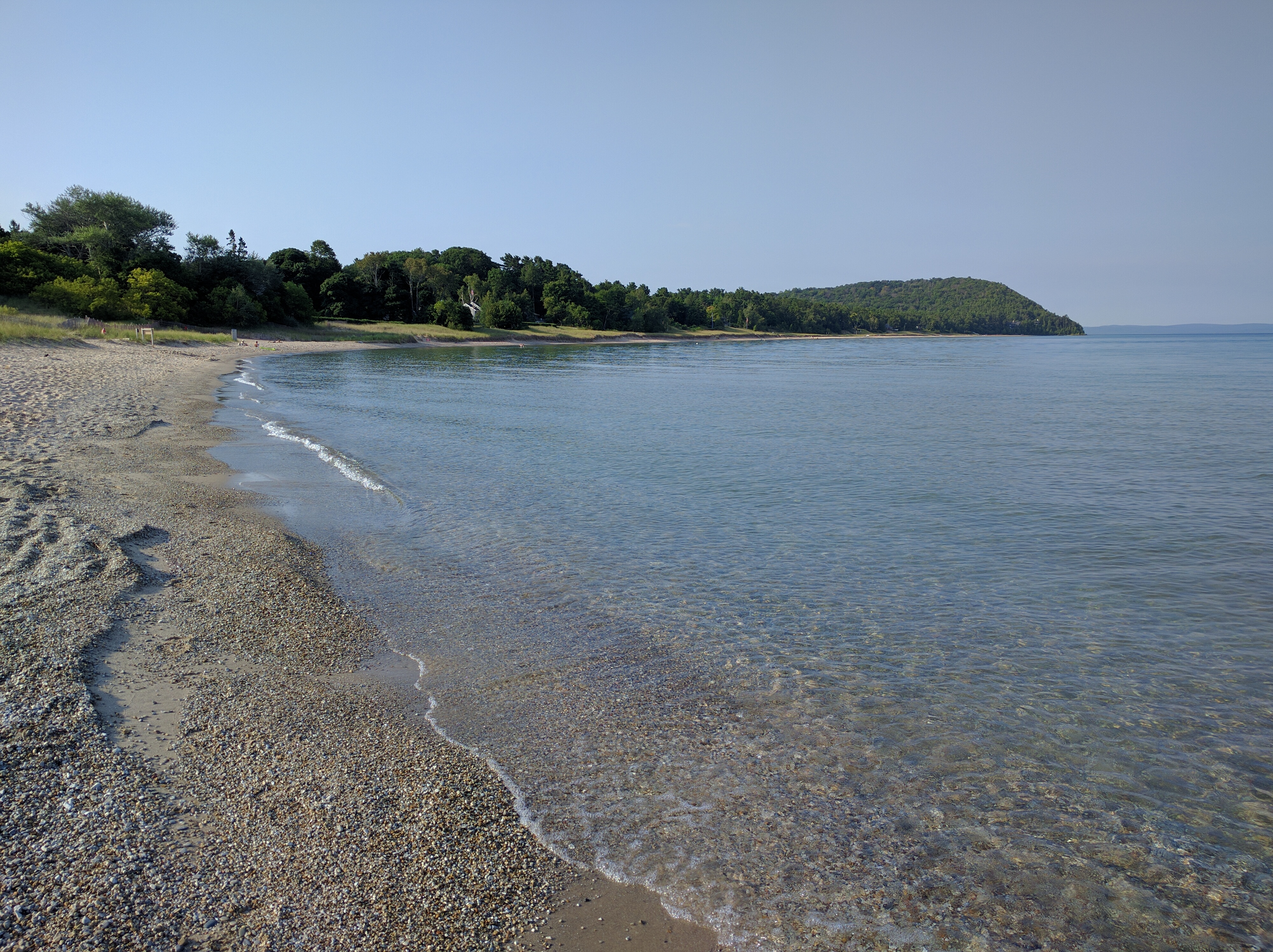
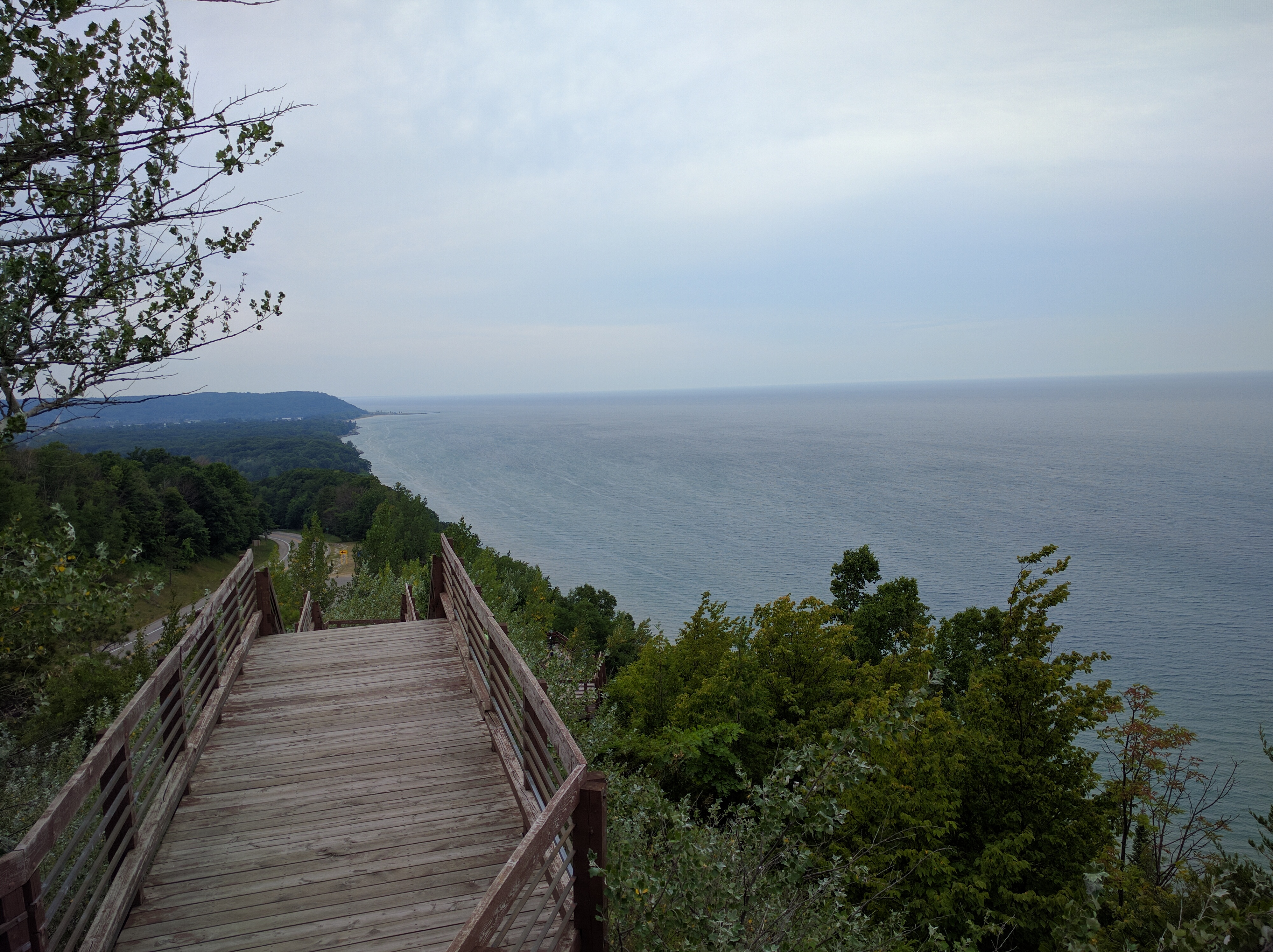
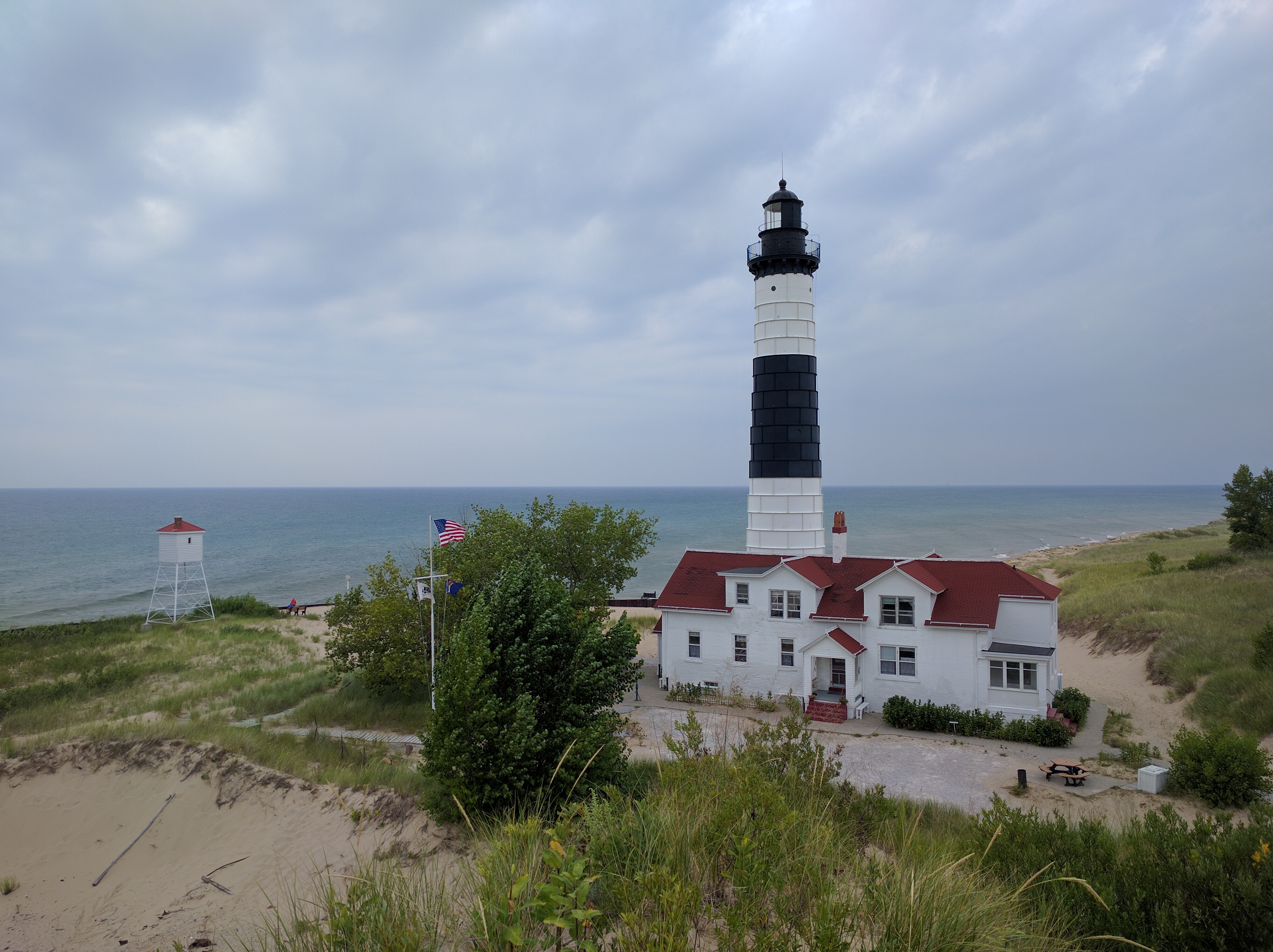
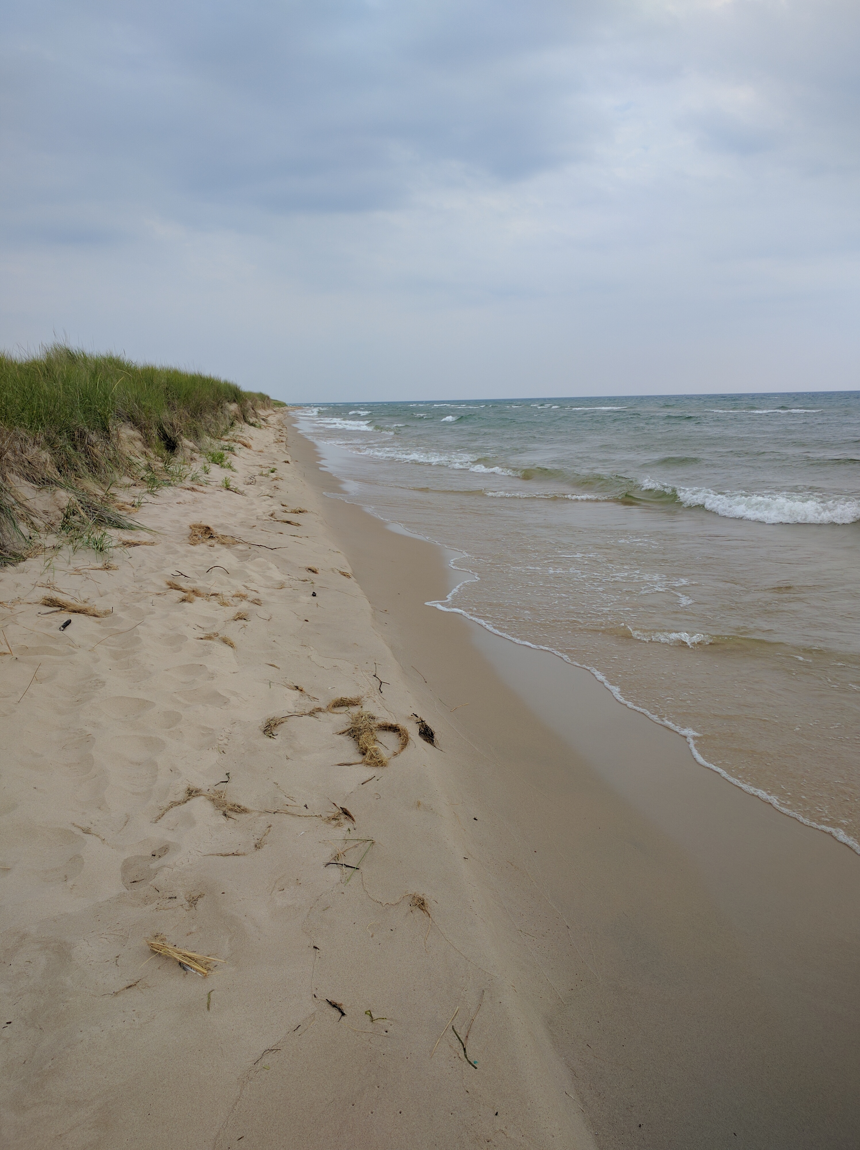
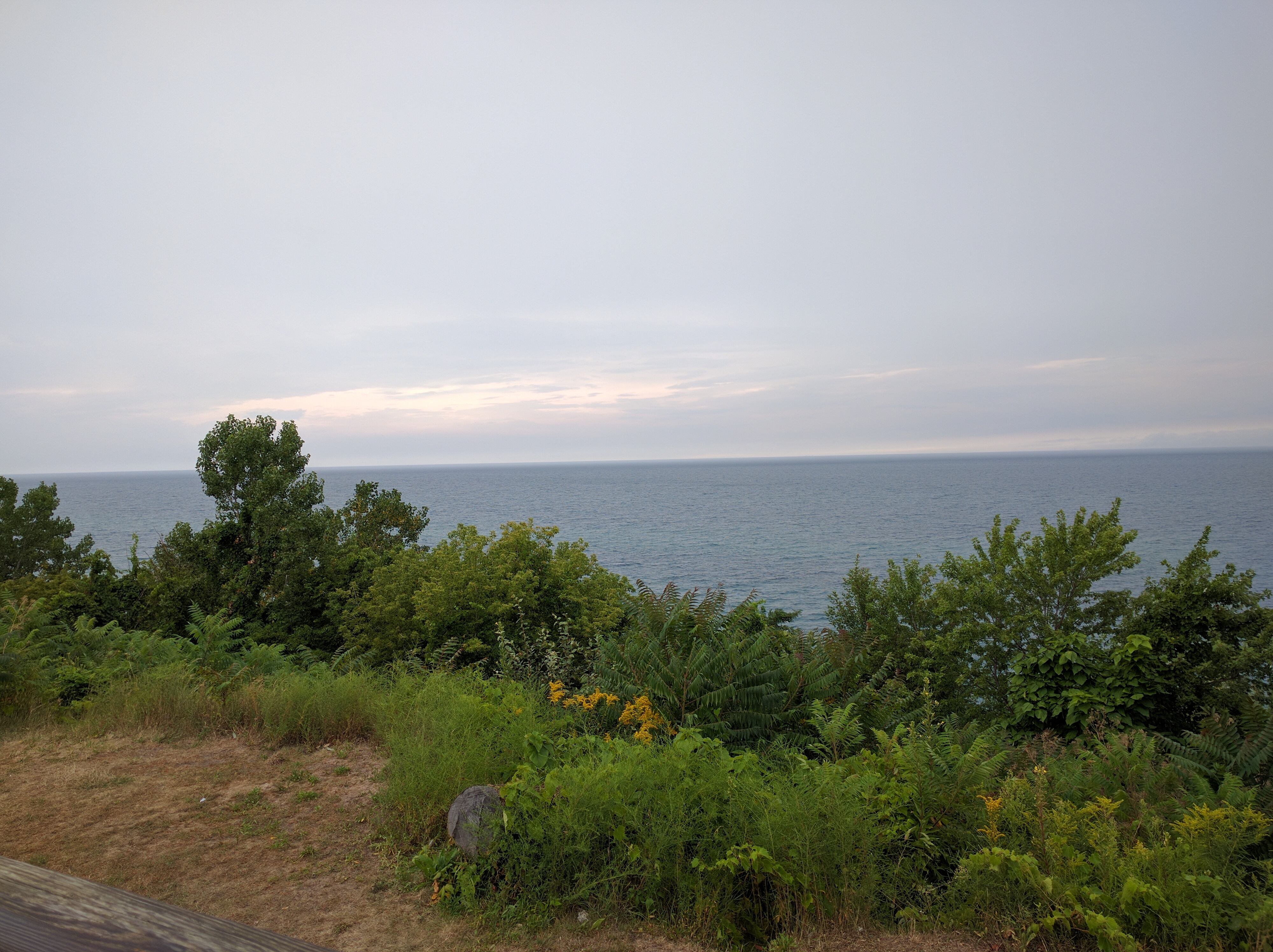
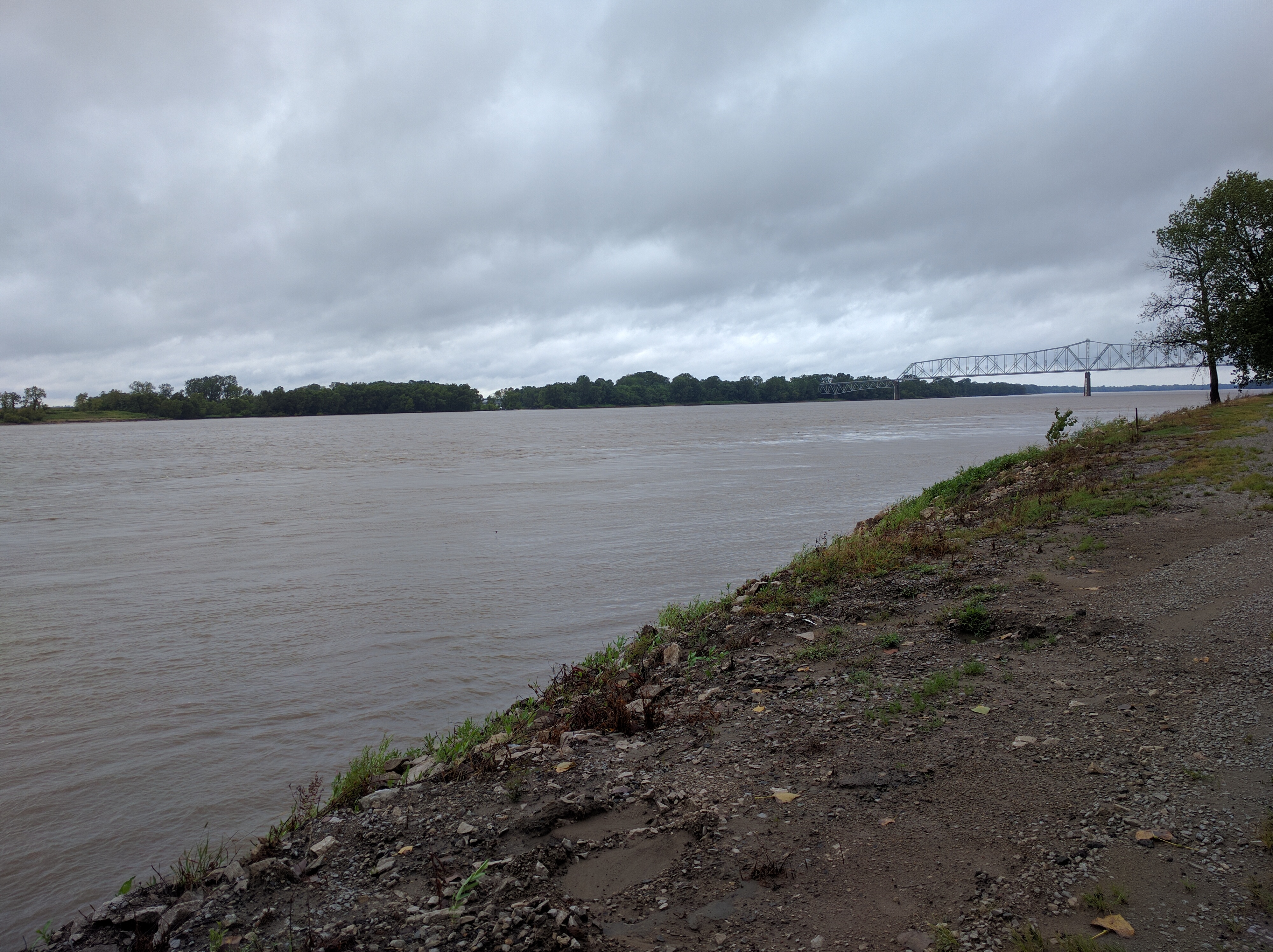
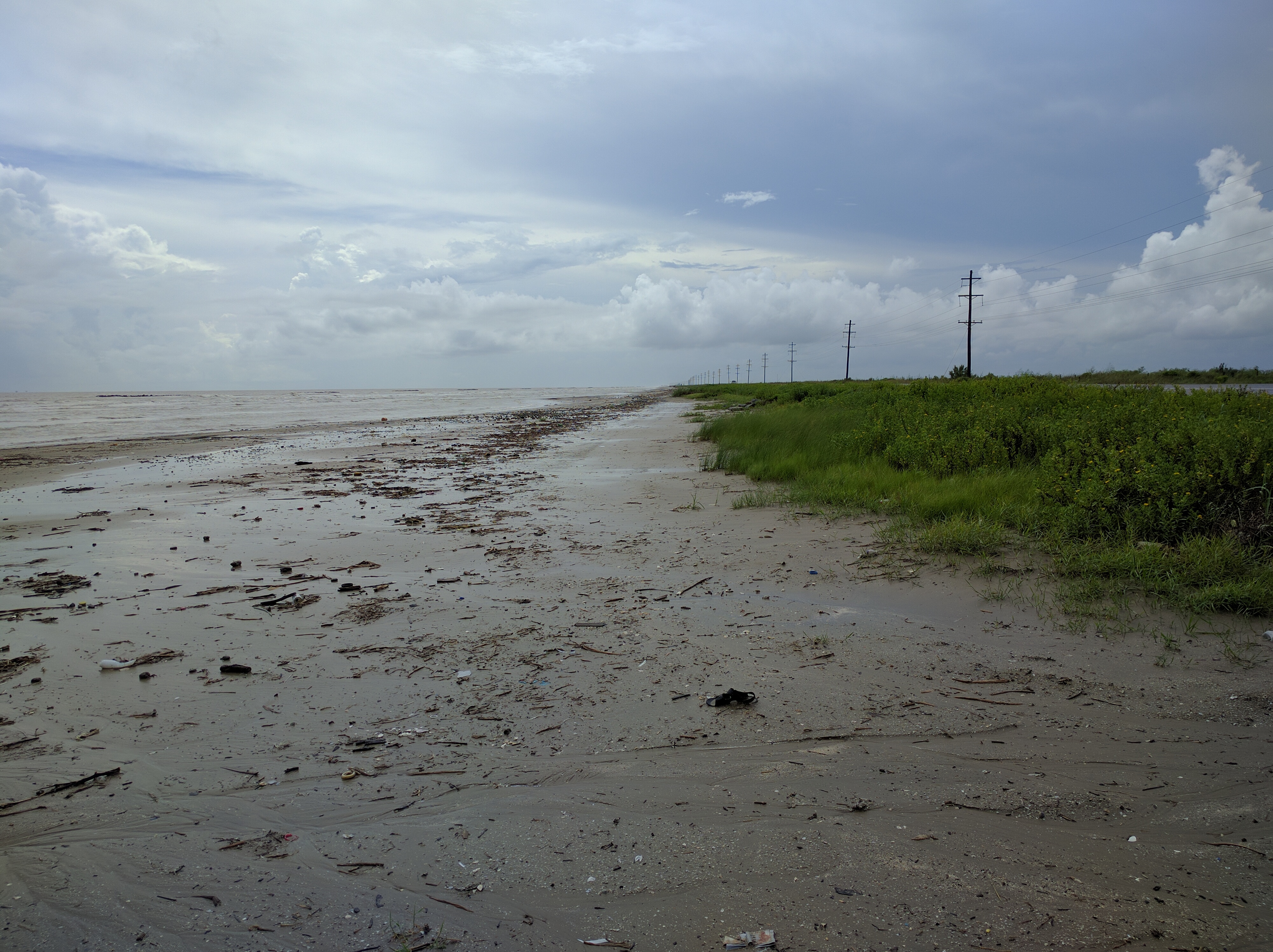
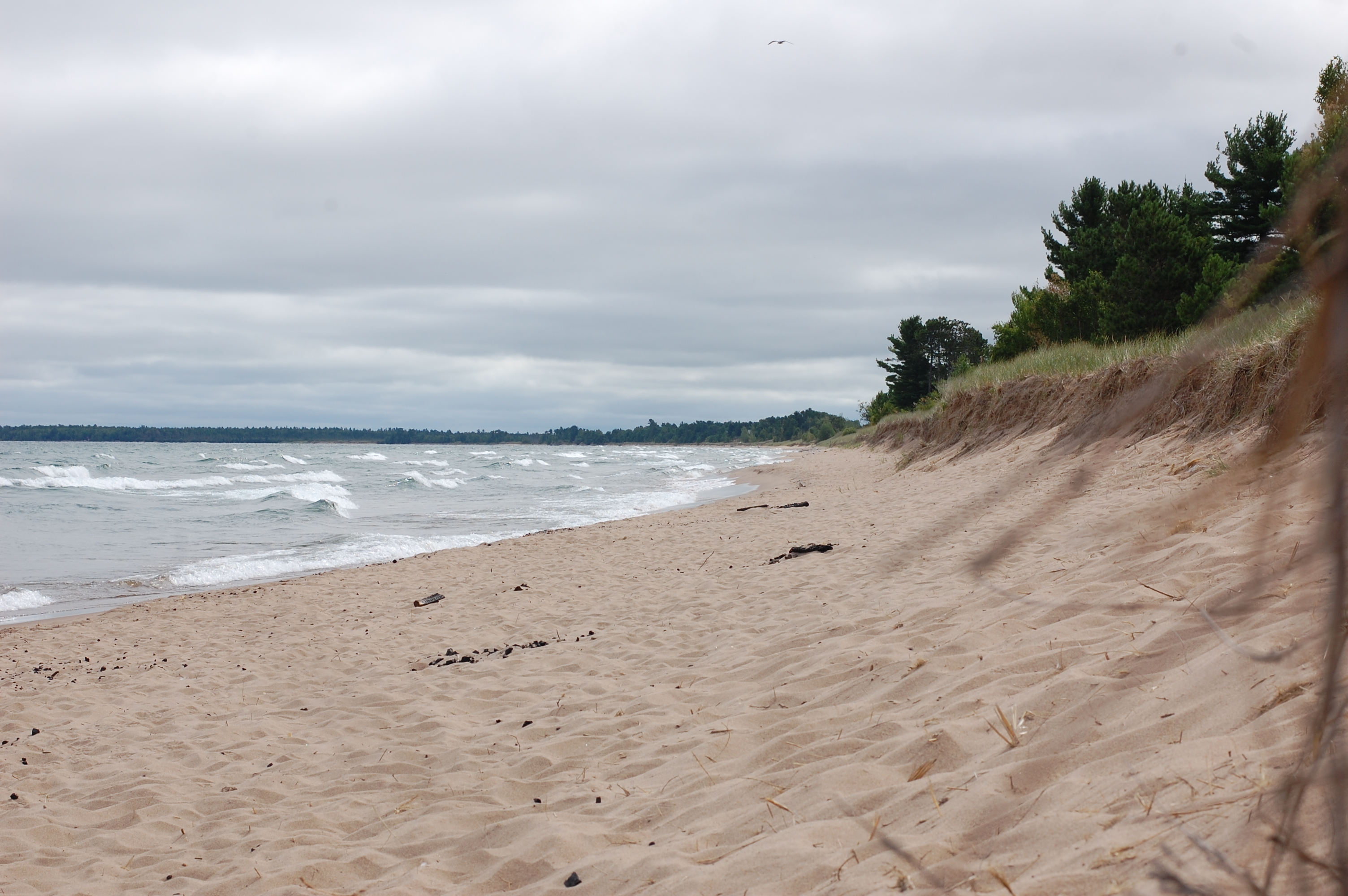
Back to Lake Michigan with highway 2, it was good to see the old boy, and sunshine all around once again. Lake Superior is undoubtedly neat, but it also seems like a creepier, mysterious older brother to Lake Michigan. The lake was lined with beach and cars were parked along the highway to take advantage. Among the cooler towns I road through was Epoufette, which had some decently sized rolling tree covered hills.

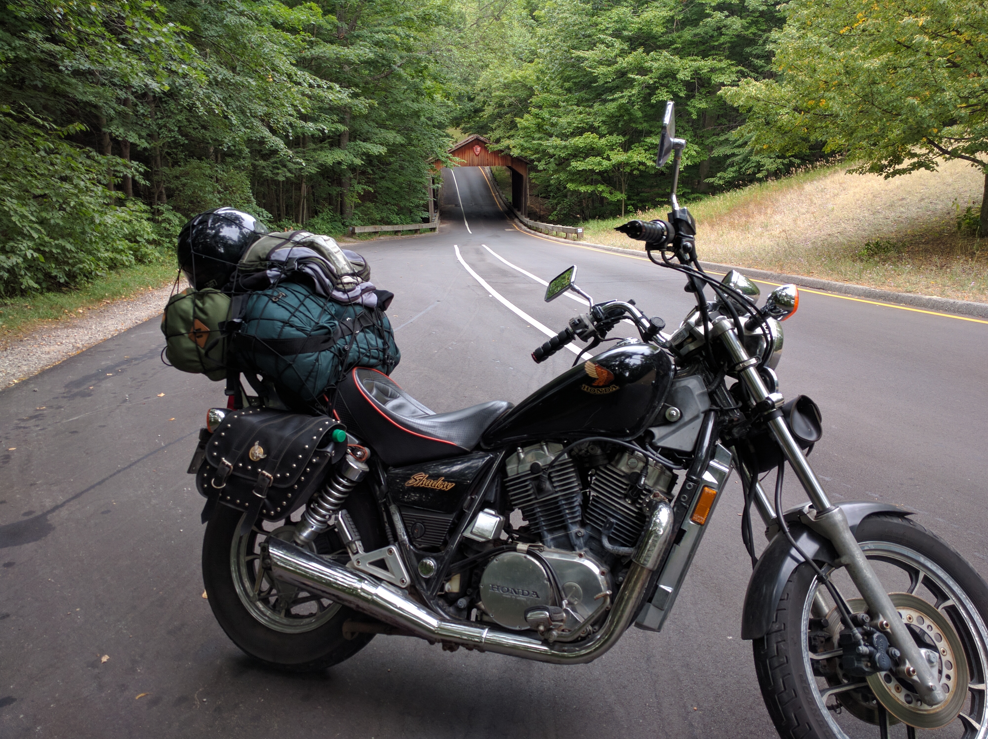
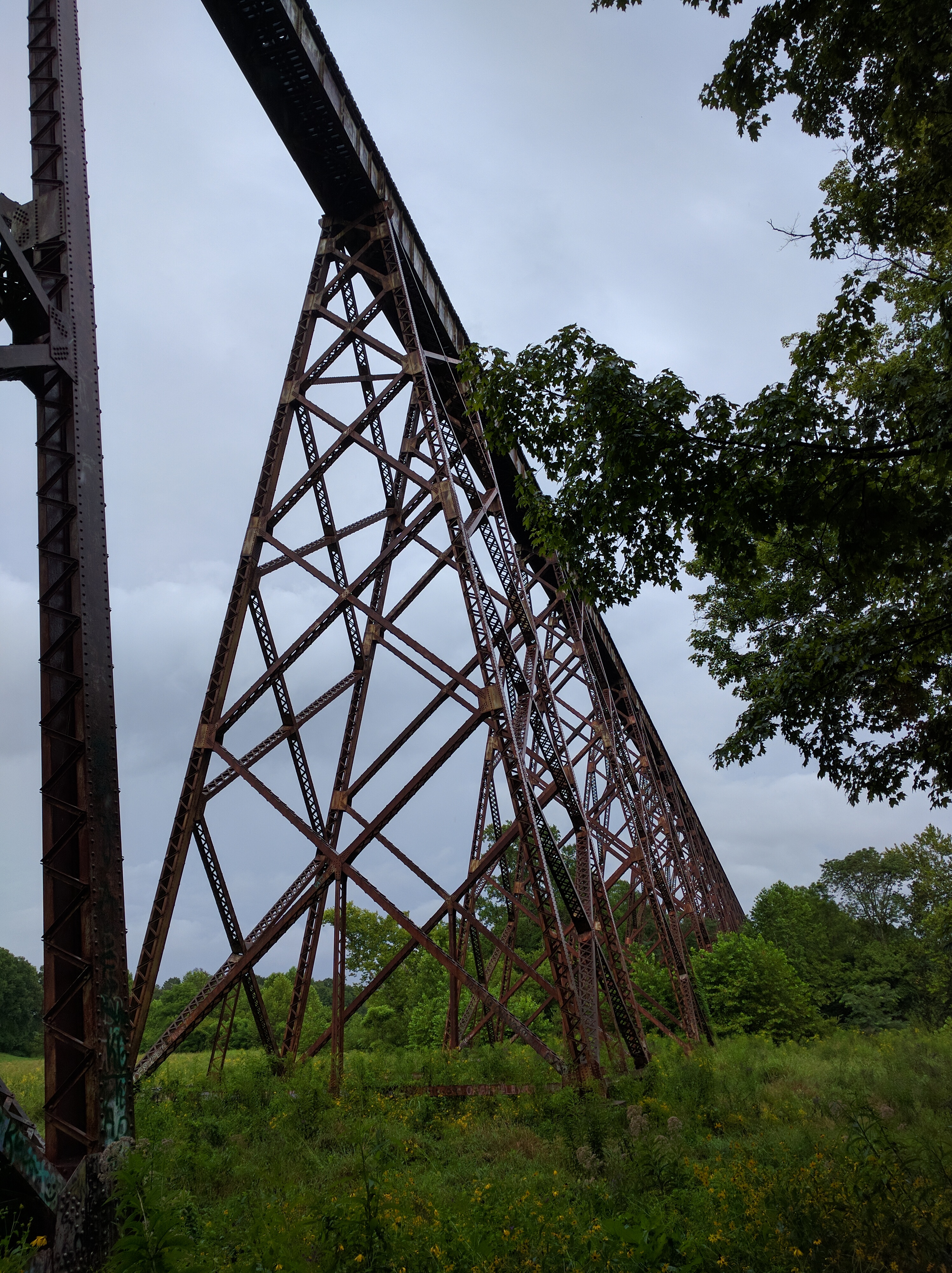
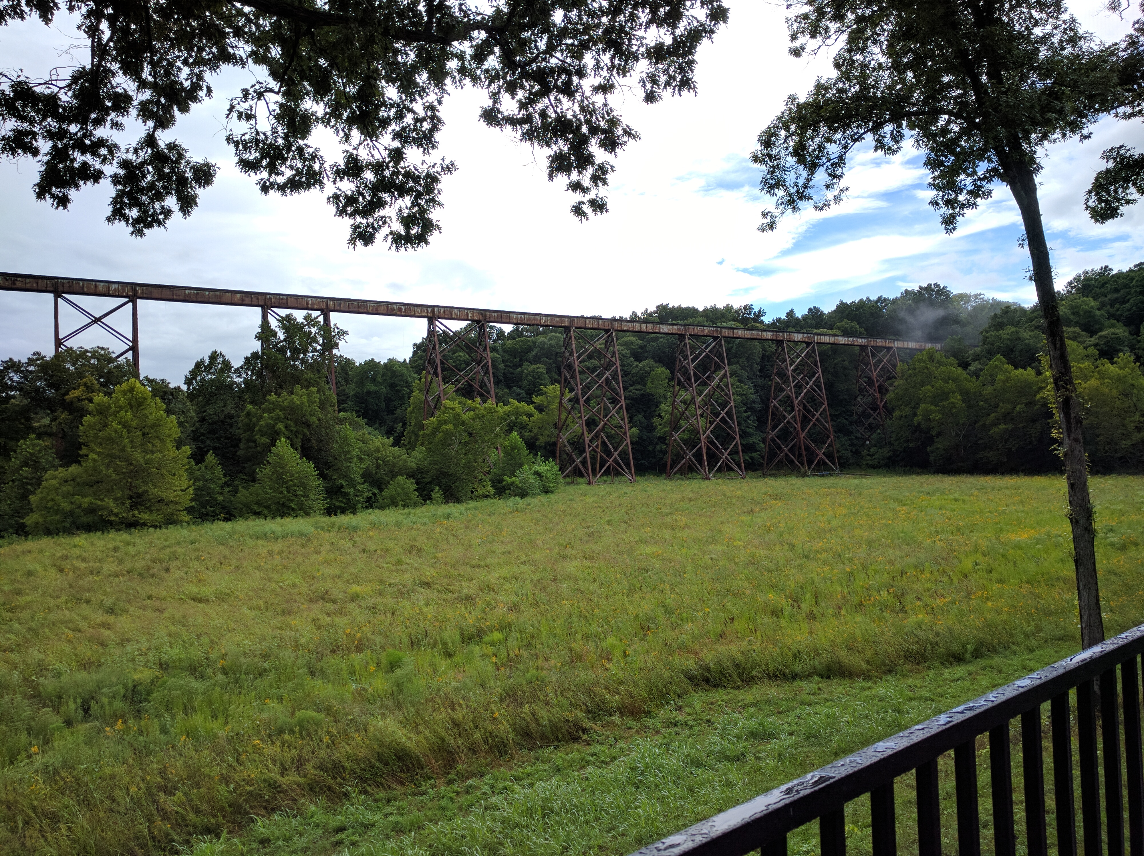
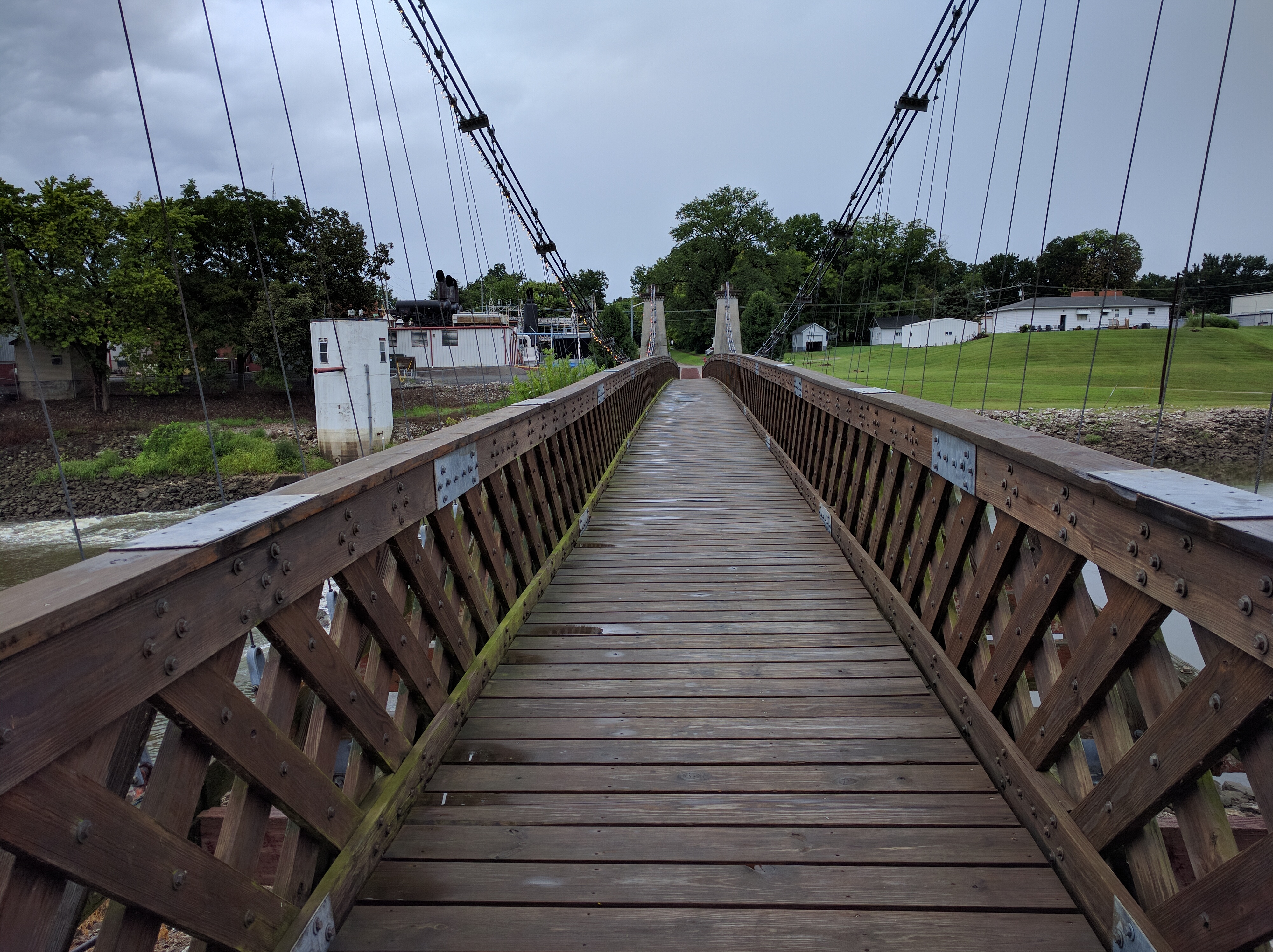
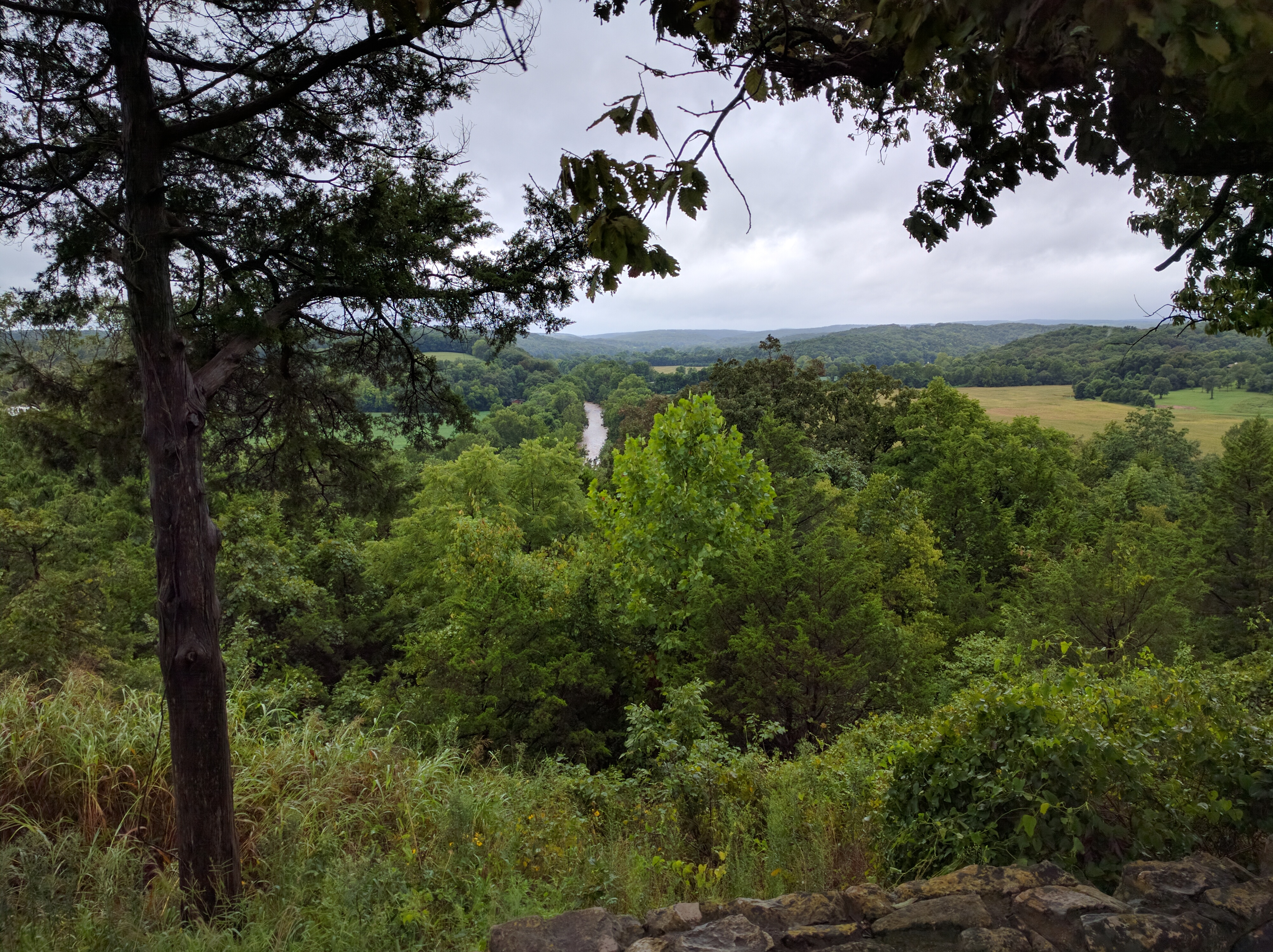
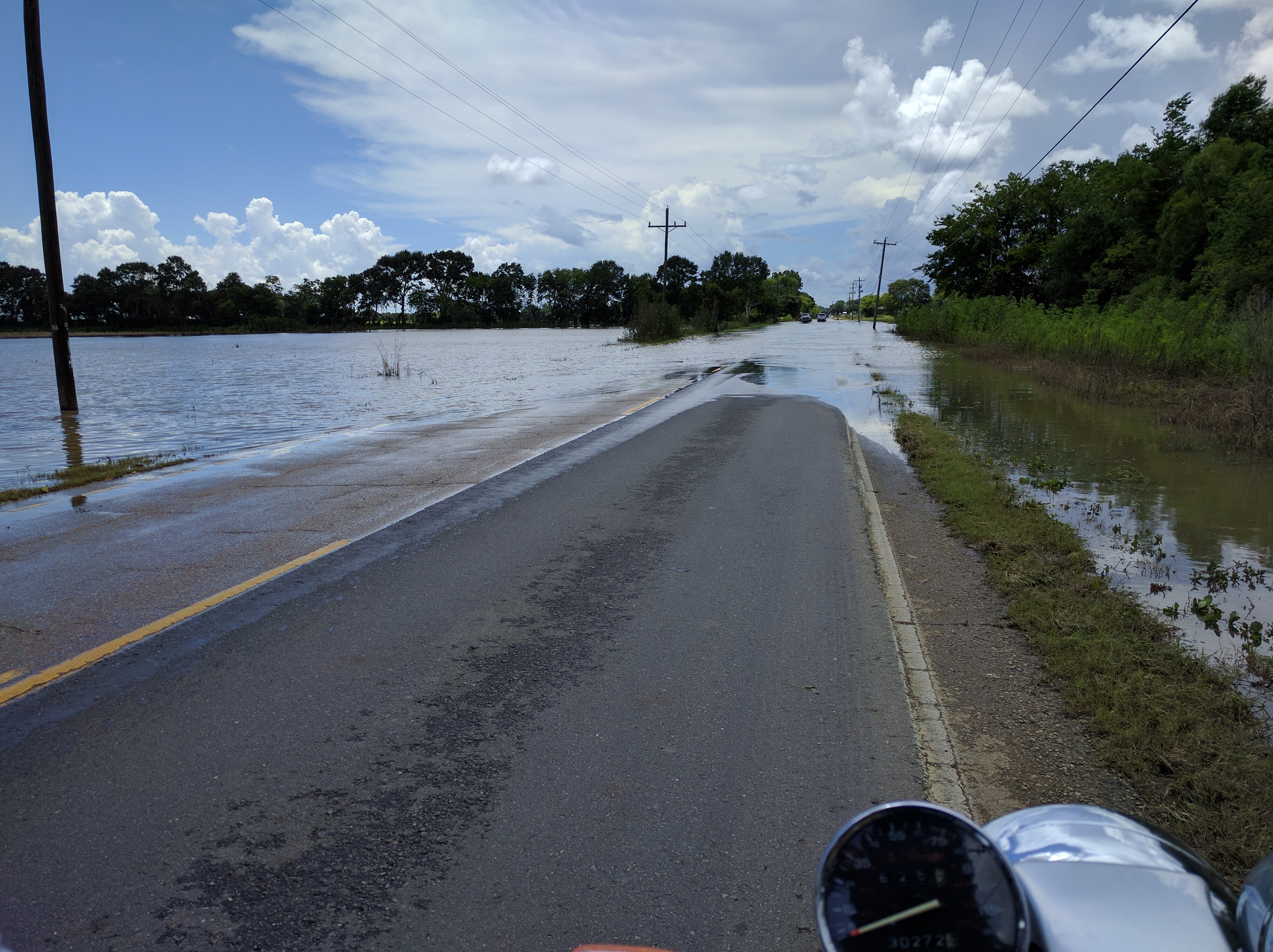
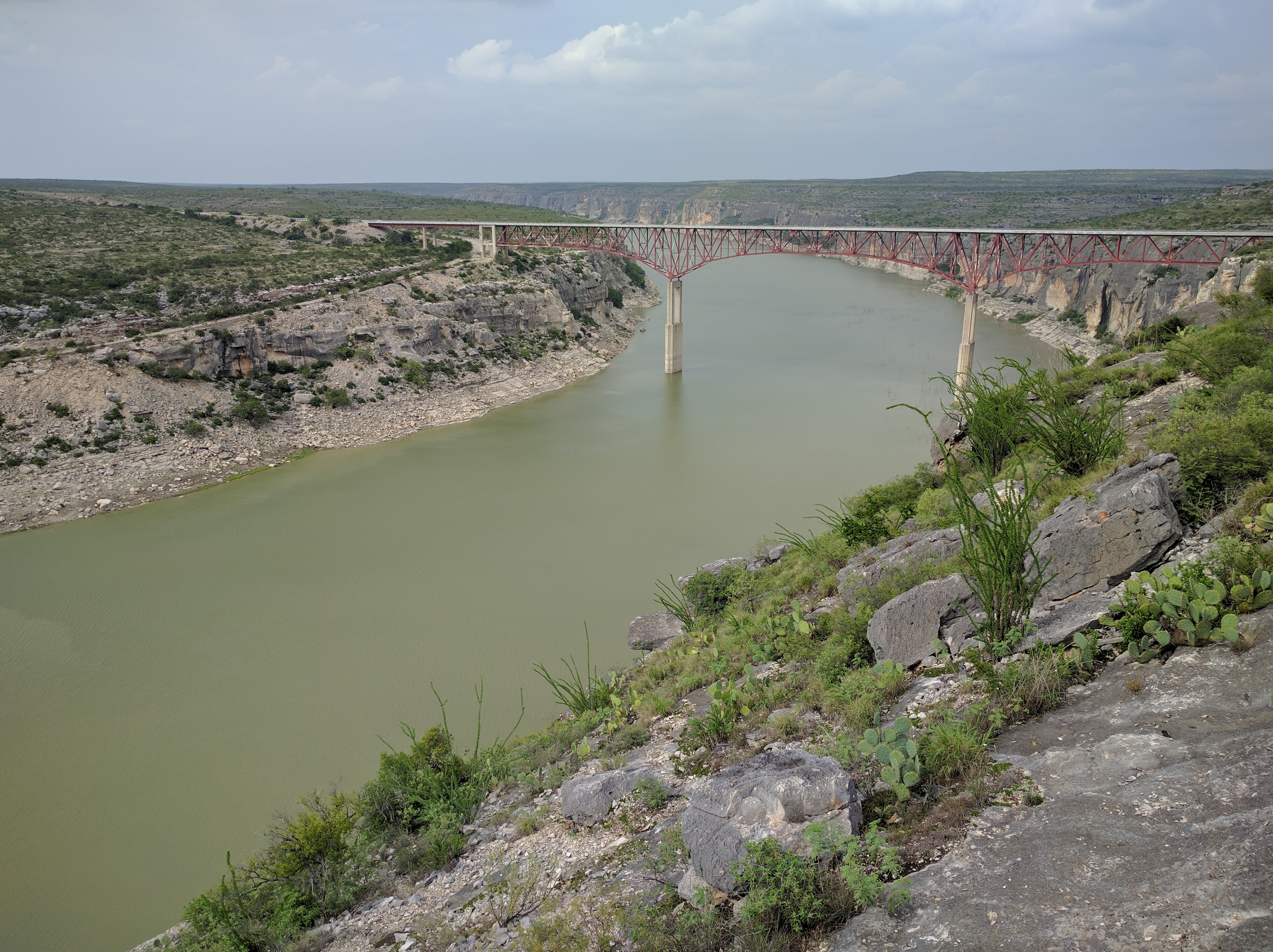
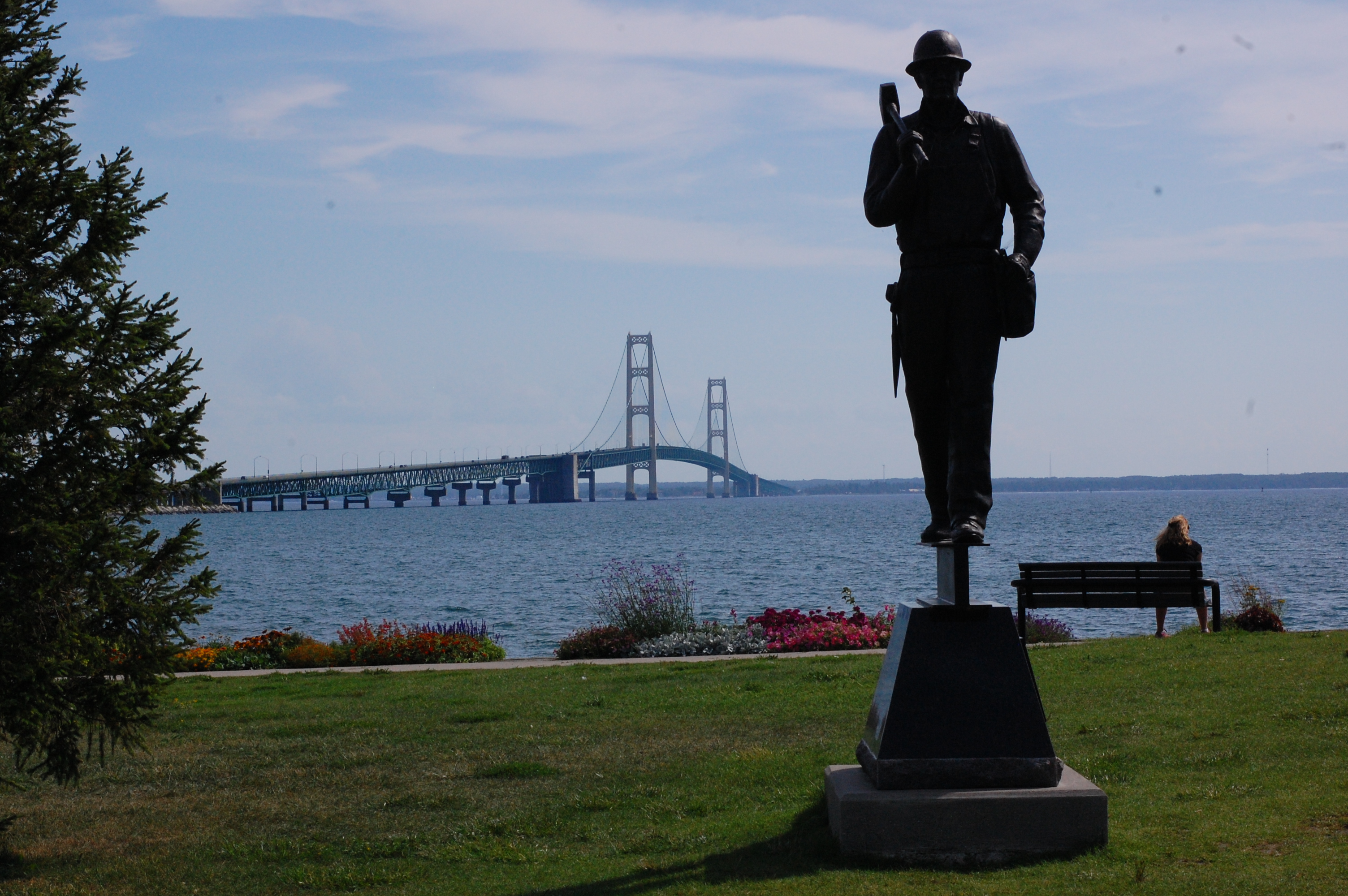
And then there was this!

damn bridge, you big
Lookin so fine
$4 to ride across. Shut up and take my money sir.

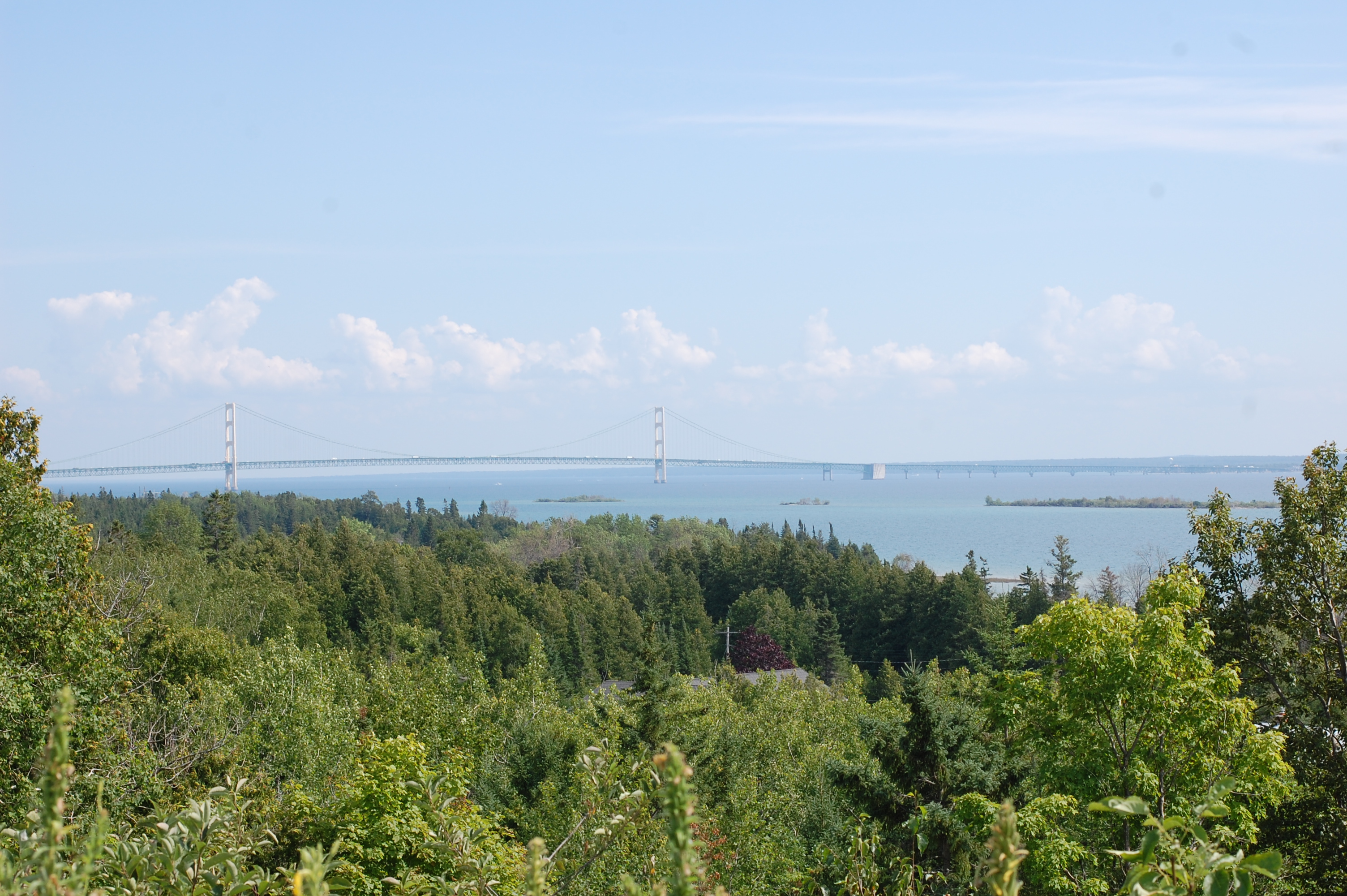
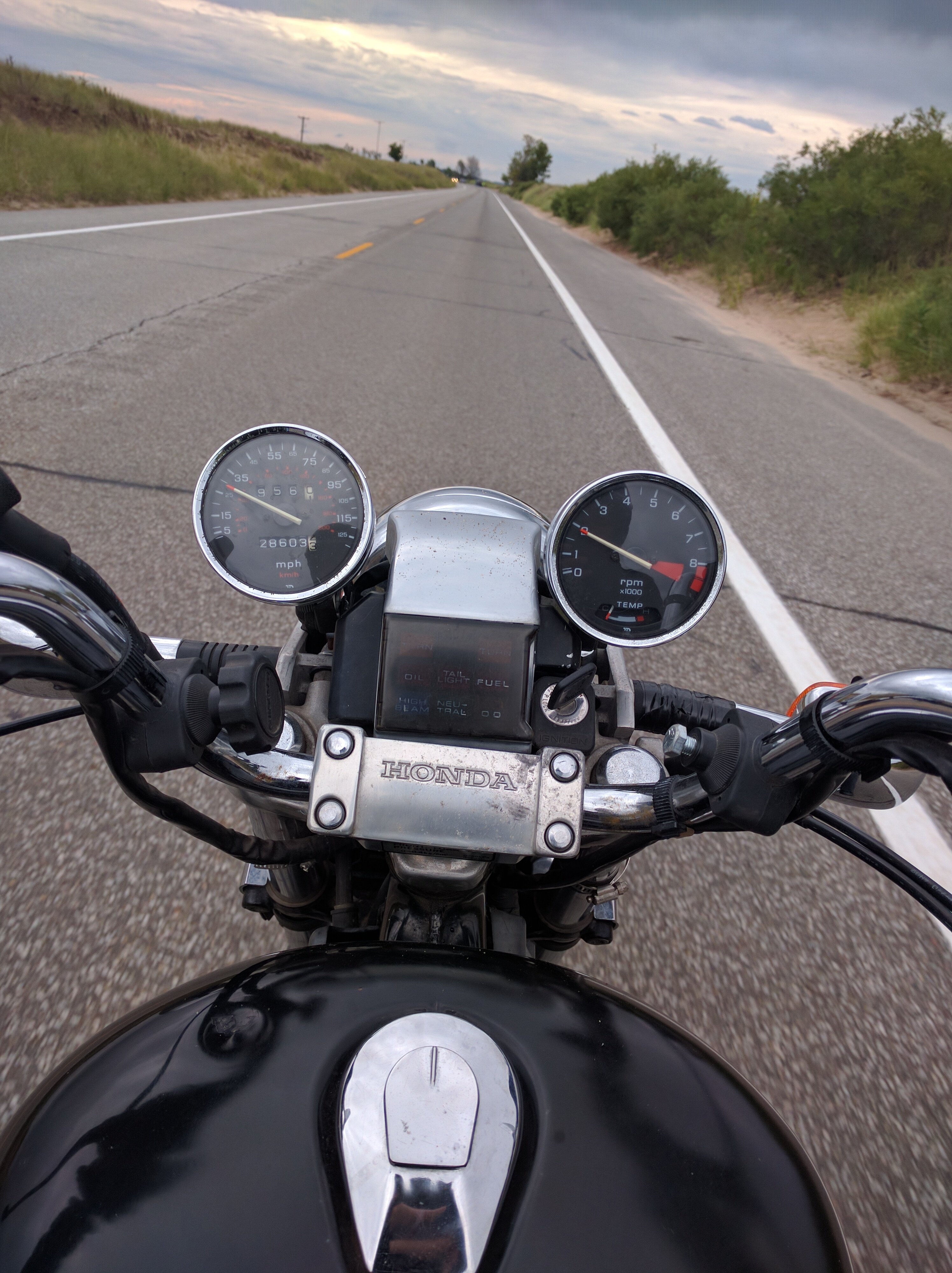
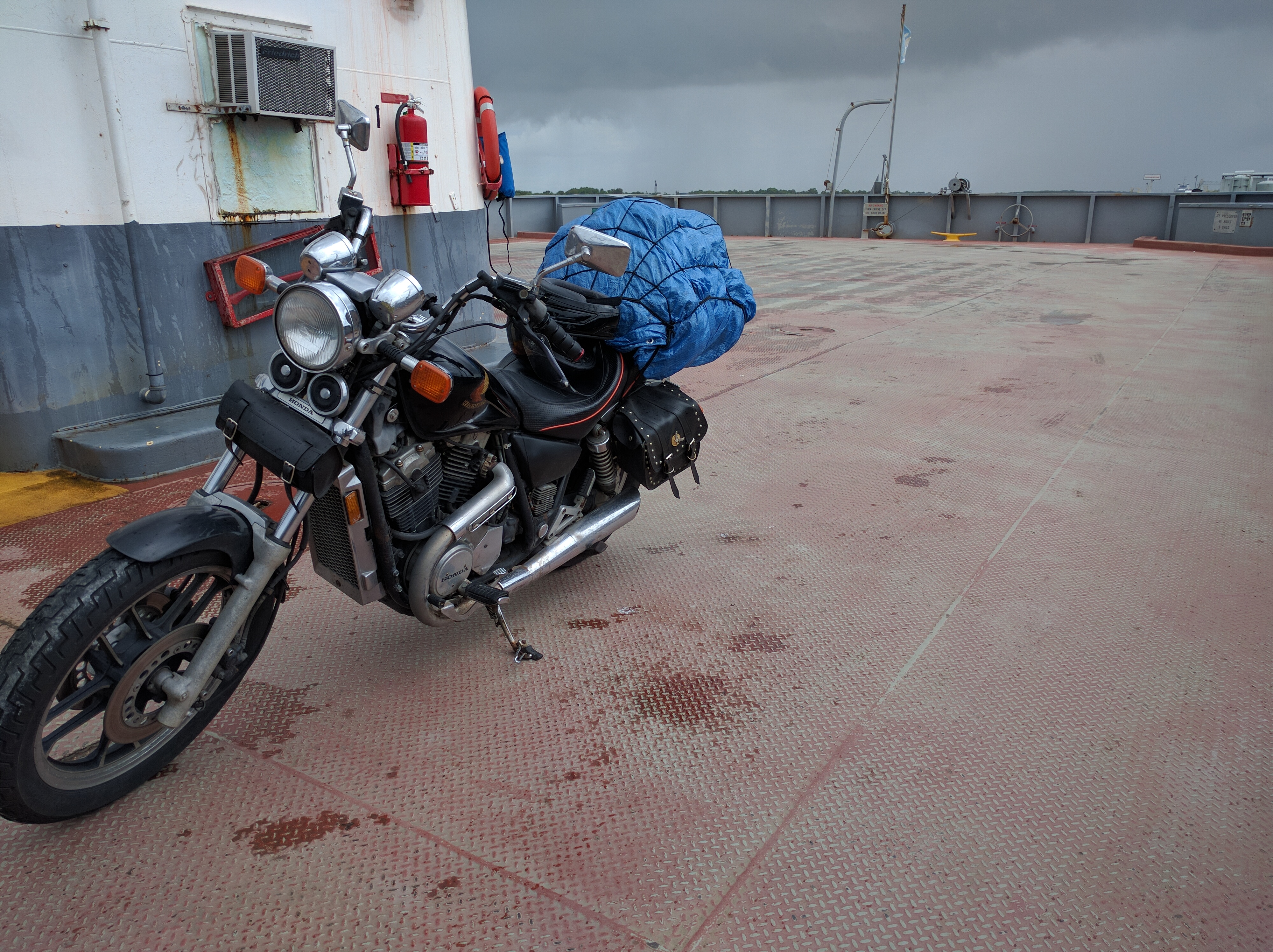
Crossing was awesome. It was like entering a freezer at the grocery store. I was surprised at how long it took to get across. On the way down the right-hand lane was closed, which was the paved/concrete one. The metal grate was definitely interesting on the bike, it felt like riding on a worse version of ice.

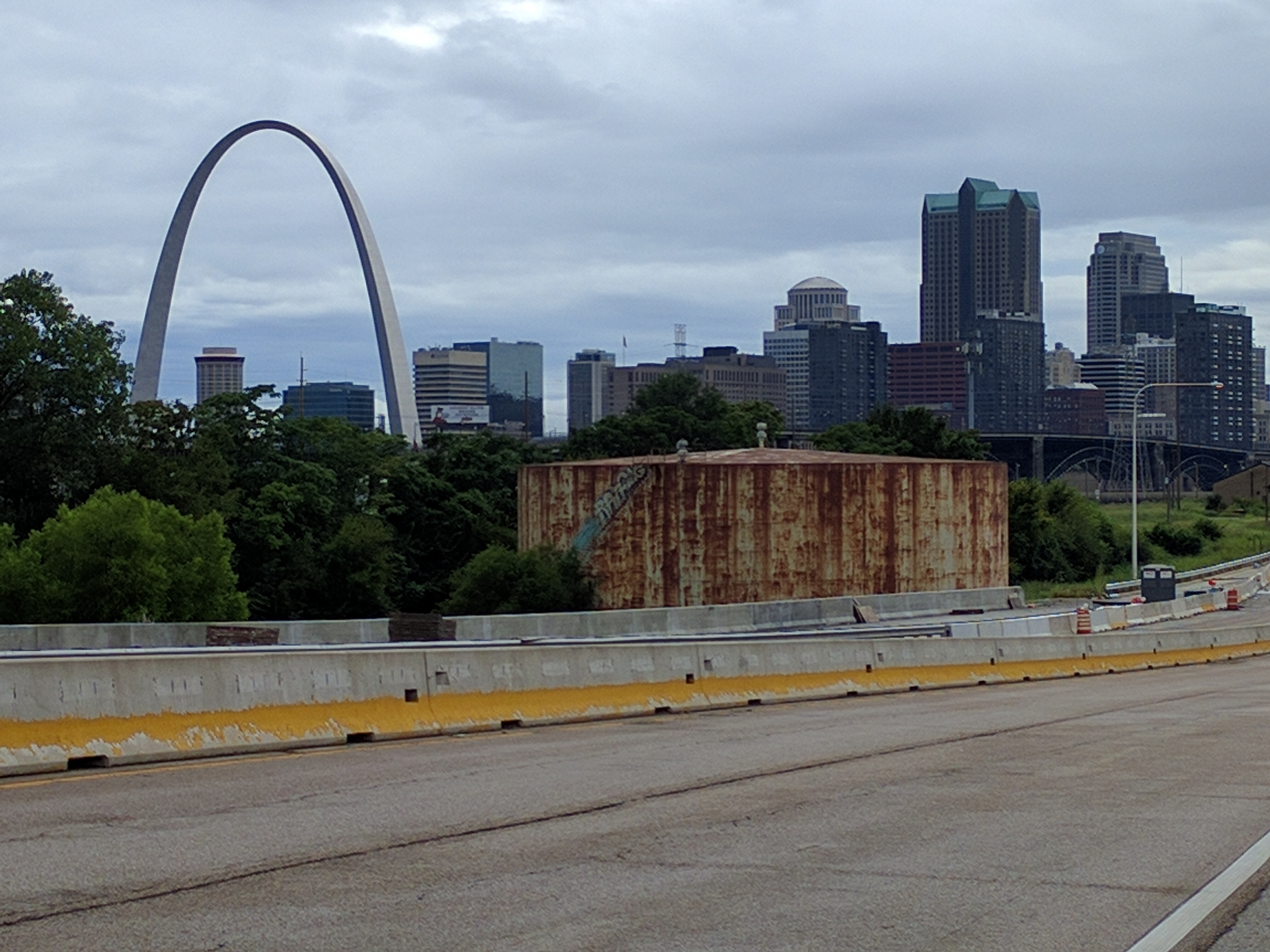
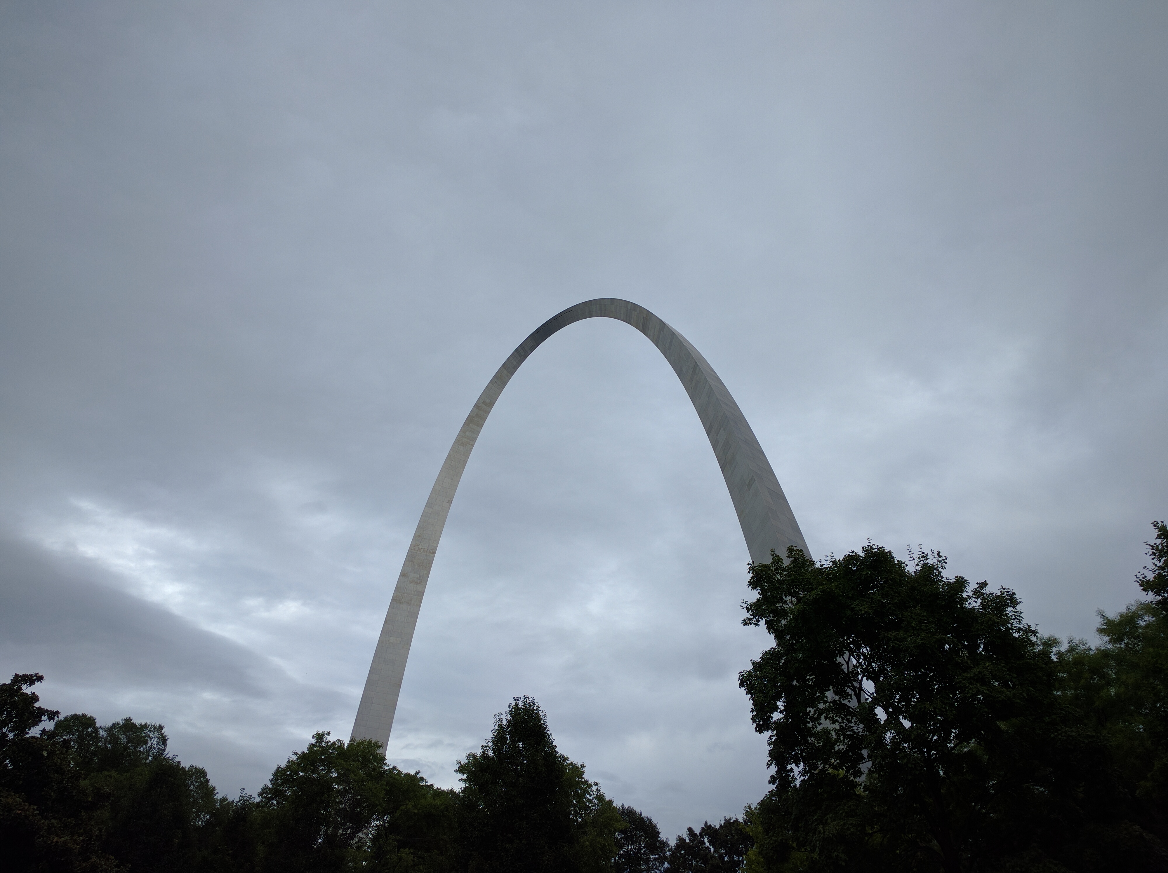
I think I’m really going to miss the Great Lakes. Aside from the fine-ass breeze that keeps a sun drenched rider cool, they are really majestic. To think it’s going to take me 4-5 days to travel around a single body of fresh water is impressive.

Something to note for future reference. Your cell phone carrier might cut off data if you’re roaming and you exceed your limit. This morning I was bummed to find all of my recent instagramulating capped my 50 meg limit pretty quickly. And it totally sucked not having google maps navigation. I had a physical map with me, and some of the digital map was available in a rudimentary offline mode, but street names were largely missing, and nothing worked aside from SMS. Poops.

dasbike

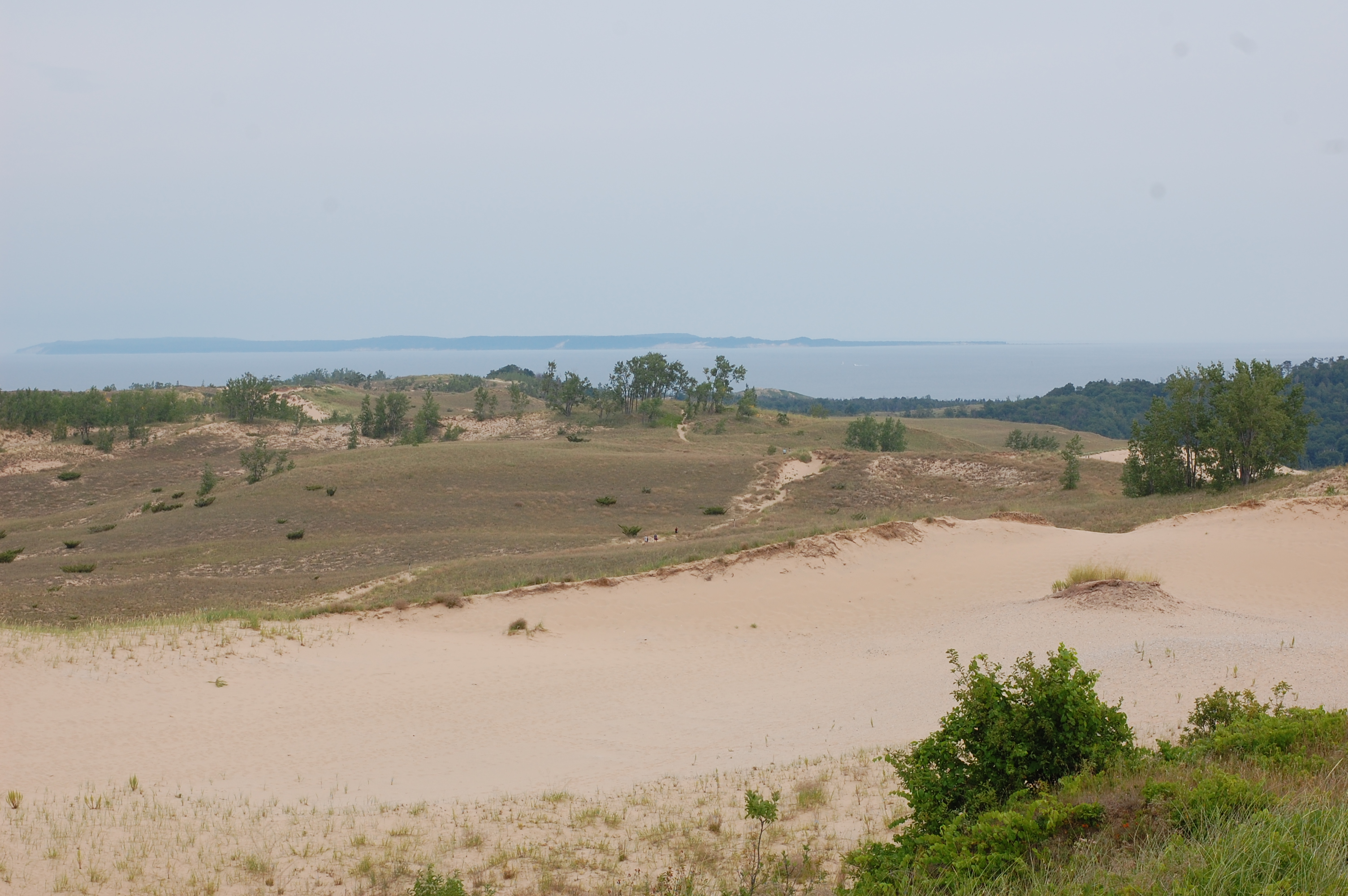
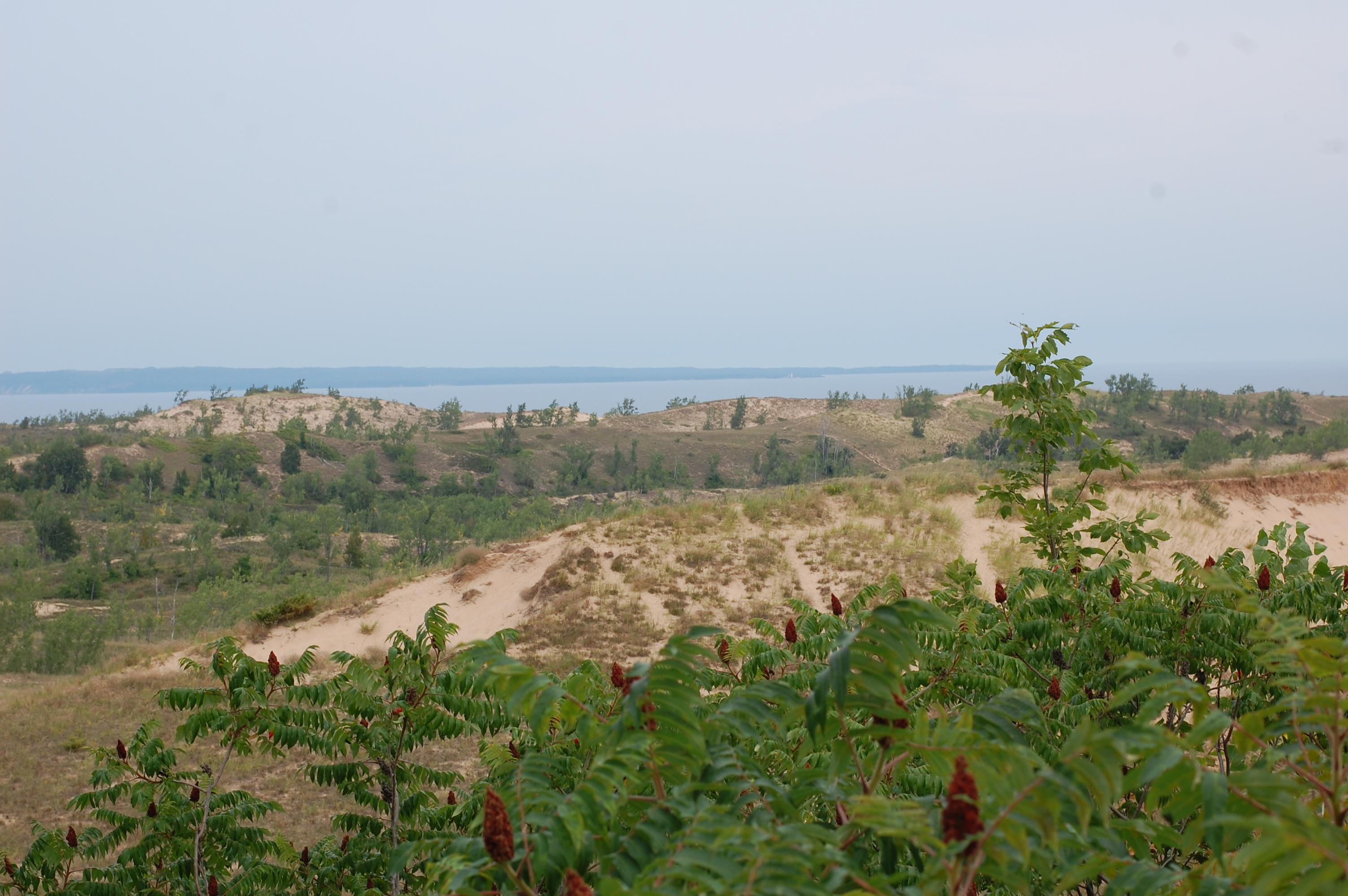
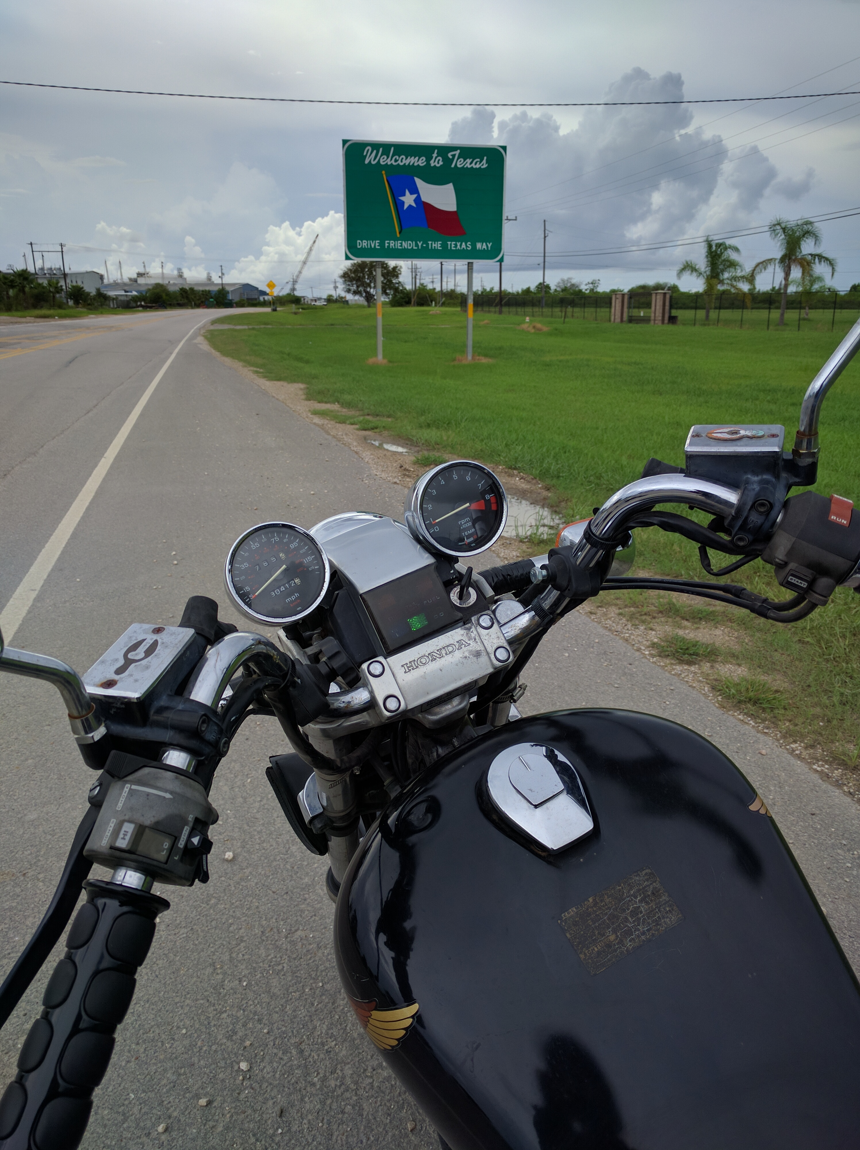
After the bridge, forest turned relatively quickly back to farmland, though not very similar to the dairyland. There are lots of berry farms out this way, at many of which you can pick your own damn berries.  I was bummed that I didn’t have a chance to follow the contour of the lake with highway 119, but I was running short on time and a fellow at the bridge view stop mentioned it’ll tack on 2 hours to the trip easy. BUT, once 31 resumed normal lakeside operation, I was pleased with cool town after cool town, especially Petosky and Charlevoix.

Finally, Traverse City. I am staying with some folks who are among the nicest I’ve ever had the pleasure of meeting. I only met Rich 2 weeks ago during my short 2 day adventure to Newaygo state park, and he was kind enough to offer me a place in his beautiful house in Cedar Michigan, just outside of TC, where he, his awesome wife, 3 amazing children, friendly old pooch and the largest lego collection I’ve ever seen live.

Childhood pete was drooling. Adult pete was drooling too

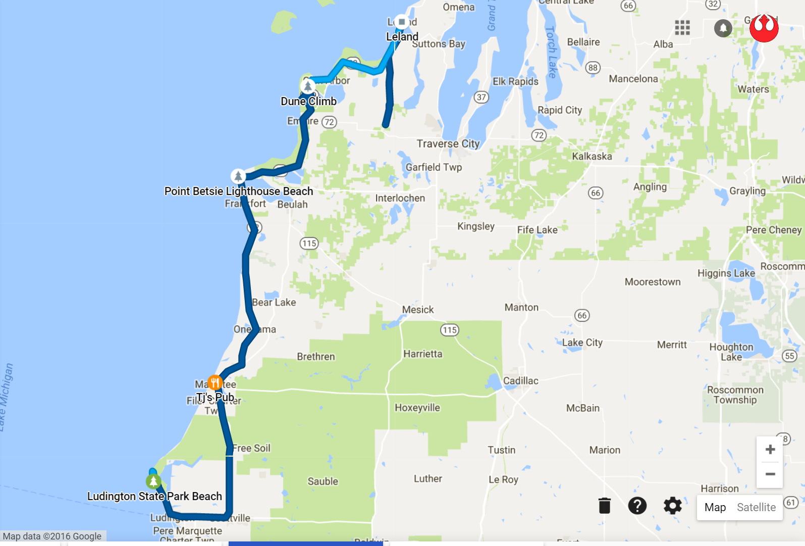
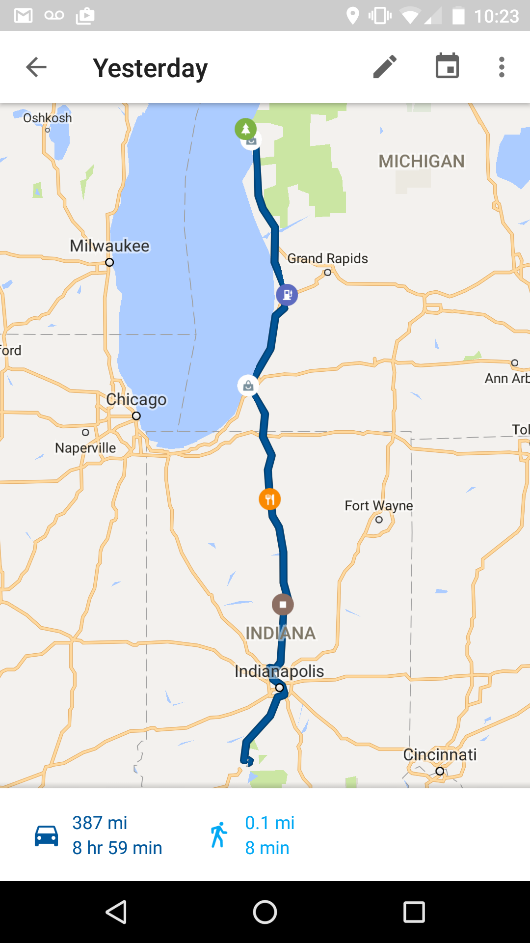
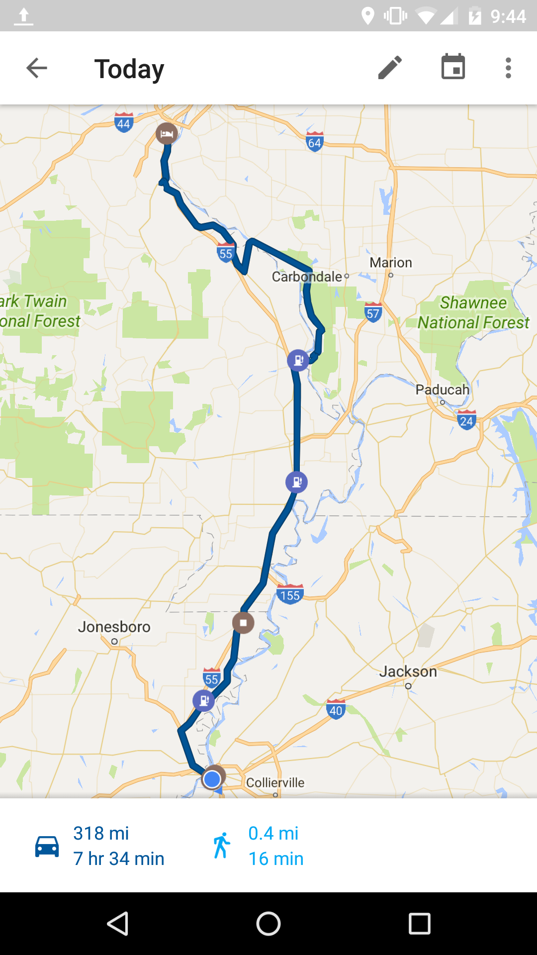
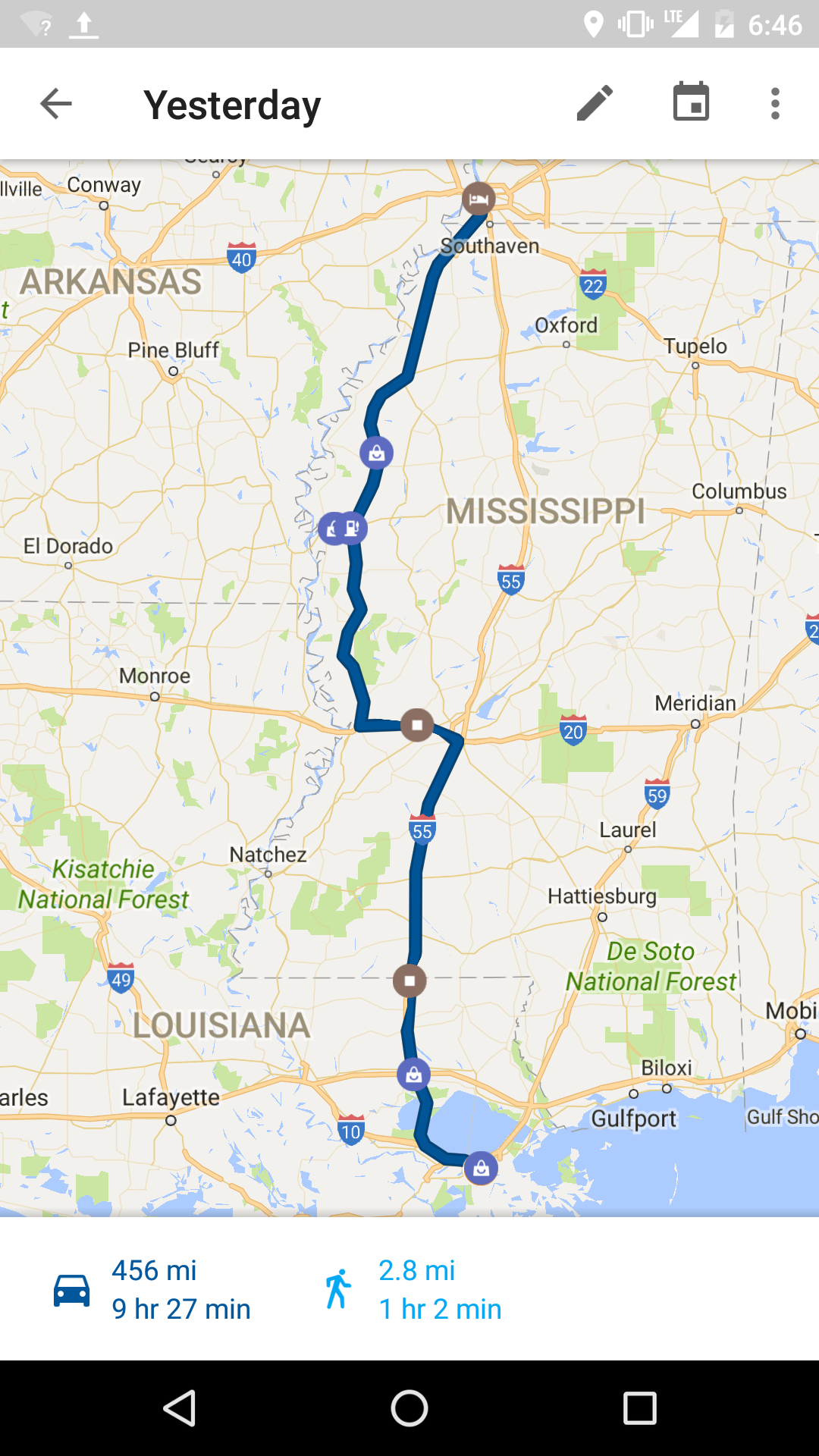
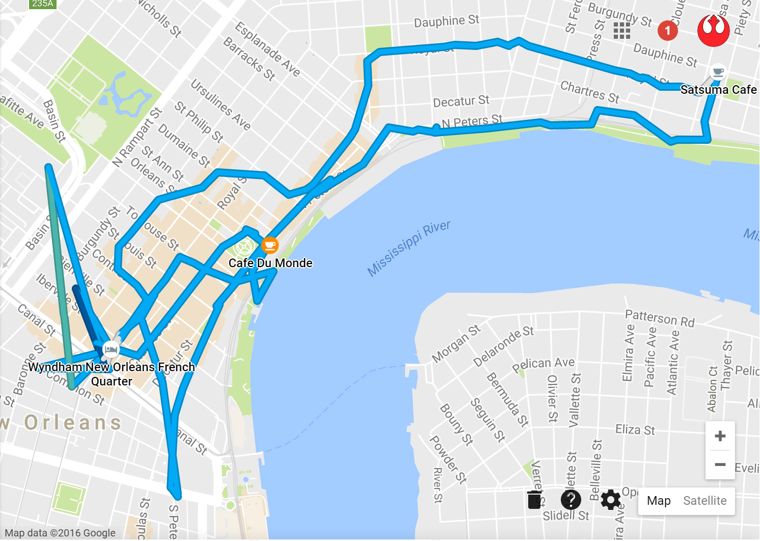
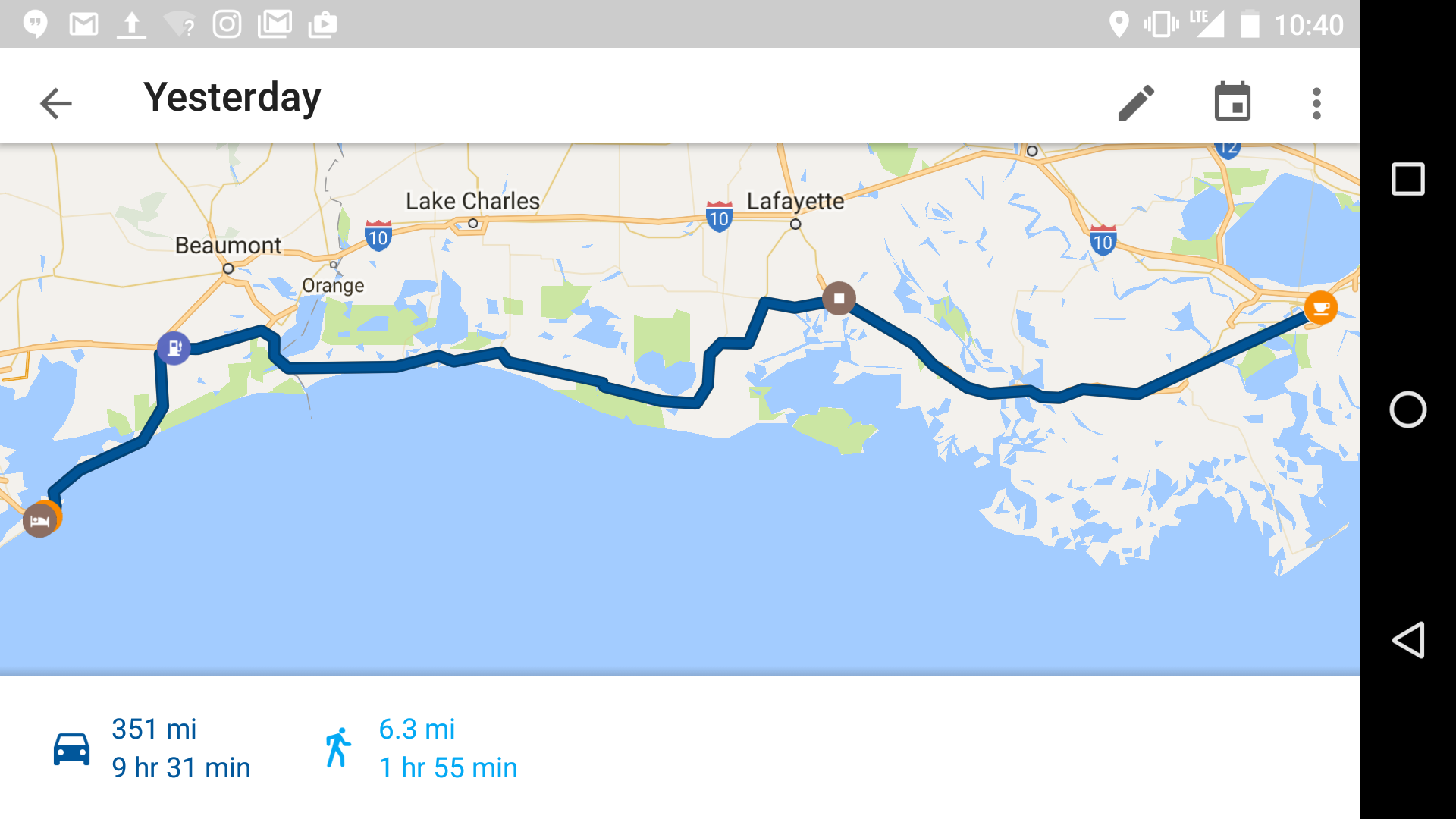
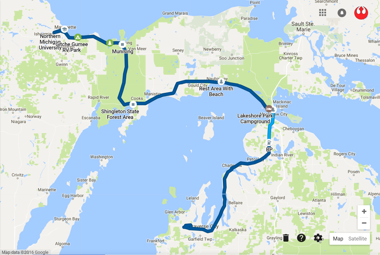
Here’s the route for today.

route3
301 Miles

Next stop Ludington State Park for some Camping. And gotta find me a Leland stone!

Day 4: The Dune Sea(s)

Day 4: The Dune Sea(s)

Today was about a little less bike and a little more hike. And a lot of sand. After hearing some really cool things from Rich and Megan about sites to check out in the area, I couldn’t resist. Following a great breakfast in a little town called Leland, Rich and I parted ways and I began hunting for the elusive Leland Blue, a stone that tends to only wash up in Leland Michigan. A half hour or so of trotting back and forth in the sun with my badass leather boots left me a bucket of sweat, so I decided to walk back into town a buy one from a gift shop.

Vans Beach shoreline in Leland

From here, it was highway 22 until it ended, and I wish it didn’t end because it is by far one of the finest roads I’ve been on. A rider’s dream with trees lining either side providing for cool shaded road, nice gradual curves the entire time and decent hill climbs along the way. Sleeping Bear Dunes National Park is right west of Glen Arbor, very close to where I was and a recommended stop.

The first stop in Sleeping Bear was the Dune Climb. You can see it from a ways off and eventually realize there’s a whole bunch of people on that sand mountain. It was definitely a little bit of work to get to the top but was up there before I knew it. In order to get to the lake from here, it’s a 2.6 mile hike round trip that would take around 4 hours according to the ranger. Unfortunately I didn’t have time for that. Going down was a breeze and lead to the first time I emptied a pound of sand out of my shoes today.

Yep, sand
Yep, sand

A little further down the road there was a sign for a scenic drive. The $10 I paid for the park pass at the Dune Climb got me in here for free. I’m really glad I didn’t pass this up because man, there were some killer views and the road was really cool on a bike. Super windey, only 20 mph the whole time and some of the coolest sights to date.

beardrive

DSC_1195
Okay folks, on your right you’ll see some sand

I met a nice couple who gave me some pointers on where to stop and what to check out on the rest of my trip down 22/31. It was a pleasure talking to them and I’m glad I had some additional places to see along the way.

Betsie Point Lighthouse was the first, just outside of Frankfort. A neat little lighthouse and also where I was able to score a M22 sticker.

DSC_1197

Then this really surprising scenic outlook just outside of Arcadia. You had to climb quite a few stairs to get to the top but the view was outstanding.

arcadia

After a quick lunch stop in Manistee to fuel up on pizza and tea I finally made it to Ludington State park. The ride in consisted of sandy dunes on either side of me (yay more sand!). The main thing I wanted to see was a lighthouse at the end of a 1.5 mile trail. This trail lead to the 2nd and 3rd time I emptied sand out of my shoes.

Spoils at the end of the trail
Here we find sand, in it's natural habitat
Here we find sand, in it’s natural habitat

Finally a quick dunk in the lake to cool off just as storms were rolling in (and 4th time I emptied sand from my shoes). I got back to my tent just as it started drizzling and quickly monsoon like conditions ensued. I’m glad it rained like it did, was nice to chill out and do nothing for a little while.

Ludington was certainly a beautiful place, but the campgrounds were obnoxiously close together. This, and it was more of an RV park than tent camp ground. Seemed like 90% of the place was a camper of some sort. The next time I’m in Michigan, I’ll definitely be booking a place at Sleeping Bear, the area was full of cool things, 22 is right there, the park itself is gorgeous and of course I’d love to play some legos with the little dudes.

I’m pretty sure I’ll have sand with me for the rest of my trip. It’s literally everywhere; inside the tent, in my shoes, on all of my stuff, probably infiltrated it’s way into my clothes bag and who knows what else. Oh well!

Route for today:

112 Miles
112 Miles

Next stop is Indiana-ish area as part of seeing a good bud in Bloomington before I start along the Mississippi River.

Day 5: Farewell Oh Mighty Lake!

Day 5: Farewell Oh Mighty Lake!

Today was a different kind of hike. I left Ludington at around 10:00AM (plan was to leave at 8, nice) and it was another dark and ominous looking morning. This time though, drizzles in the parking lot at the gas station. I figured it would be best to put on the full face, since digging that out from under the tarp is a whole process. I wasn’t as lucky this morning, sure enough just as I got back to 31 it started to rain. I pulled over, slipped on the rain suit and was on my way.

Bon Voyage Ludington!

I was surprised at how comfortable I was riding in the rain. Aside from my hands getting a little wet, it was all good! Ditching that cheapo rain gear and getting this riding stuff was definitely a good move.

I also forgot that wearing the full face certainly has it’s advantages, aside from warmth and rain protection. These being:

  • Not getting whapped in the face with giant bugs
  • Being slightly more aerodynamic than my face, allowing for easier cruising at higher speeds
  • Ability to hear myself talk and assigning dumb lyrics to whatever gas station song is stuck in my head
  • Less fatigue as a result of all of the above
  • Ability to hear things differently (like engine noises)
  • No need to slather on sunscreen at every stop

These things are nice but I still like my half helmet and the openness it provides.

It rained for all of 10-15 minutes on the road before stopping and just looking like it was about to monsoon at any second. Taking off the gear was tempting since it’s not exactly very airy in there, but I decided hold tight, for fashion reasons more than anything else of course.

spaceman
Hello stranger, please take a picture of me in my fashionable spaceman constume

Eventually 31 turns into a very interstate-like highway, so around Holland I jumped on the Blue Star Highway/A2 for a much more scenic and enjoyable ride. I stopped off in St. Joseph for a quick lunch and some coffee and was on my way again just as the rain was coming through. Very neat little town, seems like a great place to bring kids and have some good ol’ fashioned family fun.

This was the last time I’ll see Lake Michigan for quite a while, since from here it was 63 to 31, almost straight south toward South Bend, which was my ultimate goal for the day.

Later dude
Later dude

I was unable to find a couch surfing host in South Bend so things were flexible in terms of where and when I should hunker down. I reached South Bend around 2PM, and with the assumption there wasn’t a whole lot to see there, I decided to push on and see how close I can get to Indianapolis. The shorter the ride in the morning meant more time I could spend with my good friend Nicky Nick and his newly hatched little meatball.

Indianapolis approached quickly. It was funny seeing the workings of a big city again after not having seen one since Milwaukee. Nick and I both sort of figured at the same time I could probably get all the way to Bloomington tonight. And so I did! I was surprised how the landscape changed after Indy, 37 coming into Bloomington was quite scenic and enjoyable, despite the road construction here and there.

And so we enjoyed a delicious pasta dinner and watched the first two episodes of Mr. Robot before crashing. Tomorrow (today at this point) I look forward to a day chilling out before heading back out to St. Louis on Monday morning.

Here’s today’s long ass route:

route5

Day 6: Chillout Grillout

Day 6: Chillout Grillout

A much needed day of no travel. After sleeping in a bit, Nicky B took me along with him on his shift as an Indiana State Police officer. Dude was lookin’ mighty fine in that uniform no doubt.

It was thankfully mostly uneventful, save for a telephone pole down in the street. Nick jumped into action and directed the shit out of the resulting traffic.

It was definitely neat to see what he does, I’m still surprised this is his job. What a guy.

When things were a little quieter we took a ride down some of the backroads in the area to checkout this really sweet train trestle. The scenery around here never ceases to surprise me. If this is any clue as to what going further is going to look like then I’m pumped.

trestle

trestle2

Pretty damn scenic, nice job Southern Indiana

Getting back, we lounged a little with Dr. Who and the brand new little meat nugget Dylan, whipped up some burgers & dogs and ended the night with the Empire Strikes Back in the basement theater.

Ready to Rock
Ready to Rock

Since I had a chance to think about some of the little things I’ve learned along the way, I thought this was a good opportunity to jot them down. Here are just a few reflections after almost a week of riding.

  • Ear Plugs are Magic
    • I can’t imagine riding without them. They allow for a much more serene ride and allow to cruise much easier at higher speeds. Not to mention it’s great to hear yourself think. Still probably going deaf though.
  • Plan to Take Longer Than Expected
    • Everything takes longer on the bike. Strapping gear on in the morning, taking it off in the evening, pulling something out of the bag, putting something in, stopping t see cool stuff.It all adds up too. I usually add two hours to whatever google maps says, even with highways and tolls turned off.
  • Don’t Rush
    • I’ve learned that it’s important to never rush. You’ll get there when you get there and most of the time there’s nothing you can do to get somewhere any faster, so there’s no need to worry or rush. Rushing just leads to anger, anger leads to suffering and suffering, well you know what that leads to…
  • Nice to Start Early
    • Similarly to the above, its good to get an early start. It really makes getting to where you’re going a lot easier. Or at least, getting there earlier is nice.
  • Don’t Eat a Shitload Before Jumping Back On
    • Made this mistake twice now. It’s so easy to indulge in a feast when stopping for lunch, but it makes riding shortly after a total chore. Eating a ton makes you sleepy and sleepy rider makes for not fun riding. I had to stop in the UP for a quick nap on a picnic bench.
  • Stop if You Wanna
    • If you feel like you should stop to check something out, even as a split second’s passing thought, then stop. Chances are you wont be coming back through that way for a second chance, and you might wind up seeing something totally awesome. I made the mistake of passing up what looked like a cool scenic outlook in Epoufette, and it haunts me still. But I made up for it with the Sleeping Bear Scenic Drive.
  • Rest Easy
    • Stopping often is nice, and getting good sleep is important. Probably obvious but once you learn the hard way it’s an important thing to keep in mind.
  • It’s Fun to Talk
    • Don’t be a afraid to start conversations. The time’s I’ve wound up asking some questions along the way have led to either some good convos or really good knowledge on neat things in the area.

Though a day of no travel was a nice change of pace, I’m ready and rearin’ to hop back in the saddle and get back on the road, even though it might be kind of wet these next few days. St. Louis, I’m comin’ for you.

Day 7: Crossing the Great Plainness

Day 7: Crossing the Great Plainness

It was so good seeing Nick & fam. Amazing that only a few years ago we were romping around Loyola, and now this guy has a wife, house, two fuzzball doggers, a meatball baby and arrests people. While he may have rapidly transformed into a super adult at an unparalleled rate, it was good to see he’s the same old funny character. Don’t ever change, love ya bud. Yip!

It was a wet morning yet again, and on and off throughout the day but overall a decent day for riding. Just outside of Bloomington I dealt with my first bout of motorcycle maintenance. Nothing serious, the left handlebar grip came loose and after a little bit of emergency gas station super glue treatment, we were good to go. I also took this opportunity to pick up a tire patch kit, something I meant to have on the packing list before I left.

There wasn’t a whole lot to see along the way, only the occasional “mud creek” or “crooked creek,” maybe a river crossing here and there. The plains are beautiful in their own right, but not too exciting for a cyclist. Roads that are uneventful, straight as an arrow, sometimes not exactly brand new, no gradient whatsoever, nothing to see but farmland and the occasional weathered town.

I did make a quick stop in Carlyle Illinois, home of the largest lake in Illinois (who’da guessed?) and snapped this picture of a historic suspension bridge crossing over the Kaskaskia river.

carlyle

Other than this, Lebanon was OK. Central Illinois isn’t exactly scenic I suppose.

That’s alright, because St. Louis made up for it.

arch1

arch2

Crossing the Mississippi river was pretty sweet, the city is littered with different types of bridges all over the place. I decided the goal was first to just check out the Arch and be a tourist downtown for a while. After getting closer, I remembered you can actually go up to the top and I am not one to pass up a good view.

13 bucks to get in and get a ride up seemed totally worth it. You’re assigned a time on your ticket and either a South Tram or North Tram. After standing in line for a while, you hop in one of eight space pod looking things that seat up to 5 people in a very tight space. Definitely cramped and not for people with claustrophobia. Then you sort of jiggle your way up to the top as strange clanks and creeks are happening all around you. Was pretty sweet. Very much worth it for the views though:

No sand here
No sand here
Apparently Paul McCartney played at the stadium just last night!

In line to get to the top, I met a fellow Star Wars fan, he appreciating my shirt and I appreciating his star wars shoes (now that I know that’s a thing, I need them) and eventually conversation led to grabbing some dinner at the Hard Rock Cafe down the street.

Here’s the route for today:

route6

Tomorrow I start down along the Mississippi toward Memphis TN.

Day 8: Highway 61 Visited

Day 8: Highway 61 Visited

The rain is getting a little old, and to bat, most of the day was windy as well making for a ride that was less than enjoyable. It wasn’t until about half way to Memphis that things finally started to dry up a little.

This being said, highway 61 was a pleasure and I’m glad I finally got to experience it. Coming out of St. Louis, there were some great curves and hills and some of the views really showcased the southland.

h61

I wanted to try and stay along the Great River Road National Route most of the way, which incorporates 61 for a large portion, but jogs across the Mississippi river and ties into other roads as well. At one point I was back in Illinois along Highway 3, another cool road, not a lot of traffic at all and some great views of the big muddy.

h3

I must have crossed 4-5 bridges today, each one maintaining it’s own rusty character. It was interesting to see parts of the river that weren’t attached to major cities. Even out in the middle of nowhere, it’s a pretty industrious shoreline most of the way with factories spewing interesting odors and barges carrying who knows what.

A valuable lesson learned today along Highway 3. With the rain and rain gear, my fuel economy was not quite what I thought it was. The fuel light came on unexpectedly around a little town called McClure and after driving around looking, there was no gas station in sight. Fuel light means reserve tank which means about 20 miles left. Luckily I found a guy that happened to be gassing up his truck in the driveway and he was kind enough to hook me up with a gallon or so to get me back across the river to nearest station. Thanks Joe Livingston, wherever you might be.

The GRR was neat but it was also super time consuming. It was almost 2pm and I wasn’t even halfway to Memphis. Interstate 55 was a good chance to dry off and gain some ground, and happened to also tie right back into 61 eventually. I think it got back on the scenic byway just as I entered Arkansas.

The closer I got to Memphis the hotter it became, almost hit 90 and quite humid. A big change from leaving St. Louis at 73 this morning. The landscape was flat most of the way but it was a great ride and the scenery was beautiful, wild flowers and fields and different colored grasses all over the place. I’d recommend jumping on 61 to any cyclist. Arkansas in general is probably a great place for riding.

Finally Memphis was in sight and the stomach was rumbling. Luckily Beale Street is home to some fine BBQ and Blues. I couldn’t help but to indulge.

Lookin Lit!
Lookin Lit!

Today’s Route:

route7

Tomorrow the plan is Louisiana. Originally I was going to make a quick stop for the evening in Baton Rouge via 61 the whole way, but considering the current state of affairs around that area I’ll probably split off to 55 around Jacksonville and ride all the way into New Orleans.

Days 9 & 10: Hola Nola!

Days 9 & 10: Hola Nola!

I was a little disappointed in the blandness of highway 61 after Memphis. It was like being on a regular interstate with nothing but corn on either side most of the way through Mississippi. I suppose the lack of traffic made up for it.

Right around Vicksburg things became a little more scenic, and I was surprised to find that Interstate 55 was actually decently scenic. Despite the larger amount of cars, it was enjoyable with dense trees lining the road all the way into Louisiana.

Then things got really interesting as the highway became elevated on concrete pillars and there was swampland down below on either side. At first I thought all of the water under the highway was due to the recent rain and flooding, but then I noticed a lot of people had pontoon boats parked under their swamp-shack canopies, so I’m pretty sure it was always like that.

The only signs of flooding I noticed were a few exit/on ramps closed here and there with some water lingering around them.

Then the highway crosses over Lake Pontchartrain, very scenic the entire way. I don’t have any pictures of this stuff because there wasn’t really any great place to stop and take them and it was on the verge of getting dark and wasn’t in the mood to stop anywhere aside from my final destination in the French Quarter. Anyway, you should come take the ride and see for yourself.

If you’re a rider, be sure to gas up before the highway becomes elevated. At that point, there aren’t many exit ramps or places to pull off in search for some fuel, until you hit the city. I’m sure the swamp people are accommodating but I don’t even know how you’d get down there to find out.

I decided to swank it up a little bit with a room at the Wyndham after noticing a pretty sweet deal on booking.com. This and I haven’t had super great luck with the couch surfing requests lately. I think everything has been just too last minute, so I figure having the room is a good chance to catch up on these sorts of things for future destinations.

Finally after arriving I was able to strip off the rain gear, put on some normal shoes and find a place to stuff my face full of cajun style deliciousness. And I did just that, at Coop’s place with a sampler which included a cup of seafood gumbo, shrimp creole, cajun fried chicken, red beans & rice with sausage, and rabbit & sausage jambalaya. I was satisfied.

The heat was on along bourbon street, in more than one way

Today was a lot of strolling around town, having coffee and beignets, being a tourist and sweating my butt off in the sun. Oh and one of the sole reasons for my trip to NOLA, to find the beet lemonade. It was delish. Definitely a fun city, I could totally see assembling the boys and having a time.

At one point there was what appeared to be an impromptu swing band jam session in the middle of the street right in front of the hotel I was staying at. Police closed off the road and everything, people dancing and naturally being drawn in by the music. I walked by an hour or two later and it was like nothing happened. You crazy NOLA you.

Now after this wall of text, have some pictures!


St. Louis Church right in the heart of the French Quarter


riverboat
A butt


The New Orleans Skyline. Driving into this as it was getting dark was excellent.

I’m off to get some BBQ with some friend’s I’ve yet to meet, and then tomorrow an early start towards Texas! My planned route is known for gators chilling out on the road. Wish me luck!

Yesterday’s Route:

route8

Today’s walk around town, thought it was funny:

walkroute1


Day 11: The Great All American Ferry Tour 2016

Day 11: The Great All American Ferry Tour 2016

It was the first morning that included sunshine since being around the Traverse City area. It didn’t last long though, at one point on 90 going west toward Lafayette a sort of microburst thunderstorm thing rolled through. 2-3 miles of raining as hard as it could and then sunshine again. This was the theme really throughout most of the day.

The ride on 90 wasn’t bad, but it was relatively high traffic and fast speeds. At one point though the highway was elevated with thick marshlands on either side, the trees with the hanging moss were all around and nice to look at.

I meant to check the Louisiana Department of Transportation notices about my route before leaving but it slipped my mind so I was a little nervous as to what I’d find. Flooding was happening mostly to the north and west of New Orleans and I was staying pretty far south, but it was also raining all along this route the previous 2 days.

My first attempt at jumping on Louisiana 82 confirmed my worries. The road was under maybe 10-16 inches of water for a few hundred feet and it looked a little deeper than I wanted to attempt, though trucks were plowing through it no problem.

Nope
Nope

Luckily there was another way to get on 82 after going a few miles further through town, and this was looking much better. The area around here was affected quite a bit by the high waters. Around the towns of Perry and Esther, parking lots and driveways were under quite a bit of water, people seemed to be going on with their lives anyway though and just parking in the shin deep water.

Most of the houses along the route are built on stilts, sometimes only a few feet off the ground, sometimes a few stories off the ground. They look like the typical rectangular mobile home, except in the air. I think they call em cajun high rises.

82 was a neat ride altogether, I’m really glad I decided to come this way. Also called the Spur Byway, large portion starting about halfway between Lafayette and Galveston consists of the Creole Nature Trail. Nature was certainly present for most of the ride. It was mostly grassland/bayou/swamp all around, aside from residences and business occasionally along the way. I saw turtles crossing the road, a snake doing snake stuff in the middle of the road, tons of large crane-like birds and pelicans. And these were only the living ones. Quite a diverse road-kill scene around these parts as well. No gators though, damn.

One portion of the highway that goes east/west just after Esther is in rough shape, but it was also quite scenic. I also had to ride through a few small streams crossing the highway though as a result of the highwater. After this stretch though, the highway was in good shape and clear the whole way.

Stopped to suit up for impending rain. It was so quiet, the rustling of the grass was loud

Eventually around the town of Cameron, I came to a ferry crossing. $1 to get on a ride across. Or don’t get on and ride across and go back the way you came. It was pretty awesome, just me and two other cars. Apparently you can spot dolphin pods around the area. It started to pour rain for like the 6th time though right after I took this picture.

ferry1

Then all of a sudden the Gulf Coast shows up and kicks your right in the eyes. It was an amazing sight, seeing the beginning of such a massive piece of water.

gulf

822

A few more miles of this and back to grass land and the occasional gas station. Eventually after crossing a few awesome bridges, the Lone Star State.

texas

Riding into Port Arthur was like something out of a science fiction horror movie. Factories and refineries and smoke stacks as far as the eye could see, tons of them taking complete control of the landscape. Fire spewing from some, smoke spewing from others, oil derricks here and there. Quite the change from coming out of the Creole Nature Trail.

Eventually after a short time on Texas 73, I was headed down 124 on the Bolivar Peninsula. The same style of houses on stilts were all around, except these looked like big nice modern houses, only they were 30 feet in the air. Entire towns of stilt houses, pretty cool.

And another ferry! I’ve never been on a ferry in my entire life, at least that I can recall, and here was #2 for the day. Ferry #2 was much larger, probably 30-40 cars on the one I was on. It goes from the Bolivar Peninsula right into Galveston.

Finally I made it to Galveston. It was a long ride through swamps, heat, multiple rainstorms and a couple of bodies of water that no one bothered to build bridges for. But it was totally worth it, the ride was quite scenic along 82 and I’d recommend it to anyone, car or motorcycle.

galv

Though Galveston is cool, their lack of Uber/Lyft and availability of Taxis, in addition to no sort of bus/shuttle to take you down the miles of Seawall Dr left me a little pissy. It was about 2 mile hike to the restaurant, another mile or so to the pier and then all the way back to my hotel. I was drenched in sweat and tired. Apparently at one time they did have Uber, but have since decided to employ protectionist policies for the cab industry that wasn’t even anywhere to be seen anyway. Thanks Galveston! Sweaty Pete crafted a delicately insulting email to the city council members upon return to hotel room.

Here was the day’s swampy route:

route10

On to Austin TX today and I’m quite excited to see some familiar faces!

Days 12, 13 & 14: Friends in Texas

Days 12, 13 & 14: Friends in Texas

Leaving Galveston marked the end of scenic roads and interesting landscape for a while. This was partly my doing of course since I opted for the insterstates in order to get to Austin as quickly as possible, since there were familiar faces to see and fun to be had.

And that’s just what the weekend consisted of; a great time with great food, great people, great beers, great places, thanks to some great friends. Austin is a cool town and I look forward to returning for another look at the city.

Stevie Ray Vaughn Just Hangin

Yesterday (Sunday) I made my way early to San Antonio, where for another time on this trip I had some friends that I’d never even met waiting. After a Sunday Funday Brunch that extended well into the evening, I was ready to put an excellent weekend in the bag, but also quite glad I was around for the ride, able to see friends old and new.

My plan was to depart early this morning and make my way further southwest but now I think I’ll take some time to check out San Antonio a little further before heading out toward Big Bend National Park. Looking forward to the (dry) natural beauty of that area.

Being couped up in a helmet offers a decent amount of time to reflect and ponder. Much of my time on this trip has been spent doing just that, and honestly I look forward to every future moment of doing so. I suppose I have the weather to thank for fueling this habit, but it’s been a good habit to get into. In any event, its worth a try even if you aren’t riding a motorcycle or wearing a helmet.

Its always difficult to say farewell to friends, but a new day and new adventure awaits wherever the next stop might be.

217 Mi, 4 hr 33 minutes


99 Mi, 2 Hr 38 Min
99 Mi, 2 Hr 38 Min
Days 15 & 16: Hidden Gems in the Southwest

Days 15 & 16: Hidden Gems in the Southwest

First off, go ahead and take everything you think you might know about Texas and sweep that shit right out the door. Second, fill up your cup of coffee or grab another beer because I’ve got stuff I want to tell you about.

I wound up waking up and getting started later than planned on Monday morning which created a requirement to shuffle around some loosely scheduled destinations. I noticed a little town called Alpine which is right at the start of where I’ve read is quite a scenic ride. I figured it would be perfect to start here rather than try and rush through all the things I wanted to do and see.

The road I jumped on leaving San Antonio is US Highway 90 and there wasn’t a whole lot to see aside from highway and gas stations until just after a boarder town called Del Rio. Before this town was my first boarder patrol check station. Was a little nerve racking for no apparent reason whatsoever other than I guess this is just a first for me. I went to pull out an ID and the guard simply asked if I was a US citizen. “Yes Sir,” Ok see ya later.  After Del Rio there was an infinite expanse of ranch-land, what I would describe as lush grassy shrubbery, fenced off for the length of the abyss and the occasional Texas style ranch entryway.

Then things started to get pleasantly less flat and slightly less green, and happened upon this magnificent bridge just after a town called Comstock.

Crossing was as fun as looking at it

I was really lucky with an overcast day that never necessitated the rain gear. Perfect riding weather for someone coming off that weekend bender. Eventually things became more and more mountainous, a really delightful surprise, I had no idea Texas could be this tranquil and beautiful.

alpine1

The close I got to Alpine the better things were looking. I couldn’t believe when I rolled into town, it was nothing like another town I’ve been to thus far. It’s a little college town, home of Sul Ross State University with a downtown area inclusive of trendy bars and boutiques, everything in walking distance (Galveston still haunts me, never did hear back from anyone of those council members). The Holland Hotel is what I eventually wound up snagging on booking.com and it was absolutely the right choice. A historic hotel and building, right in walking distance and everything around and probably the most character/charm in a hotel I’ve been to, certainly on this trip so far. Take a whiff

hollandhotel

Whew now this was only my way into Alpine. It only gets better once things are light again and I make my way south.

Texas Highway 118, a road where fairytales come when they need some inspiration. At least for the first 30 miles or so. It was beautiful, a perfect/boarderline brisk 72 ish degrees and lots to look at. I didn’t stop to take too many pictures because I was mainly enjoying the ride and I knew once I got to the National Park there’d be plenty to gawk at. Here’s one from 118 though

118

Interestingly enough, about 5 miles outside of the Town of Terlingua, the temperature went from my cool 72ish to like 95 almost instantly. We went from comfortable AC to hot hair dryer quite quickly.

Terlingua is interesting after being in Alpine. All of a sudden you ride around one more mountain and there’s this dusty desert town with places that are a toss up as to whether they are a functioning businesses or abandoned shack. Was a neat place. Also home of a little outskirt town called Terlingua Ghost Town, which was not actually a ghost town but a little desert town area with old looking business and whatnot.

So, in to Big Bend National Park. I was absolutely correct when I figured there’d be more stuff to look at once I got here. Like bear crossing signs.

bb1 bb2

DSC_1208

After riding around in the park for a while and checking out the visitor center, I was off to FM170, the sole purpose for my venturing this far south in Texas in the first place. It goes from Terlingua to beyond a town called Presidio, where I was planning to head back north toward Alpine.

Did I mention I booked another night in Alpine? I liked it so much here I thought why not stay another day and take my time getting out.

Anywho, 170. After 118 and Big Bend, I figured nothing coming my way will really surprise me. Welp, I was wrong. No wonder this road is talked up, in fact it is no road, it is a ride and it takes you. Aside from riding in a furnace at like 105 degrees, the road was out of this world. Steep hills, crazy sharp turns, side-winding cutbacks and views of the Rio Grande all along. Oh and signs for cattle crossing, loose livestock, 15% grade, rock slides, falling rocks and flash floods (they actually had “Flood Gauges” which were like giant rulers in case there was water you could tell if it was 1 ft or 5 ft deep). Lucky for me though it was still a sunny furnace.

The pictures hardly do it justice

Along 170 there are trail markers for the Big Bend State Park system. I talked with a station ranger right at the beginning for some tips on cool sights along the way, and one of the recommended to-dos was a .7 mile trail called “Closed Canyon.”

I found the pull off for closed canyon and thought for a second. I have to leave all my stuff on the motorcycle a stone’s throw away from the boarder, I’m in 105 degree sunny heat, have long pants and steamy leather boots, no cell phone signal, a bottle of hot water. K lets do it. Bring the sunscreen.

It turned out to be totally worth it. A narrow passage of sheer canyon on either side of you, pools of grimy green river water, silence at some points and shaded most of the way.

cc

Not sure you could fit a T16 through there though

Alright time to high tail it back to Alpine, feeling tired and hungry and about done with this furnace. Presidio was interesting, jumping onto 67 I could have went south straight into Mexico or north back toward a town called Marfa. You could see the town on the other side of the boarder. Neat.

About 10 miles or so outside of Presidio, the heat was ticking down until I had to stop and put on the damn rain gear, after which it became surprisingly chilly. Weather says 73 but seems colder to me at the moment. Very cool drastic changes in temperature.

Here I am back in town writing this post, but it doesn’t end here. Outside of that town called Marfa there’s a unique anomaly known as the Marfa Lights, a sort of unexplained display of dancing balls of light off in the ranch-land. Sounds like something I’ll have to check out.

Yesterday and today’s routes:

route13

route14
Apparently the phone lost connection. I went actually to 67 up to Marfa then 90 back into Alpine. Or maybe that was a fabricated memory. #marfalights

Thanks for the time Texas! Much more glorious than I imagined. Tomorrow I set forth toward Arizona. Later!